Climbing Slieve Binnian from Carrick Little (for novice hikers)
Would you like to sponsor this article?

For me, the walk along Trassey Track to Hares’ Gap in the northern Mournes is my favourite hike. Although this is a relatively short walk as a roughly linear out & back, there are various options to explore further around the area. The trek begins at the Trassey Track car park, and as you exit the car park turn left and walk up the road towards a set of gates (note: as this is private land, respect the signs and keep the gates closed after you pass). Going through the gates a gravel forest road takes you along the edge of Clonachullion wood. As the gradient very gently rises and the road turns, the view of Spellack and Slieve Bearnagh appear providing a glimpse of what lies ahead.
READ: Doan: Panoramic Prince of the Kingdom
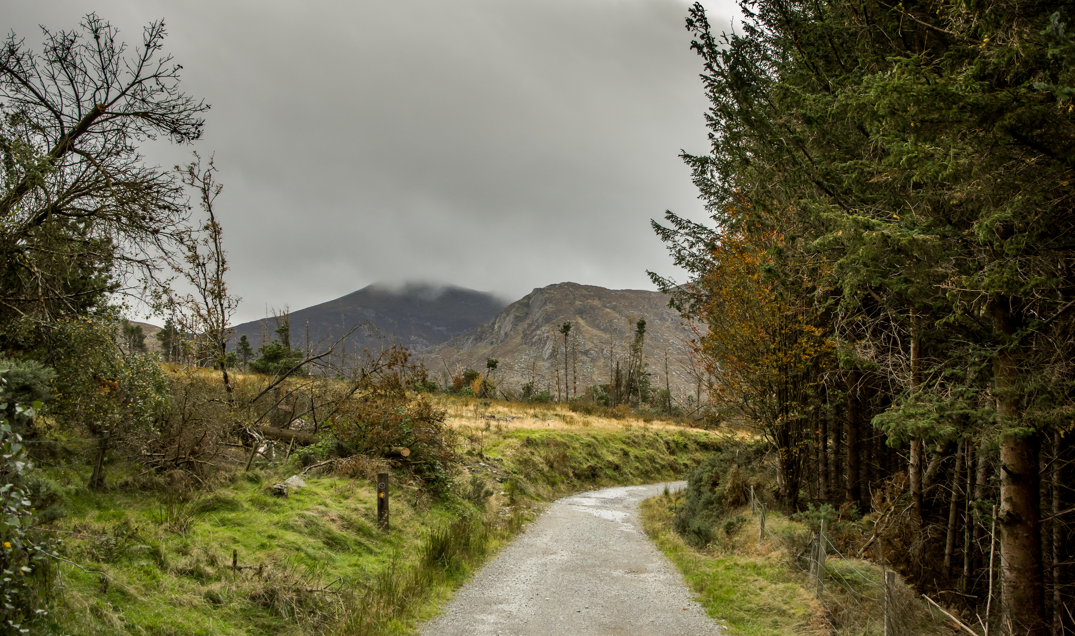
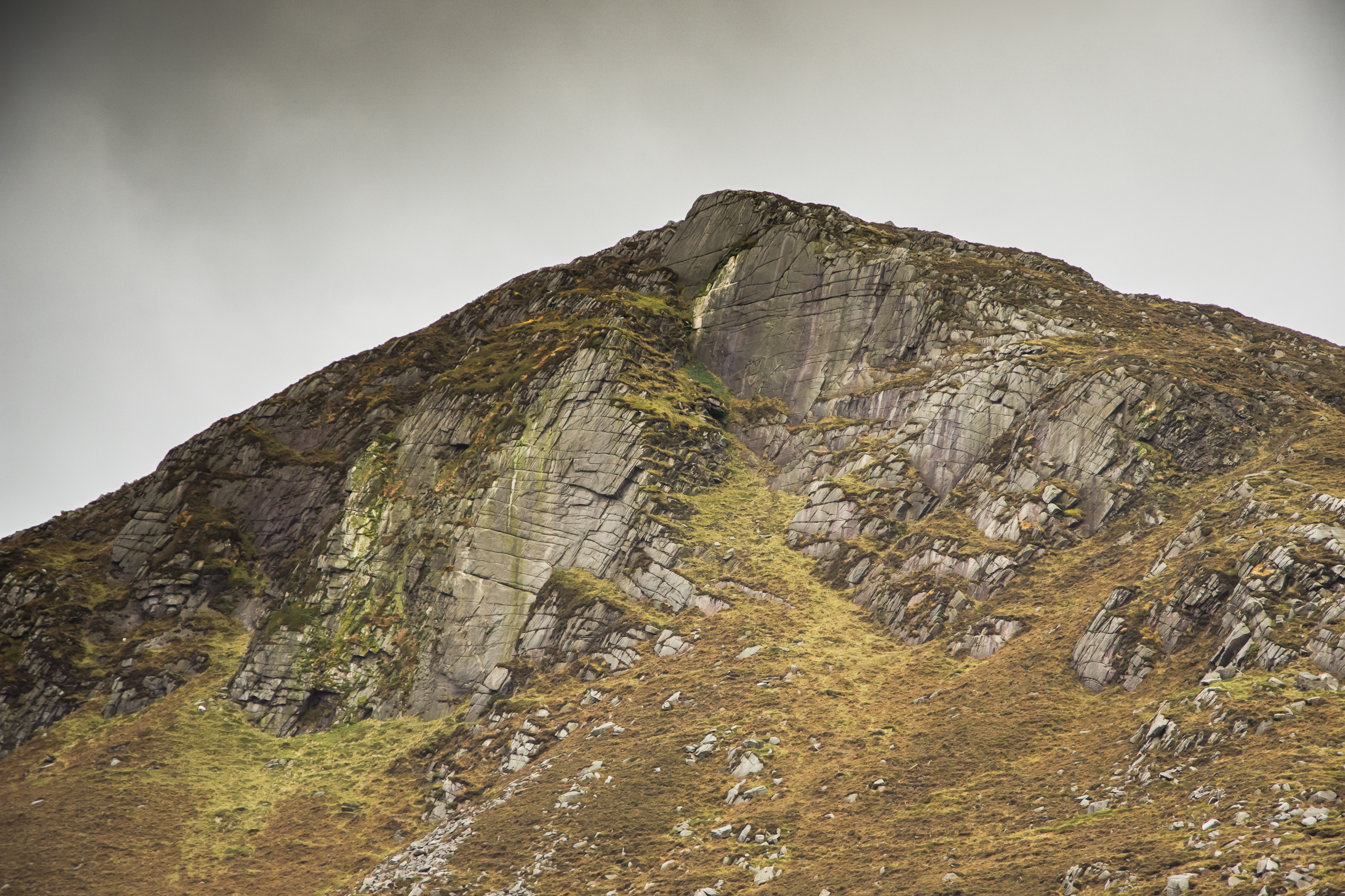
After roughly 0.7km, you pass through a second gate that continues for another 0.3km. A difference in the terrain occurs after the second gate going from hard-packed gravel forest road to a looser stone path. Although this change doesn’t make the trek too difficult, a small degree of caution wouldn’t go a miss in places. A third gate is passed, leaving Clonachullion wood behind and the vastness of the Mournes begins to open up. The path continues to gently rise and cuts left, providing views of the slopes that up lead to Slievenaglogh. Following the path along, it begins to track right and leads you towards the granite walls of Spellack (the north-eastern side of Slieve Meelmore).
READ: Slieve Gullion: trekking Armagh’s mysterious high point
READ: Hugh Annett: Why the Mournes are special to me
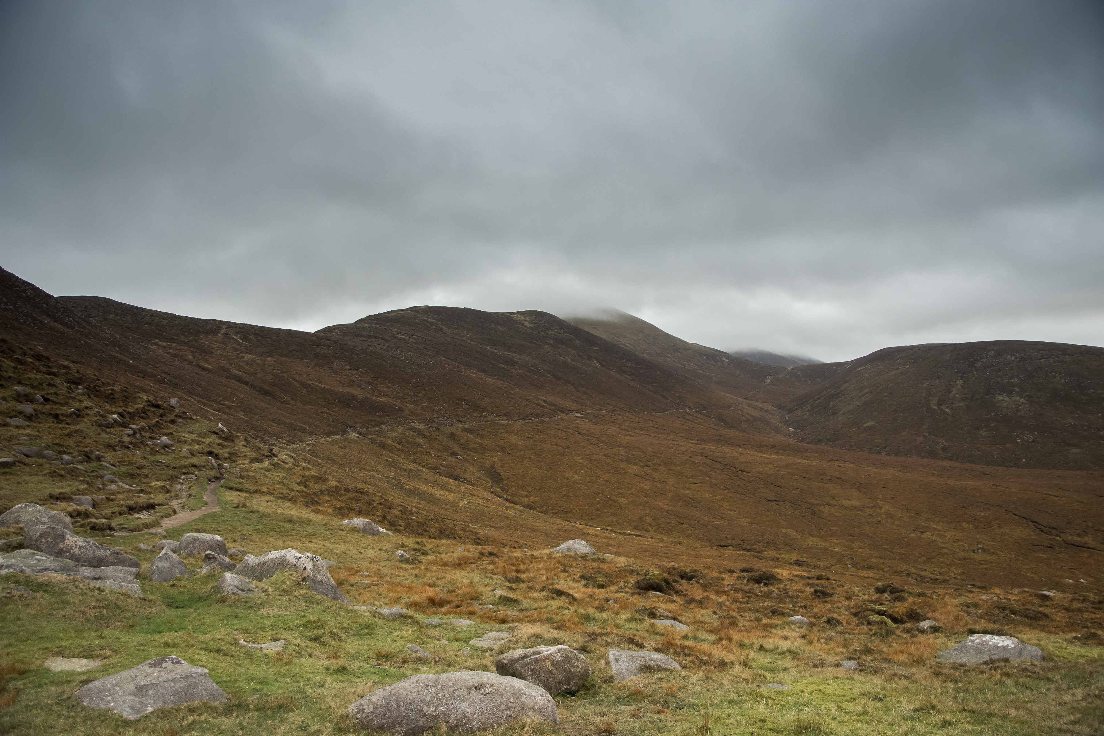
For the more adventurous, the walls of Spellack offers over 50 routes of trad climbing, with grades varying from ‘Difficult’ to ‘E5’; making it a option to get a spot of climbing done with a very short approach if pushed for time. For this trek, we continue along the path that runs alongside the Trassey River, however you could turn right and cross a small ford to reach the edge of Spellack. Trekking onwards, the col between Slievenaglogh and Slieve Bearnagh becomes quite obvious and indicates the location of the end-point for this hike. As the path leads us towards the col, we cross a small ford leading to a fork in the path that either cuts right (leading upwards towards the col between Slieve Bearnagh and Slieve Meelmore) or continues to the left in the direction we want to go. Further along another fork in the path occurs. Taking the steep right path of the fork leads up to a small quarry on the north side of Slieve Bearnagh (which can link up with the path that leads to the col between Bearnagh and Meelmore, also known as Pollaphuca).
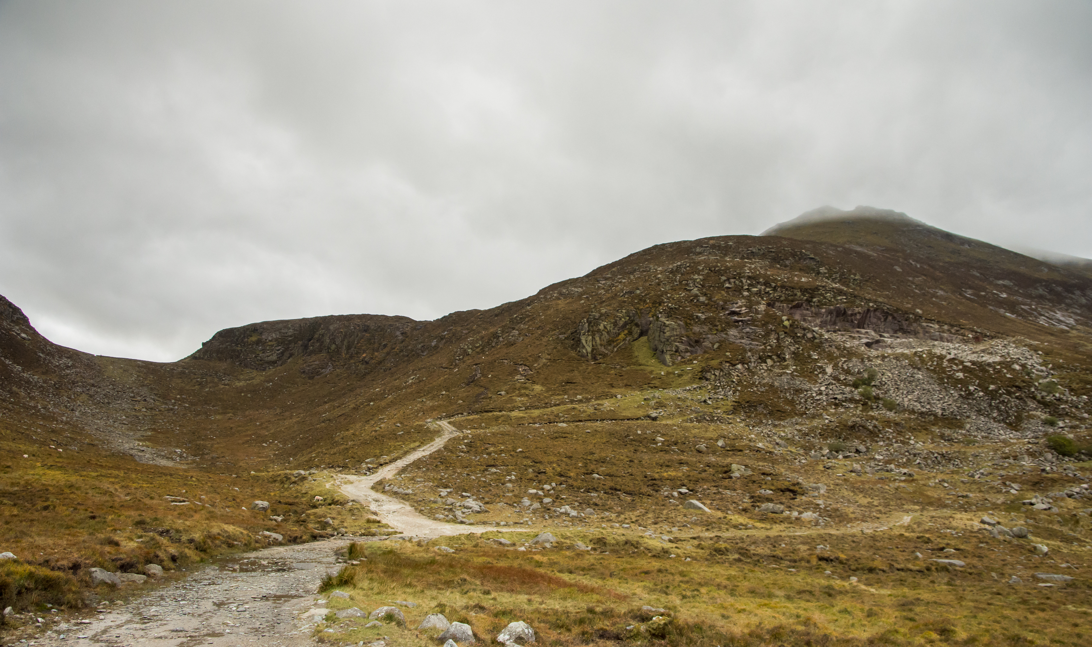
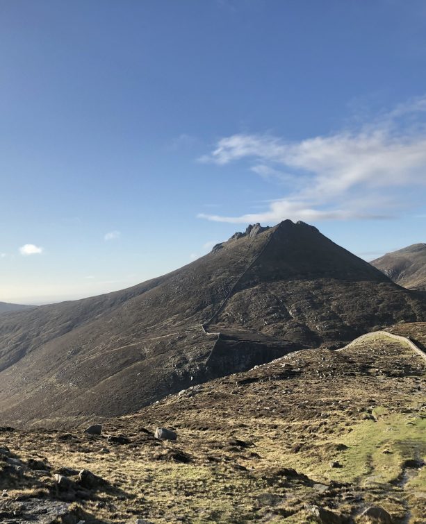
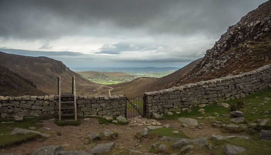
Again for this trek we keep left, descending a small depression and crossing another ford before reaching a boulder/scree field that leads up to the Mourne wall. At this point looking up it can appear to be a wee bit daunting, as the wall is not clearly visible when standing here. However, carefully making your way up the boulder field is not that bad as the gradient is not too harsh. I tend to zigzag up this section, where the stones can provide plenty of good foot placements (as it can get boggy in places here). Pushing upwards the boulder field ends and a small grassy plateau greets you indicating that for this walk, the ascending has finished and its time to enjoy the views. The Mourne wall runs across the top, with a stile and gate providing crossing points that lead into the inner Mournes. Look to the left and the wall leads up towards Slievenaglogh. To the right is the north tor of Bearnagh.
READ: Cuilcagh Mountain from Gortalughany Viewpoint
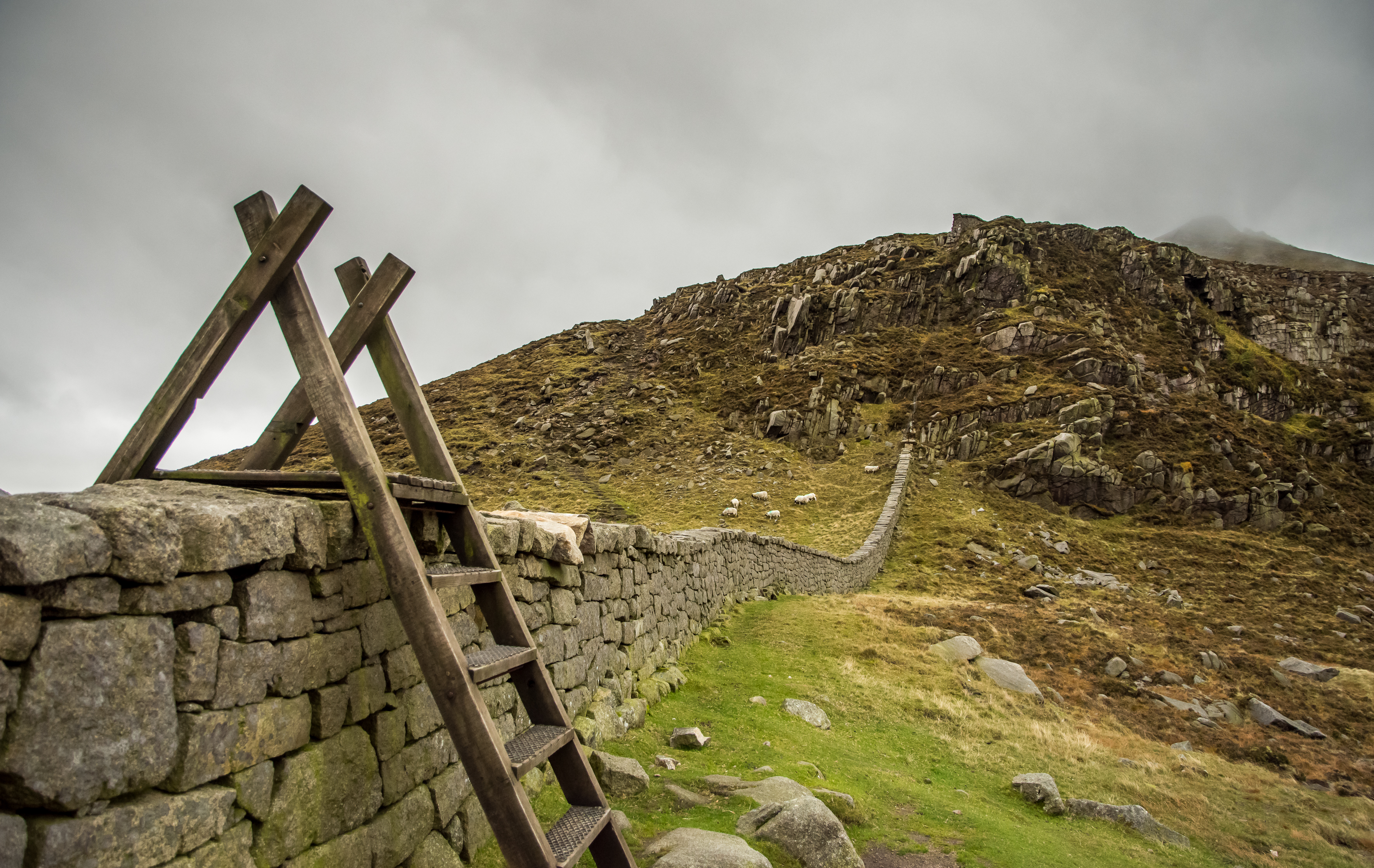
Crossing the stile, a small cairn and a few small boulders are spread out over this grassy area. Looking to the left towards the Brandy Pad, the trail is visible that leads towards Slieve Commedagh and Slieve Donnard (and beyond).
In addition Ben Crom reservoir peaks into view when you wander over to the south side of Bearnagh. At this point you can have a snack and look back towards Trassey track and enjoy the view of the route you have just completed, before re-tracing your steps back down again to the car park.
READ: Photographer in Focus: Christine McIlroy

This trek can be done at anytime of the year; though as with any hike, a clear sunny day always helps with the view!
The route along Trassey Track is relatively easy; gaining an elevation of 267m over 3.5km that can make this an ideal trek for those staring out walking in the Mournes. In addition, navigation is straight forward on this route that also helps anyone new to the area. Seasoned hikers can also enjoy this as part of an extended hike through the Mournes. Taken at a leisurely pace, this trek to Hares’ Gap and back can be completed in just over two hours.
I love how this short hike up to Slieve Bearnagh can provide some of the best views in the Mournes. The gentle rise along Trassey Track is a great warm-up trek before things get steep should you choose to go for the summit of Bearnagh!
Every time I’ve been here the wind has been brutal, so pack a good jacket just in case (and a flask of coffee & chocolate is always good too!).
Follow Robbie on Twitter.

Robbie Carson lives in Belfast and works as a Postdoctoral Research Fellow at Queen’s University Belfast. Outside of work time is spent enjoying the outdoors either hiking or mountain biking and landscape photography. Also enjoys climbing and beginning the transition from the indoor climbing walls to the proper outdoor stuff!
 Belfast,Photography
5 scenic walks around Lisburn
 Mourne Mountains
Bearnagh: Chased the sunset, caught the rain
 Mourne Mountains
Camping in the High Mournes
 Fermanagh and Tyrone
Cuilcagh: Stairway to Heaven
 Features
Every Game of Thrones Location in Northern Ireland
 Mourne Mountains
Hen and Cock Mountains
 Mourne Mountains
Leganabrachan, Millstone and Thomas: Donard’s Seaside Bodyguards
 Mourne Mountains
Percy Bysshe and Cove Caves