Climbing Slieve Binnian from Carrick Little (for novice hikers)

Would you like to sponsor this article?

This is one of my regular routes, particularly as I don’t have to drive anywhere to access it (nice!). There are many different ways to walk through the forest to get to the starting point but I will take you on a journey through my tried and tested route past Drinneever quarry, across Leganabrachan, over Millstone and Thomas’s mountains.
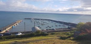
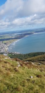
This trek begins at the Granite Trail/ Bogie line which is found mid-way across King Street in Newcastle. You will be able to find it easily as it is directly above the harbour (and Bogie Hill) so you get a tranquil view before you have even begun.
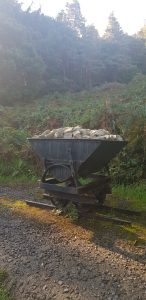
Walk up the line until you meet the first artefact relating to the quarrying of granite, a ‘Bogie’. Take the path past the Bogie and continue on the paths on the right hand side at the crossroads to begin the ascent to the top of the tree line.

SHOP: Amazing gift ideas from local makers across Northern Ireland
Find Out MoreThe second hill and longer steeper one is known locally as ‘heartbreak hill’, I think because back when the granite industry was in full force, individuals pulled carts or trolleys up the extensive hill to the quarry, which would break your heart! Though when walking it I have often wondered how many relationships have ended on this hill (it would only take the wrong comment from someone!), or how many heartbroken people have gone up there to heal.
Once you meet the gate and stile, you have made it to the boundary of Donard forest. Some people have named this part ‘the buzzard trail’ due to a protective buzzard that has been witnessed in the area. I know of a few people who have been taken by surprise by it and lived to tell the tale but I have never seen it… thankfully!
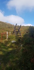
Cross the stile and follow the clear path that winds up towards the wall. Stay on the path to the right and walk to the corner of the wall where it descends back down. Pick a rock to sit on and take a drink. This is one of my favourite viewpoints. If it is windy at ground level, be prepared that once you reach this part, the winds will appear and get worse when you reach the summit points. The joys of being beside the sea!
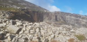
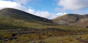
After your beautiful visual, follow the wall up again (towards the piles of rocks) until you meet a gap in the wall. Go through this and follow the small path up towards the quarry (wall is now on your left hand side). Keep following the wall until you cross over the fallen rock piles that have disturbed the path (a good couple of hundred metres past the quarry). This is where you will begin the ascent up towards Leganabruchan and Millstone mountain.
There is a path up this route so try and stick to it and keep going up (parts of the path do veer a little left). On my recent trek in this area, the gardeners/animals/weather had addressed the summer overgrowth and it appeared tame, making everywhere easier to visually and physically navigate – very much appreciated!
Keep to the left of Millstone mountain and walk until the views of the back of Donard are in full view. Here you can see Crossone mountain too. Try and find a small path and trek left for a different perspective (over Leganabrachan). Spend time taking in the views then follow the same path back and walk straight up Millstone.
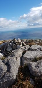
There is no path on Millstone so carefully negotiate the water holes and marshy land until you find the first rock pile. Look for the second rock pile (my personal favourite viewpoint on this peak) then head left (past a third rock pile) towards the valley between Millstone and Thomas’s mountain.
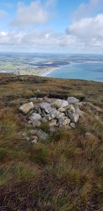
Keep high in the valley to avoid the small streams and try to find the path at the base of Thomas’s mountain to start your final ascent. The path can disappear at times and take you over marshy ground but don’t panic. Once you get to a certain height (around 450metres, you should be able to see a pole about 30 metres up above), you can start to walk towards Thomas’s mountain summit (Slieve Donard will be on you left).
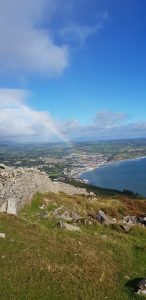
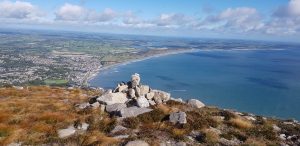
Keep going, avoiding sludge holes by using the stones as relief. You will find a little pile of rocks on the mountain and will have reached your destination. The views in front are awesome but don’t forget to look behind at the magnificent stature of Donard and Commedagh.
There are options for the descent from here but I generally return the way I came and descend down the path in the valley towards Thomas’s quarry. You can brave the Black stairs but I wouldn’t attempt this if you are a novice hiker, the weather is poor, or you are not wearing appropriate footwear.
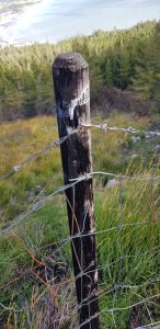
Once above the quarry, having followed the path and river line, you need to cross the river at the point where you see the rocks accumulated. You will be able to see a path on the other side. Be careful with your footing as it can be slippery. Follow this path left and down towards the fence which is now scorched after the large gorse fire.
READ: The Mourne Coastal Path: Bloody Bridge to Annalong
Find Out MoreContinuing to follow the fence and path you will meet the main path again of the Granite trail. You will see the gate to the quarry on the left however go right to meet the gate at the top of the Bogie line where the Shoddy Hut is situated. You are just descending straight down to the beginning of the trek. The rest is history…..literally.
This route is just over 8km and takes around 2 hours at a comfortable hiking pace. It is a great quick hike for seasoned hikers and would be manageable for novice hikers with the correct footwear, clothing and good navigation.
I usually add on Crossone (545m) too which is a lovely additional peak when in this area but only when the visibility allows this. Whilst not overly long in kilometres, there are a few tricky areas to negotiate.
Bring lots of snacks, drinks and all the usual hiking safety equipment. Additional clothing such as a hat and windproof/waterproof jacket is advisable particularly as the weather can change quickly. The wind can definitely blow the cobwebs away (and your body heat) and you at times, so fly…I mean, hike…safely!

I have been hiking in the Mournes all my life but more vigorously over the past 5 years. Writing about them intensifies my enthusiasm and love for them.

Climbing Slieve Binnian from Carrick Little (for novice hikers)
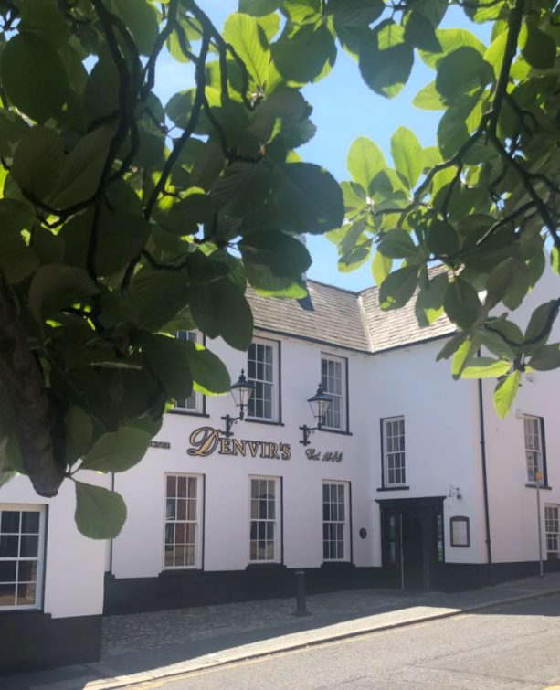
Denvir’s of Downpatrick: The Perfect Base for Walkers and Explorers in County Down
5 Outstanding Late Winter Hikes in the Mourne Mountains
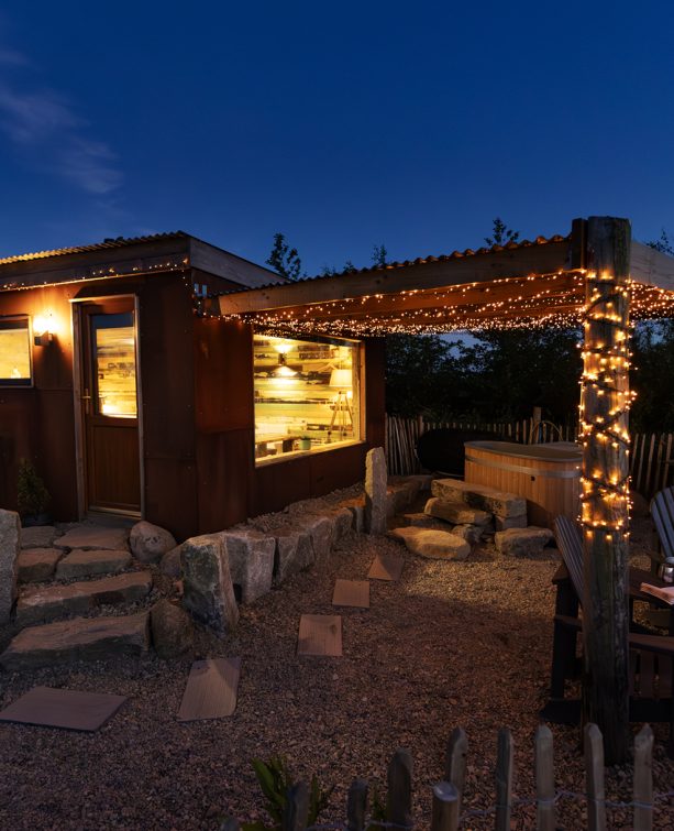
Willowtree Glamping: a Romantic, Rural Retreat in the Mournes
 Belfast,Photography
5 scenic walks around Lisburn
 Mourne Mountains
Bearnagh: Chased the sunset, caught the rain
 Mourne Mountains
Camping in the High Mournes
 Fermanagh and Tyrone
Cuilcagh: Stairway to Heaven
 Features
Every Game of Thrones Location in Northern Ireland
 Mourne Mountains
Hen and Cock Mountains
 Mourne Mountains
Leganabrachan, Millstone and Thomas: Donard’s Seaside Bodyguards
 Mourne Mountains
Percy Bysshe and Cove Caves
