Climbing Slieve Binnian from Carrick Little (for novice hikers)

Would you like to sponsor this article?

A few years ago I endured two failed attempts to reach the summit of Slieve Foye, the first due to inexperience and incompetence, the second falling foul of extreme weather conditions. This time I would have no excuse as I was favoured with bright, early-summer sunshine, perfect visibility and armed with map, compass, GPS and a reasonable dose of mountain experience.
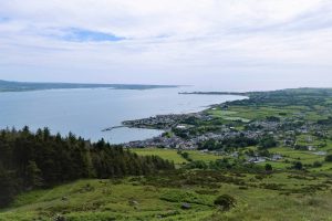
After parking in the large seafront car park beside the Tourist Office in Carlingford, a left turn past Taaffe’s Castle, followed by another left turn, took me into the village square. Walking west, I passed to the right of Savages Victuallers and up the steep and narrow River Lane. Slieve Foye’s imposing slopes soon came into view, leaving no doubt that this was to be a sea-level to summit trek with nearly 600m of steep upward progress in prospect.
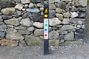
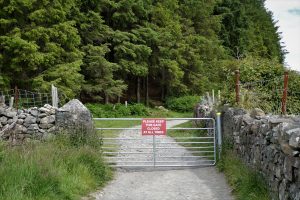
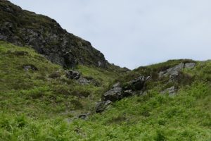
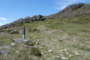
After about 0.4km, the lane reached a junction where a route marker offered several options. The green arrow for the Commons Loop is the one to follow for a north-west ascent from the col between Foye and Barnavave. This is probably the easiest, if longest, option and is one of the most popular access routes to the summit. However, having tried and failed twice using this approach, I turned right at the waymarker intending to reach the summit by scaling the eastern slopes and then descend by the path down to the Foye/Barnavave col. After a few metres, I passed through a gate and soon took a left turn up a narrow, bracken- and gorse-lined path that skirted the forestry on its right.

SHOP: Recycled Half Zip Micro Fleece
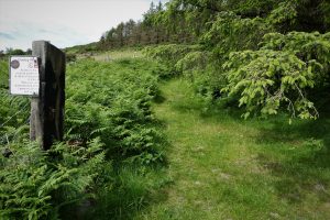
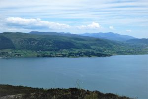
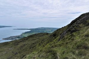
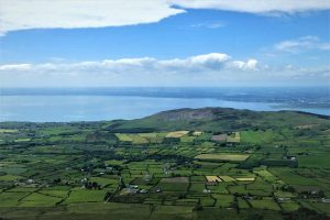
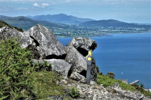
Find Out MoreAfter another gate, the path widened temporarily before narrowing again until eventually it gave way to open mountainside, revealing views of Barnavave to the south-east, with Carlingford Lough and the distant Mournes to the north-east.
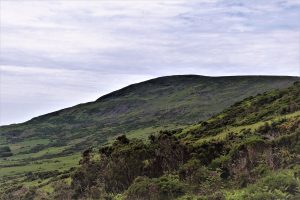
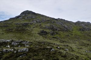
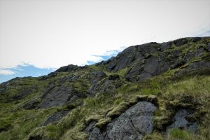
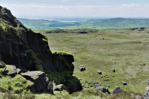
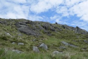
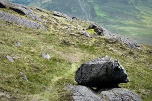
There was no obvious path to the summit, although it was possible to make out intermittent tracks here and there. Frequent map and compass checks were necessary as the challenging terrain often required detours and subsequent adjustments to make sure of heading in the right direction.
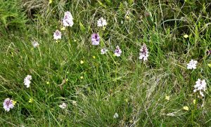
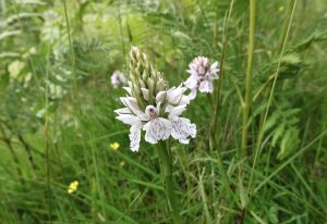
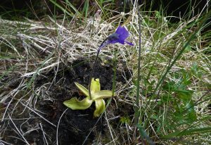
The diversity of wildflowers enhanced the climb and encouraged frequent rest stops, swathes of orchids and occasional groups of the carnivorous butterwort mingling with the more common varieties to add colour and cheer to the wild mountain atmosphere.

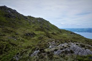
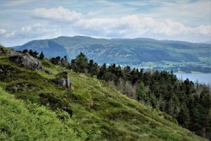
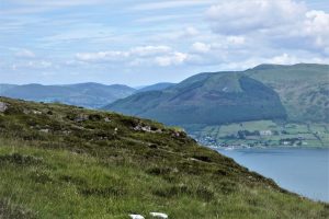
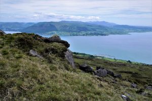
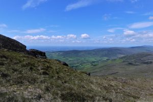
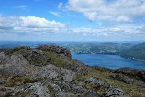
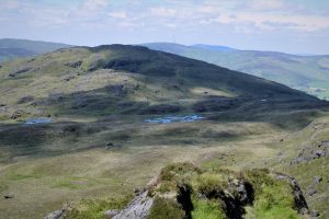
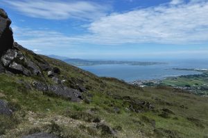
As height was gained, the views expanded to include Warrenpoint, Rostrevor and ever more spectacular Mourne vistas, with the peak of Northern Ireland high point Slieve Donard tucked in behind the distinctive, rugged summit plateau of Slieve Binnian.
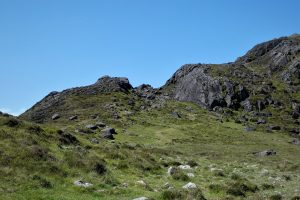
There were several dispiriting false summits on the journey to the top. However, any disappointment was soothed by the increasingly majestic scenery on display.
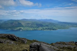
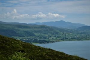
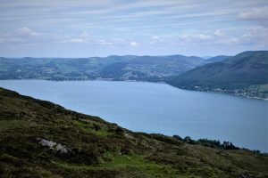
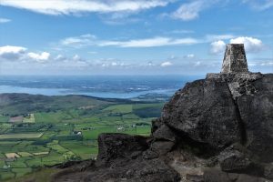
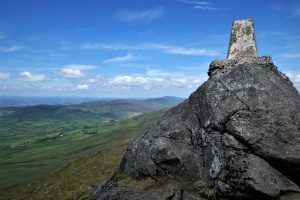
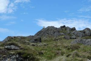
The first sight of the summit trig pillar injected a psychological uplift and immediately the climbing seemed to become a lot easier. The views from the 589m top were superb, Dundalk Bay, the Cooley coastline, Carlingford Lough and the other Cooley Mountains joining the spectacular Mournes silhouette to the north, with distant Newry and Slieve Gullion in the north-west.
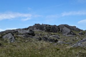
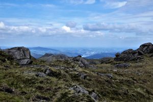
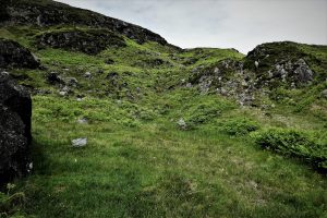
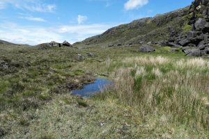
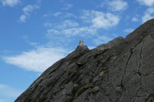
Instead of an immediate return to ground level, I decided to explore part of the extensive summit area. Time constraints prevented a detailed tour, but the area close to the summit held plenty of interest. The summit ridge was a series of rocky outcrops, boggy squelches and small ponds, every turn introducing breathtaking vistas in all directions. North-northwest of the summit, a stone cairn at 579m offered expansive views to the north and, nearby, various vantage points presented views of the western Cooleys and other prominent points on the ridge. The area is definitely worthy of a longer hike encompassing the landscape between the summit and Windy Gap to the north-west.
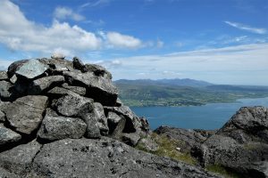


As I wandered along the ridge I found myself at its south-western edge. I zigzagged my way down through rocky outcrops to flatter ground with a grassy surface laced with small streams and a few boggy dips. When I checked the map, I saw that I was roughly opposite the point where I had started my ascent, except of course with the mountain in between. As I was keen to check out the route down from the top to the col between Foye and Barnavave, I persuaded myself to revisit the summit.

The climb was much easier than the earlier ascent, with better ground conditions and fewer false peaks. The fact that the start point was already about 300m above sea level helped considerably. Passing to the right of the trig pillar, I met a well-tramped path with several badly eroded sections, suggesting that this was the favoured route to and from the mountain. As the path proceeded down the slopes, waymarkers for the Slieve Foye Loop confirmed that this was a much used path. Please note: do not confuse the waymarked Loop with this walk – the “official” Loop stays well clear of the summit.
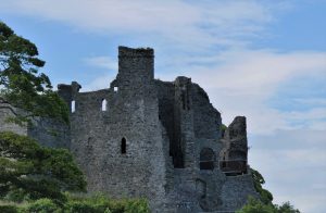
On reaching the col, the path took a wide loop, initially towards Barnavave, before turning back towards the lower slopes of Foye, then veering east above Carlingford. I turned left at one of the Slieve Foye Loop markers and followed a narrow path north which took me to the top of River Lane. I had time for a quick look at Carlingford Castle which was just up the road from the car park. The busy town abounded with cafés, restaurants and bars eager to refresh hungry bodies and sooth tired legs.


From the north, drive down the A1 and take the first Newry turnoff. Keep to the left through the town as if heading for Warrenpoint/Rostrevor, but after about half a mile, carry on round a wide bend ignoring the left hand turnoff for Warrenpoint. Turn left at the Quays and drive down the Albert Basin with the canal on your left. Turn left onto the R173 and continue through Omeath to Carlingford.
READ: Slieve Donard: an alternative approach via Crossone
Find Out More13km (8 miles)
5 hours
Temp 14˚C – 16˚C; calm, dry, sunny.
OS Ireland: Discovery Series: Sheet 36 (1:50000)
… you’re prepared for a tough climb that requires competent navigational skills. Map, compass and strong boots are essential and gaiters would be useful in wet conditions. Above average fitness would be a distinct advantage in an environment which is rocky and steep. You will be rewarded with exceptional views, including unrivalled vistas of the Kingdom of Mourne. Slieve Foye is one of the most characterful mountains in the north of the island and bears favourable comparison with many peaks of greater height. The rocky, rolling summit ridge is a feast for the senses with interesting rock formations and several other minor tops. A longer trek could include vantage points on the ridge such as Eagle’s Rock, Split Rock, Raven’s Rock and Foxes Rock.
The walk describes three ways of accessing the summit, but there are others. For instance, a hike over the summit ridge could begin at The Windy Gap. The car park for Slieve Foye Forest, between Omeath and Carlingford, could also serve as a convenient starting point. There will be other access points known to regular Foye visitors and a chat with local hikers could unlock a few interesting alternatives.
The town of Carlingford is well worth a closer look. It retains its medieval layout, characterised by narrow lanes and small streets. The medieval town gates can still be seen in Tholsel Street. Other attractions include the Dominican Friary, Taaffe’s Castle, the Town Wall and the Mint, the 15th century house of a wealthy merchant. The Tourist Office in the car park can provide further information.

Derek, 76, spent 35 years working in national, academic and public libraries, followed by 14 years in the wine trade. He only began serious walking in his 60s, although he had previously travelled many miles on foot pursuing his favourite hobby of fishing. After retirement, he decided to give the fish a rest and bother the hills of Ireland and Britain instead. Derek regards walking as a simple pleasure to be enjoyed, not endured, and prefers a solo hike in quiet, remote surroundings.
 Belfast,Photography
5 scenic walks around Lisburn
 Mourne Mountains
Bearnagh: Chased the sunset, caught the rain
 Mourne Mountains
Camping in the High Mournes
 Fermanagh and Tyrone
Cuilcagh: Stairway to Heaven
 Features
Every Game of Thrones Location in Northern Ireland
 Mourne Mountains
Hen and Cock Mountains
 Mourne Mountains
Leganabrachan, Millstone and Thomas: Donard’s Seaside Bodyguards
 Mourne Mountains
Percy Bysshe and Cove Caves