
Climbing Slieve Binnian from Carrick Little (for novice hikers)
Would you like to sponsor this article?

This walk avoids the more popular routes to and from Slieve Donard; the only part of the route where you are guaranteed to meet fellow walkers is at the summit of Donard and on the Bloody Bridge Track. The walk begins on the Granite Trail and continues past two disused quarries. It then follows a rough path between Millstone and Thomas’s mountains until reaching Crossone, a spur of Donard. Arriving at Crossone’s 545m summit, the rarely visited south-eastern slopes of Donard present the toughest and trickiest segment of the walk.
From Donard’s 849m summit, the route follows the wall towards the Bog of Donard and takes the quarry track, passing Crannoge Quarry before heading north across the Bloody Bridge River and along the tranquil eastern slopes of Crossone. After fording the Glen Fofanny River the route proceeds over the summit of Millstone Mountain (460m) and down a forest path to arrive back near the start of the Granite Trail. A short walk along Newcastle’s Central Promenade leads back to the car park.
This is a demanding route suitable for experienced hillwalkers with good navigational skills.
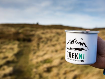
SHOP: The Trek NI Mountain Mug – your perfect hiking companion
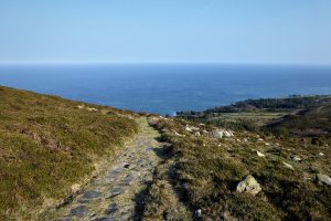
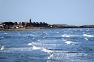
Find Out MoreLeave the car park by the entrance beside Hugh McCann’s bar and turn right onto Central Promenade. Keep walking towards the harbour for about 1km enjoying the continuous sea view on your left until, opposite the harbour, you reach the sign for the Granite Trail.
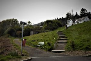
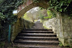
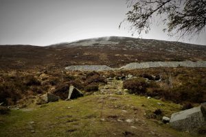
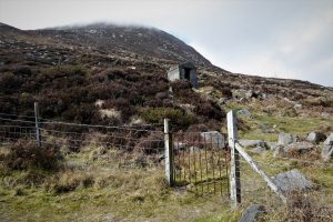
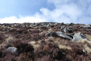
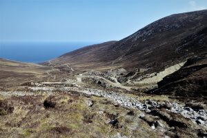
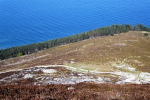
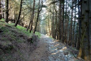
The section of the Trail that runs straight up to the mountains is known as the Bogie Line, the site of a former funicular railway built to transport granite from the quarries to sea level. The trail runs steeply uphill in a combination of steps and gravel pathway, introducing several artefacts associated with the Mourne granite industry. After about 800m, a gate leads onto open mountainside at the foot of Millstone Mountain. Carry on straight ahead on a clear path which soon veers right passing the disused quarry until, after 500m, it reaches a wooden gate.
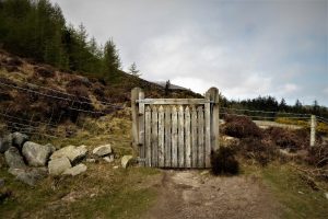
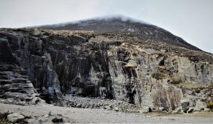
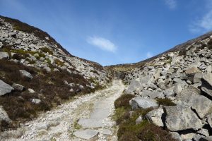
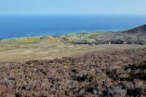
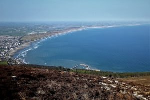
The gate leads to Thomas’s Quarry and a viewpoint laying out an expansive vista over Newcastle, Murlough Nature Reserve and Dundrum Bay. Passing the quarry, the path runs down towards an old metal gate. Go through the gate and look out for a faint track to the left of an old concrete hut. The track takes you past the edge of the quarry and continues between Millstone Mountain and Thomas’s Mountain.
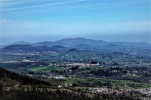
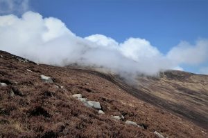
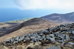
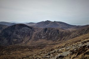
Upward progress brings expanding views, with the Dromara Hills and Murlough Bay prominent. Check compass and map regularly to ensure that you are where you want to be. Crossone is a spur of Donard and the first sight of the two mountains, from a certain perspective, can produce a trompe l’oeil with Crossone appearing higher than Donard. Experience will prove emphatically that this is an illusion.
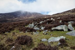
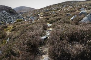
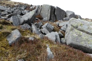
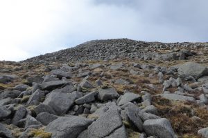
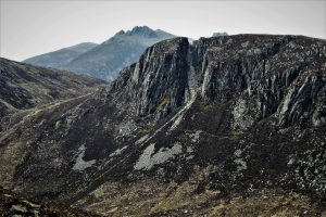
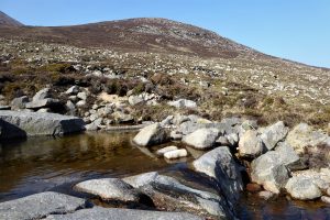
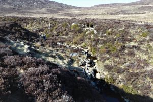
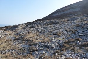
Carry on walking south until you reach the upper part of the Glen Fofanny River. Cross the river, which is little more than a trickle at this point. Continue south until you reach the slopes of Crossone. There is no beaten track up the mountain and whichever starting point you choose, the ascent will involve a certain amount of scrambling, as the slopes are strewn with small boulder fields.
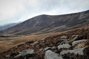
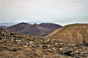
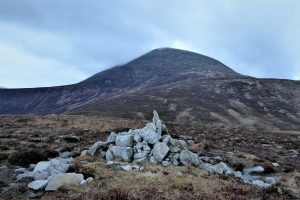
The summit of Crossone (545m) affords pleasurable vistas in all directions, with Chimney Rock Mountain and Slieve Binnian’s tors to the south, the Irish Sea at Bloody Bridge to the east, the Glen Fofanny River Valley and Millstone Mountain to the north and Donard to the west.

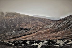
From the summit, head west down Crossone’s heavily peat-hagged slopes and gradually begin the ascent of Donard. Take it easy and slow, keeping a sharp eye on the terrain which is composed mainly of boulders with grassy interludes. Over your shoulder, the Irish Sea and the County Down coast provide spectacular views and an excuse to take plentiful rest stops.
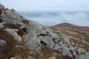
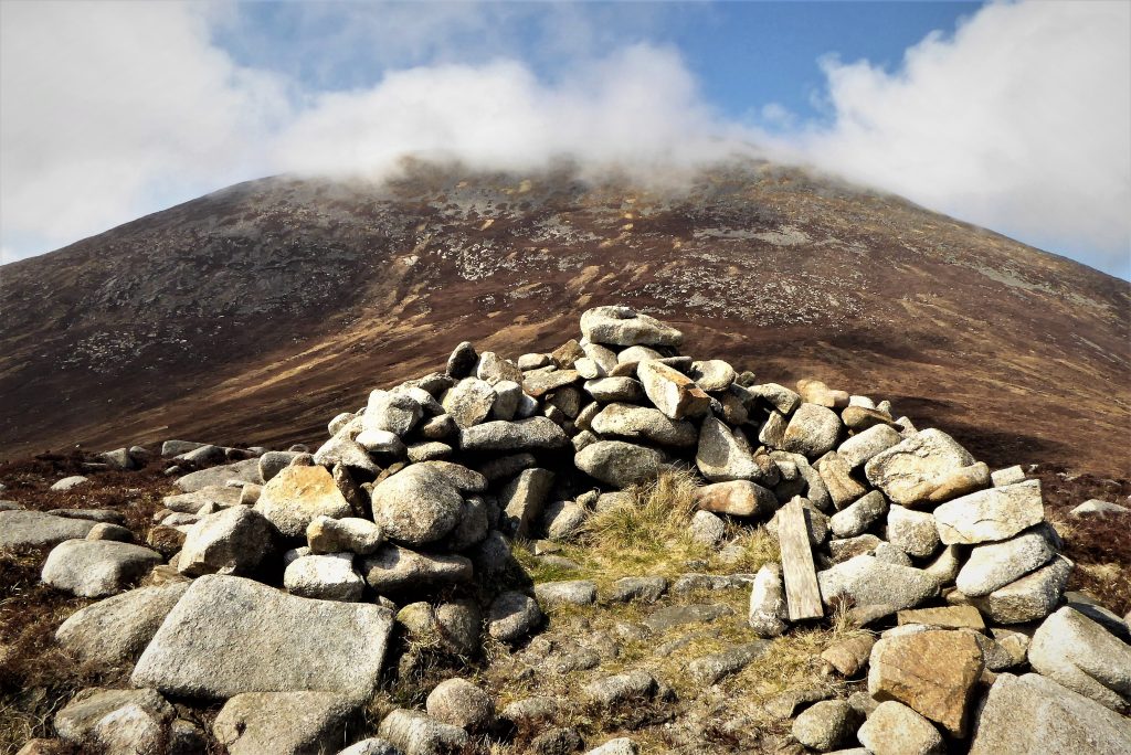
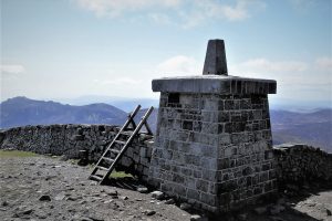
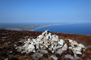
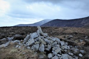
After a fairly gruelling climb the welcome sight of the Lesser Cairn coincides with much more forgiving terrain and expanding views of Commedagh, Bearnagh and Meelmore. Both of Donard’s cairns have suffered the ravages of time and human intervention, with little remaining save two large piles of small rocks.
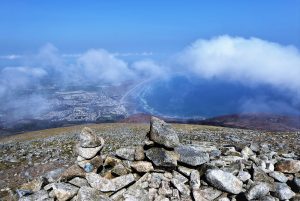
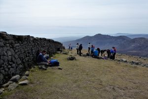
From the end of the Granite Trail until this stage of the walk, it is unlikely that you will have met anyone. That’s about to change – no matter how extreme the weather and regardless of the time of day, there’s always someone on Donard’s summit.
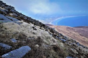
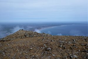
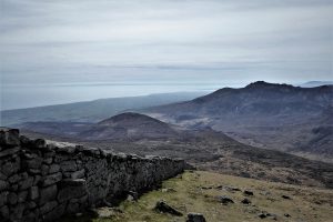
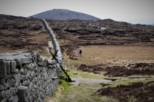
The strength and direction of the wind will determine which side of the wall to take for the walk down to the Bog of Donard. The right hand side is considered slightly easier as it has more firm, grassy segments and fewer rocks. It also allows an unobstructed view of the photogenic central Mournes.
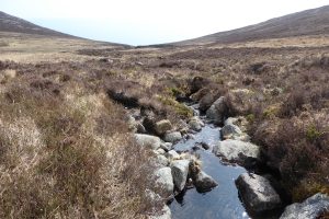
Turn left at the stile and take the obvious path that skirts the left side of Chimney Rock Mountain. After about 750m, arrive at Crannoge Quarry, cross the Bloody Bridge River and proceed towards the coast on the quarry track. About 450m from the quarry (at or around Grid Ref IG J 368266) leave the track and select a crossing point on the Bloody Bridge River.
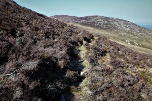
Once across, follow the path that makes its way up the opposite side of the river before veering right and following a course along the lower slopes of Crossone. After a couple of hundred metres it seems to peter out at a small grassy area. However, go back down the path for a couple of metres and search for a narrow track that continues on a northerly course. Keep going on the faint track through the heather enjoying the sea views and peaceful surroundings as you approach the Glen Fofanny River Valley.
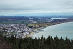
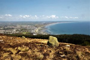
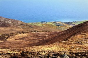
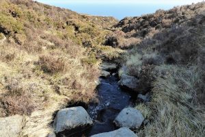
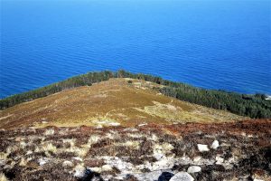
Cross the river and walk for about 400m, keeping to the left of the slopes of Millstone Mountain, before beginning to ascend east towards the 460m summit, which is marked by a small cairn. The views from the top are superb. Tucked in under the mountain lies the harbour from where, in times past, granite conveyed down the Granite Trail was exported to Britain.
Make your way east from the summit towards a grassy area edged by conifers. As you descend, you will see a wall with a couple of openings which lead to the open, green area. Be careful on the steep descent; there is no path and there are occasional holes in the heathery terrain. As you near the wall, you pass through the scattered debris of the former granite industry.
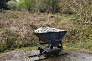
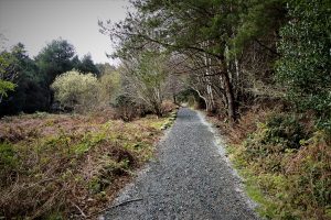
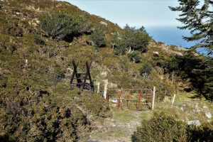
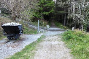
The other side of the wall introduces you to the clear path that runs down towards a gate and stile. After crossing the stile, the widening path enters a forested section. At a junction of paths, go straight ahead on a downhill course until you reach the quarry bogie that you passed near the beginning of the Granite Trail.
Turn right and retrace your steps along Newcastle promenade to the car park.
Newcastle enjoys a frequent bus service to and from Belfast – check out http://www.translink.co.uk. There is ample parking space in Newcastle with Donard Car Park offering free space for 180 cars and overspill parking when necessary. This route description assumes parking at Donard Car Park, although there may be parking places closer to the start of the Granite Trail.
April 2021
Variable, temperature 9˚-15˚C
13 km (8 miles)
6½ hours
OSNI Activity Map: The Mournes (1:25000)
OSNI Discovery Series: Sheet 29 (1:50000)
Harvey Mourne Mountains, Superwalker XT25 (1:25000)
…you find the usual access routes to Donard to be too busy or overly structured. This route benefits from its lack of use, with no discarded banana skins, sweet papers, plastic bottles or other vestiges of heavy footfall. However, this is not a walk for beginners – the weather is fickle and mist can descend without warning so compass and map are essential and other navigational aids, such as GPS, would give an added level of security. The ascents of Crossone and Donard are tough and there are no paths or wall to offer support. Donard in particular demands sound stamina as progress is dependent upon traversing several boulder fields – all your limbs will need to be in prime condition. The descent from Millstone Mountain is very steep with no clear path and should be approached calmly and cautiously.
READ: Family Treking around Northern Ireland
Find Out MoreSlieve Donard
Slieve Donard takes its name from St. Domhanghart (known by his anglicised name, St. Donard) who lived as a hermit on the mountain. It is said that he converted the Great Cairn into a hermitage and the Lesser Cairn to an oratory. He lived on the summit until his death in AD 506. Pilgrimages to the summit are documented from the mid-17th to the mid-19th century. Slieve Donard was one of Ireland’s four principal Lughnasa pilgrimages celebrating the beginning of harvest, along with Croagh Patrick, Co Mayo; Mount Brandon, Co Kerry; and Church Mountain, Co Wicklow.
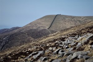
St Donard may have been the first to vandalise the cairns, but he wasn’t the last. Over the years pilgrims have altered and added to the cairns and in 1826, the Royal Engineers used Slieve Donard as a base to map Ireland. They camped on the mountaintop from late July until late November that year and used the two cairns to make triangulation points, badly damaging the cairns in the process. The construction of the Mourne Wall resulted in further change and consequent damage to the Great Cairn. Today, alterations are being made to the two cairns by walkers who seem unable to resist adding stones to them.
Despite the ravages suffered by both cairns through time, most scholars agree that the Great Cairn located on the south-west side of the summit is likely to have been a Neolithic passage tomb possibly dating to the latter part of the 4th millennium BC, while the Lesser Cairn sited 200 metres away to the north-east is considered to have been a multiple cist cairn dating to the Early Bronze Age (the later 3rd to mid- 2nd millennium BC).

Derek, 76, spent 35 years working in national, academic and public libraries, followed by 14 years in the wine trade. He only began serious walking in his 60s, although he had previously travelled many miles on foot pursuing his favourite hobby of fishing. After retirement, he decided to give the fish a rest and bother the hills of Ireland and Britain instead. Derek regards walking as a simple pleasure to be enjoyed, not endured, and prefers a solo hike in quiet, remote surroundings.
 Belfast,Photography
5 scenic walks around Lisburn
 Mourne Mountains
Bearnagh: Chased the sunset, caught the rain
 Mourne Mountains
Camping in the High Mournes
 Fermanagh and Tyrone
Cuilcagh: Stairway to Heaven
 Features
Every Game of Thrones Location in Northern Ireland
 Mourne Mountains
Hen and Cock Mountains
 Mourne Mountains
Leganabrachan, Millstone and Thomas: Donard’s Seaside Bodyguards
 Mourne Mountains
Percy Bysshe and Cove Caves
