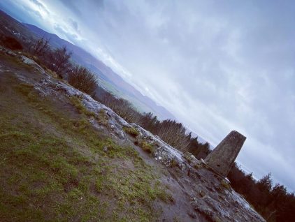
Climbing Slieve Binnian from Carrick Little (for novice hikers)
Would you like to sponsor this article?

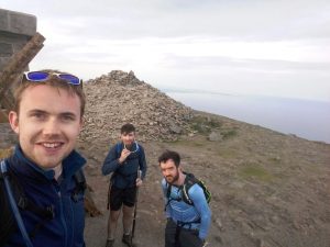
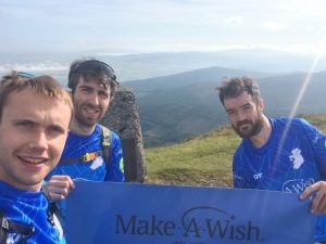
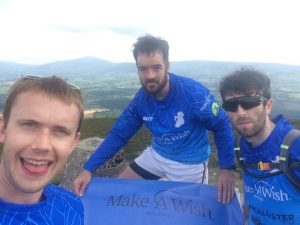
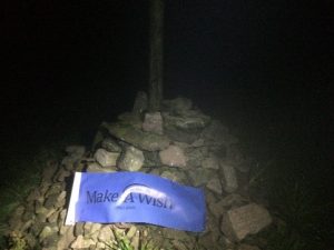
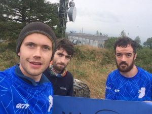
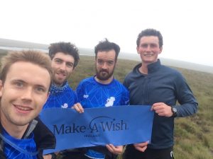
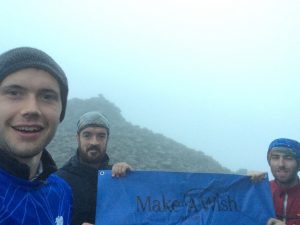
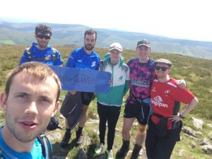
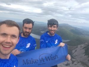
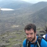
In August 2019, I, Andrew Goulding, along with David McKelvey and Peter Knox set out to climb to the highest point in each of the counties on the island of Ireland in aid of the Make A Wish Foundation, all within a long weekend.
David, Peter and I first met in work and immediately realised a mutual interest in the outdoors and challenges; running, cycling, hiking etc. In the summer of 2017, we decided to do the Northern Ireland Peaks Challenge – starting in Fermanagh we climbed Cuilcagh, followed by Slieve Gullion in Armagh, Slieve Donard in Down, Trostan in Antrim and Sawel, the highest point in Derry and Tyrone. We completed the challenge in just under 14 hours. The event evoked a real love of such challenges but more importantly we discovered that a two-person tent is so termed for a reason and doesn’t fit three people comfortably!
The following summer, 2018, we decided to undertake the Mourne Wall challenge. The temperature was above 20oC leaving Belfast at 0500 in the morning and it only got warmer, turning into one of the hottest days of the year. This challenge furthered our enthusiasm and more importantly taught us how much of a lifesaver the water pipe on Slieve Commedagh could be!
SHOP: Scratchable Map of Ireland
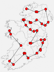
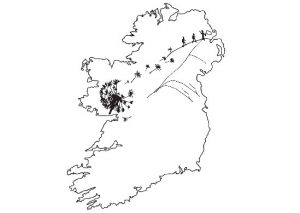
Find Out MoreIn looking through the “Ireland County High Points” book by Kieron Gribbon, which detailed the highest point in each of the traditional 32 counties in Ireland, I noticed on one of the back pages there was an image which indicated the most direct order and route between each of the high points. It set in motion the formation of a plan.
At the same time, a friend of a friend’s family member was undergoing treatment for a serious illness and received fantastic support from Make A Wish. It gave me an insight into the fantastic work that Make A Wish do and how much of a difference they make to children’s lives. In Autumn 2018, an idea then developed – we could climb each of the high points using the route from the book and raise money for Make A Wish – perfect!
The planning soon commenced. The initial figures were pretty startling: a €5,000 fundraising target, over 170km of hiking with just under 10,000m of climbing. We also would need people to drive us over 3,000km between each of the peaks, a far from small task in itself. My first challenge was to get the guys on board and then slowly ease them into these figures! Both David and Peter signed up immediately without any persuasion needed (naively they admitted in hindsight). We quickly decided on a name the “Ireland Country Peaks Challenge”, set the dates (Thursday 1st August to Sunday 4th August 2019), my girlfriend Ashlee designed us a logo, and we were set – all we needed to do was start to train and raise money. Easy!
Over the next six months we scouted each of the county peaks, visiting all with the exception of Moylussa in County Clare and Knockboy in County Cork – we settled on doing these blind during the challenge. We decided to get jerseys designed by Kit Sportswear, which would allow us to get corporate sponsorship for the event to help us reach our fundraising target; McAllister Group, Warren & Partners, CORA Consulting Engineers, Kane Fencing, Fusion Physio, WSP, Northridge Finance, Cerebreon Technologies and Michael Watson Charitable Trust all generously donated to the cause.
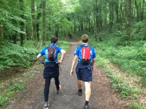
From the spring of 2019 we stepped up our training, doing a series of one day 30-45km hikes in the Mournes, building to two 60km 24-hour hikes in the Mournes by summer. We purposefully began these hikes on Friday night to try and replicate the sleep deprivation that the challenge would require. The highlight of this training was Peter being so convinced that his “eyes could adjust to the darkness” that he wouldn’t need a headtorch in the dark. After 10 minutes in the dark, walking into several boulders, Peter admitted defeat and took one of my spare headtorches! We couldn’t resist the competitive nature coming through as we chatted over the training weekends and decided that 96 hours would be good, but our target was to complete the challenge in 3 and a half days: 84 hours.
In the month preceding the challenge we tapered down our training as we focused on finalising all our support; we planned driving times and support crews, settling on a combination of myself and Peter as initial drivers, followed by a rotation of my parents, my brother Ciaran and Peter’s father Leonard. We organised a 7-seater hire car from Europcar; the two extra seats essential for the volume of gear, food and sleeping space. Regatta kindly provided us with hiking gear, trousers, jackets, backpacks, etc. Brennan’s bread donated 20 sliced pans and Brady Family Ham donated 5kg of ham; approximately 200 ham sandwiches would be the fuel of choice for the challenge!
On Wednesday 31st July we picked up the hire car from Dublin airport and headed for Mayo. We arrived in the B&B in Louisburgh just before 2300 and tried to get to sleep as quickly as possible, knowing we would up at 0300. I didn’t really sleep as I had so much running through my head: would we get favourable weather? Had we enough gear? How would we fare with such a lack of sleep? Would we get injured? Would we get lost driving? Had we completely underestimated the timing? What if we couldn’t complete the challenge, how could we admit that to people who had donated? Once I ran through these in my head, the cycle repeated and over and over until the alarm clock went off. In total I maybe got 15 minutes sleep but just enjoyed lying in a bed, knowing it would be Sunday night before I would sleep in an actual bed again! As we got into the car at 0330, I was frankly relived to have all the preparation behind us and we could solely focus on the simple things – hiking up and down hills and repeat!
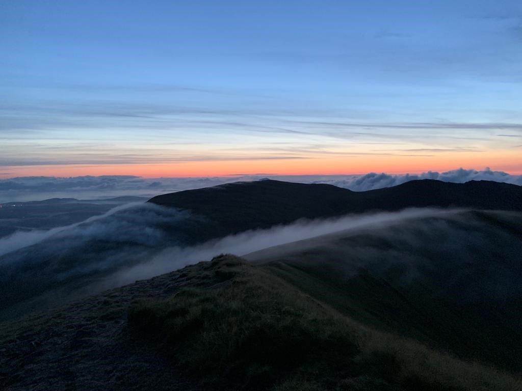
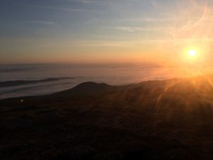
After parking at the base of Mweelrea, the highest point in County Mayo and Connacht, at 0400 Thursday 1st August, we took the first of a over a quarter of a million steps of the challenge, in the dark trudging through a wet bog. Despite the darkness and heavy footing, our spirits were high with plenty of chat and jokes bouncing back and forth. As we came out of the boggy terrain and into the steeper firmer ground the sun was rising, easing one of my first worries – it looked as though we would get lucky with the weather, for the first morning at least! By 0515 we reached the summit to an incredible sunrise view, a view that really put a pep in our step as we descended. The nature of mountaineering timing events is that they are timed from first peak to last peak, so our challenge start time was set at 0515, time on! (Total distance: 8.6km ; Total climb: 730m).

The sun was well and truly out as we started Benbaun in County Galway at 0700 in the morning. We quickly hiked along the Kylemore river before climbing the steep grassy incline onto a rocky plateau. A hike up the final steep rocky section brought us to the summit, which gives fantastic views over the Twelve Bens mountain range and out onto the Atlantic Ocean. (Total distance: 10.1km ; Total climb: 673m).
After a swift descent we were back in the car and on to Clare. Up to this point Peter and I had split the driving between us. At the car park at the base of Moylussa we met our first driving support crew, my parents, who were taking over the driving until Friday morning. My parents brought a few breakfast rolls, we grabbed them and began the hike through the Ballycuggaran Forest and along portions of the East Clare Way. We had a slight apprehension with this peak as it was one of the two none of us had visited. However, it was a quite straight forward gentle sloped hike with some great views over Lough Derg. (Total distance: 11.3km ; Total climb: 445m).
We were back in the car by 1430, relieved that none of us had to do anymore driving and were on our way to Carrauntoohil in Kerry, Irelands highest peak. With a long drive ahead of us, it was a good chance to try and get some sleep, however this was easier said than done while full of adrenaline and driving on bumpy roads.
We set off from Cronin’s Yard at the base of Carrauntoohil at 1720, heading along the flat stony route through Hags Glen before reaching the Devil’s Ladder. David and I were a bit nervous as neither of us had been to Carrauntoohil. Peter had assured us he had been up this route before. However, back in 2017 doing the Northern Ireland peaks challenge, Peter had also assured us he had visited Cuilcagh only to reveal at the base, he had confused it with another peak and actually had never visited Cuilcagh! As a consequence, David and I viewed his certainty approaching the Devils Ladder with a little apprehension.
The climb itself was very enjoyable, slow, rocky and steep with plenty of scrambling. The top of the ladder was probably the first tough moment for me, when the heat really hit. I began to overheat so a brief slow down and taking on of fluids was needed. After a steady descent, we completed Carrauntoohil in three hours. This put us four hours ahead of schedule after the first day, so we had time to grab a shower, coffee and sandwiches courtesy of Cronin’s Yard tea rooms. (Total distance: 12.9km ; Total climb: 856m).
As we travelled to Knockboy in County Cork, there was an air of trepidation. This was the second peak none of us had visited, and it was pitch black so we would be relying on our navigation skills. However, the fun really began as the approach roads deteriorated rapidly to little more than a narrow windy farm trail by the time we reached the base, not ideal for a heavily laden 7-seater!
The climb itself was slow, very wet and boggy with strong winds and overall rather forgettable. The scene from the top is supposed to be fantastic with views extending over Bantry Bay and Beara Peninsula, however at 0030 we would have to withhold judgement. This was the first time in the challenge that our spirits dropped a bit as the tiredness and the reality of the challenge set in. Peter summed it up best when we returned to the car, “I did not enjoy that at all”, an understatement if ever there was one! (Total distance: 5.5km ; Total climb: 231m).
As the car weaved slowly down the awful roads, snaking back to civilisation, we had five counties done, 48km and 2,900m of climbing by the end of day 1. Mentally this was tough, as it took one day to just complete five counties, with another twenty-seven to do in 2.5 days, but we just had to trust in our schedule and keep going.
We woke as the car was pulling into the small car park at the base of the southern slope of Galtymore, the high point in Limerick and Tipperary and the second Irish Munro/Furth (peak over 3000ft / 914m) we would summit. We felt very slightly refreshed after getting a total of maybe 40 / 50 minutes sleep. Peter as ever seemed to be a bundle of energy whereas David still seemed half asleep, I was somewhere in between. That’s the thing with these team challenges; while we are each guaranteed to have low points throughout, you hope that not all three of us will be low at the same time and can drag each other through.
Galtymore is one of my favourite peaks, offering stunning views down the steep northern cliffs to Lough Dineen. We reached the summit for an incredible sunrise over the clouds, it looked as though our luck with the weather was due to continue into day two. (Total distance: 10.0km ; Total climb: 510m).
After Galtymore, our spirits were high as we tucked into yet more ham sandwiches and tea before crashing out on the way to Knockmealdown, County Waterford. This was the second support crew changeover point, with my brother Ciaran meeting us at the base, with three breakfast rolls which helped to replace some of the calories we were burning through. A quick hike to the top gave us amazing views over the Vee Gap, Golden Vale and over the wider Knockmealdown mountain range. We were back in the car before 1000, with our first province, Munster, ticked off. We had now completed most of the largest climbs, although the next two days would present a different challenge with much more peaks, albeit smaller, but with much less rest time in between. (Total distance: 4.9km ; Total climb: 493m).
Next up was Brandon Hill, Kilkenny, a short and sweet route, primarily over a gently sloped stony track, which gives fantastic views of the Blackstairs Mountains. We arrived back to the car in just over an hour to much welcome ice creams, courtesy of Ciaran, as we set off for Mount Leinster. (Total distance: 5.0km ; Total climb: 283m).
At about 1430 we set off from the Nine Stones car park to the summit of Mount Leinster, the highest peak in Wexford and Carlow. The route itself is quite straight forward due to the RTE access road which leads right to the trig pillar. The road provided the feet with a welcome break from bog and rocky terrain, although it did highlight that our feet were beginning to blister up a little bit. The top offers views of the Blackstairs and Wicklow Mountains. (Total distance: 5.3km ; Total climb: 340m).
We were soon on our way to Lugnaquilla, Wicklow and Leinster’s highest peak and also our third and final Irish Munro/Furth. Starting off from Fenton’s Car park we skirted the military firing range and climbed Camera Hill before crossing the boggy plateau and summiting Lugnaquilla in just under two hours. Thankfully by this point, 1900, the temperature had cooled which made the steep sections that bit more bearable. The spirits were high as we returned to the car at about 2000, knowing we had two relatively straightforward climbs before a pitstop in Newbridge for some food that wasn’t a ham sandwich! (Total distance: 13.3km ; Total climb: 737m).
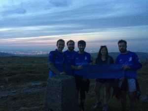
We pulled into the layby at the bottom of the RTE access road leading to the summit of Kippure (Dublin’s highest point) and met two friends, Matt and Lisa, who along with Ciaran, hiked to the top with us. Whilst the three of us get on well, some fresh voices to talk to certainly made a difference. That said, I was incredibly jealous when at the base of the climb Matt and Lisa informed us they were heading to Krispy Kreme for doughnuts whilst we had another 15 peaks and 36 hours ahead of us!! The summit is a great vantage point, offering us views of the lights of Dublin illuminating the sky to the north and the Wicklow mountains in the dusk sky to the south. (Total distance: 7.1km ; Total climb: 222m).
Next up was Cupidstown Hill, Kildare’s highest point. As one of Irelands lowest county high points, a very modest hike through a forest trail in just over ten minutes was required to tick Kildare off the list. (Total distance: 1.1km ; Total climb: 16m).
From here, we headed to Newbridge for a pitstop. We pulled into the driveway of my parents’ house at about 0030, taking on some warm food, a delicious chicken chasseur and countless potatoes, followed by a shower and fresh gear, while David treated himself to 15 minutes in a foot spa! Compeed’s were very welcomed by us all at this point to keep the blisters at bay. With day two behind us, we now had twelve peaks (fourteen counties), 95km and 5,500m in the bag.
We felt rejuvenated leaving the house just before 0200. However, this enthusiasm evaporated quickly when we got out of the car into wind and fog at 0315 at the base of Arderin, the highest point in Laois and Offaly. Although a very short hike, the darkness and fog did make it quite difficult to navigate the boggy plateau but we managed to stay on the vague track and find the summit relatively quickly. We hurried back to the car quickly for about 0400 and were happy to leave Laois and Offaly behind as we travelled in the darkness towards Carnbane East, Meath’s highest point. (Total distance: 1.7km ; Total climb: 80m).
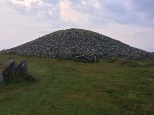
I woke up as the car was pulling into the Carnbane East car park at 0600. We reached the summit pretty quickly for some great sunrise views. Although a relatively small climb, Carnbane East offers some fantastic views of some ancient megalithic tombs. (Total distance: 1.1km ; Total climb: 57m).
We were back in the car by 0630 in buoyant mood as we knew we were beginning to knock off a lot of peaks relatively quickly. Next was Mullaghmeen, Westmeath’s highest point and the lowest of all the county high points. The route took us through Mullaghmeen woods, apparently one of the largest beech forests in western Europe, before rising up to the summit which gives panoramic views of the nearby Lough Sheelin. (Total distance: 4.7km ; Total climb: 106m).
Next up was Corn Hill, Longford and another RTE access road allowed us to make light work of a modest peak in twenty minutes and we were back in the car by 0900 on our way to Seltannasaggart in Roscommon. (Total distance: 1.8km ; Total climb: 55m).
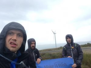
We arrived at the base of Seltannasaggart at 1000 – quite remarkably this was the first time we encountered proper rain, we had been so lucky to this point. The hike up Seltannasaggart took us along a stony trail, through the Corrie Mountain Wind Farm, the rain and clouds somewhat limited the view from the top unfortunately. We were back in the car by 1100 having done 17 out of the total 26 peaks. This was the first time it really hit me that we are going to definitely do this challenge, however, in 12 hour’s time this certainty would be challenged! (Total distance: 4.7km ; Total climb: 101m).
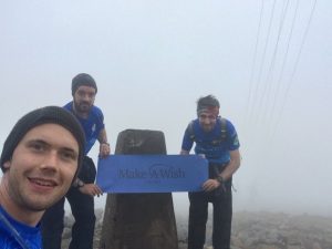
We arrived at the bottom of Truskmore, the highest point of both Sligo and Leitrim (Truskmore Southeast Slope), at 1230 – at this point we had another driver change, with Ciaran taking over again from my parents. The route up Truskmore, although relatively long and with a decent climb, was quite straightforward thanks to an RTE access road. Unfortunately, the top of Truskmore was incredibly foggy and windy so we did not hang around, got the customary pictures at both the Sligo and Leitrim points (a couple of hundred metres apart) and were quickly on our way. On our way down, we bumped into a group of three people, who had been also working their way around Irelands peaks, albeit over a few years rather than a long weekend, which at that moment in time seemed a much more enjoyable approach! They did donate to the cause for which we thanked them profusely and continued our descent. At this point all 6 legs were very sore, Peter had taken to walking downhill backwards while David and I found running downhill very slowly was helping to ease the suffering. (Total distance: 12.9km ; Total climb: 446m).
We departed Sligo/Leitrim and were headed for Cuilcagh, the highest peak in Fermanagh and Cavan, recently made a highly popular destination due to the Cuilcagh boardwalk, the Stairway to Heaven. At this point we had done 18 of 26 peaks, 22 of 32 counties, 122km hiking with 6,400m of climbing, all of Munster and Connacht, leaving only Louth left in Leinster.
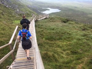
At 1530 we arrived at the base of Cuilcagh, even though it is a relatively long hike, the majority of the route was covered by the boardwalk, with the exception of the ~1km walk across the plateau from the top of the boardwalk to the summit cairn and trig pillar. The boardwalk made this one considerably easier and helped to mask the increasing leg/foot/blister pain that had been slowly building. (Total distance: 11.1km ; Total climb: 441m).
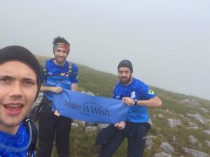
By 1730 we were leaving the Cuilcagh car park and we were on our way to Slieve Beagh in Monaghan. At the base of Slieve Beagh we met John-Joe from Kane Fencing, one of our sponsors – this was about the only positive thing about Slieve Beagh, although the route is relatively short with limited climbing, it is on the whole, quite forgettable. There was no trail or path, the ground was heavy wet bog with thick heather, the last type of terrain our legs needed at this point. There isn’t much to write home about in terms of views, with relatively flat featureless upland bog stretching in all directions. Once again, a fresh voice on the hike really helped mentally. John-Joe also told stories of how Make-A-Wish had helped his sister in the past which none of us previously knew about. This helped spur us on even further and reminded us why we were really doing what we were doing. (Total distance: 6.4km ; Total climb: 111m).
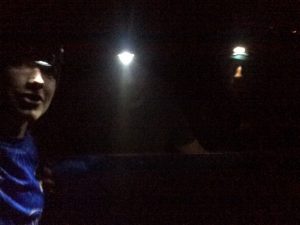
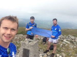
After Slieve Beagh it was onto Slieve Gullion in Armagh. We arrived just after 2200 and it was well and truly dark as we started climbing, but luckily we were very familiar with this peak and it has a very distinct trail so with the head torches on it was very doable in the dark. By the time we reached the summit cairn it was extremely windy so after a quick photo we were on our way. After Armagh, we were off the Louth and Slieve Foye. We didn’t know it at the time, but the next two peaks were the definite low points of the challenge. (Total distance: 2.7km ; Total climb: 199m).
We reached Carlingford and the base of Slieve Foye at 0030, a Saturday night on a bank holiday weekend in Carlingford. After leaving the car we had to walk past a few houses before passing into a laneway taking us through to the hillside. On this trek, we bumped into a couple of pub patrons on their way home carrying bags of chips, which at this point after endless ham sandwiches, smelled absolutely incredible! We had programmed the co-ordinates for the peak into the navigation app on my phone we were able to make decent time reaching the peak, a 3km hike up with 525m of climbing, the last 200m of which were into very strong winds. The descent was a different story – tiredness was really setting in for me and I was really struggling with navigation at this point, I was looking at the app and compass at it just seemed to be spinning and spinning. We ended up weaving considerably from the path, taking a wider and slower arc back towards Carlingford. After what seemed like hours, although on hindsight was actually 15 minutes, we were back on the track and heading towards the lights of Carlingford. The hike was wet, windy, slippery, we got lost, David and Peter were convinced we were being followed by a badger before conceding it may have been a rock, to this day we still don’t know if it was a rock or a badger. All in all it was an extremely forgettable peak, and we were all exceptionally grateful to be getting back into the car by 0230, instructing my brother to get us away from here asap. Ordinarily Slieve Foye offers incredible views over Carlingford Lough and the Cooley Mountains, but not at 0130 in the dark after ~70 hours into a challenge! (Total distance: 6.1km ; Total climb: 525m).
We reached the car park of Supervalu Newry at 0300 Sunday morning, where we met both my parents and Peter’s dad, Leonard, who was driving the final leg. At this point we swapped all gear from the hire car to Leonard’s car and had some tea. We soon left Newry, heading towards Donard, the highest peak in Down and Ulster. We really felt this was the home straight; we had 22 of 26 peaks done, 27 of 32 counties done. At the bottom of Sieve Donard, we parked in Donard car park and enjoyed some sausage baps. The hike began into the rain and darkness at Donard wood along the Glen river at 0430. We had hiked Donard countless times and it very much felt like our “home” mountain, however this time each step seemed to take an eternity – we were all pretty exhausted by this point so chat so non-existent, and it was humid to go with the rain, leaving us soaked through. We eventually reached the Mourne wall before starting the slow trudge up along the wall to the summit of Donard – this section of the Donard climb feels long at the best of times but this time it really felt endless. The sense of relief after reaching the summit cairn was incredible after quite a miserable night. (Total distance: 9.4km ; Total climb: 823m).
By 0730 we were back in the car on the way to Trostan, the highest peak in Antrim. A group of friends were meeting us at the bottom of Trostan; Chris, Ross, Oisín and Paul. It seems like a small thing but having different voices to talk to, particularly ones who weren’t exhausted, made a huge difference and we sailed up and down the boggy ascent and descent of Trostan in just over an hour. (Total distance: 4.9km ; Total climb: 221m).
READ: Slievenaslat from Castlewellan Forest Park
Find Out More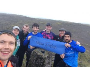
It was then on to Sawel the highest peak in Derry and Tyrone. Chris, Ross and Oisín also followed us to Sawel which again made a huge difference. We started into the boggy steady climb just after 1200 and passed a pair of hikers coming down Sawel who jokingly said to us, “should have started earlier lads”, we smiled back and hiked on, little did they know we had in fact been hiking since 0400, four days earlier! (Total distance: 4.5km ; Total climb: 335m).
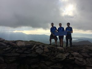
As we bid adieu to the guys at the base of Sawel at about 1330 we were on our way to Errigal, Donegal’s highest and our final peak. By this point I felt I could sleep anywhere and was asleep within seconds and woke up as we were passing Glenveagh national park. In the Errigal car park, we met David’s parents along with a couple of friends as we began our ascent. At this point we knew we would make it under the 3.5 day 84 hour target we set while training in spring in the Mournes, so it felt almost like a victory lap as we walked up Errigal in glorious weather. Knowing we were actually going to make it masked the aches and pains that had been progressively building over the past few days, and we reached the summit of Errigal at 1700, giving us a final time of 83 hours and 45 minutes, 15 minutes quicker than our target. We all had tried to envisage this moment for months. To be honest it seemed so far off it was hard to imagine it would ever come to fruition – we imagined that it would be celebratory but the three of us just sat there on the summit staring out towards Gweedore eating cola bottles for what felt like an eternity. “What next?” David and I wondered aloud. “Food that isn’t a ham sandwich,” Peter replied immediately – best suggestion all weekend! (Total distance: 4.8km ; Total climb: 471m).
After we each returned home, it took a few days before what we had done really sunk in: 172km, 10,250m of elevation climbed (the total climbing involved in Everest is ~6000m), just under 38,000 calories and 260,000 steps, all in 83 hours 45 minutes. We couldn’t have done it without the amazing support of our sponsors and support crews who we cannot thank enough. However, the most important number for us was the over €8,000 that we raised for Make A Wish, and that made it all worth it.
Andrew Goulding, 32-year-old civil engineer living in Belfast. Adventure racing, trail running and hiking enthusiast. Currently progressing through Mountaineering Ireland Mountain Skills courses and training for attempts at the Mournes 600 and 500 in summer 2021. Insta: @thegreenmountaingoat.
 Belfast,Photography
5 scenic walks around Lisburn
 Mourne Mountains
Bearnagh: Chased the sunset, caught the rain
 Mourne Mountains
Camping in the High Mournes
 Fermanagh and Tyrone
Cuilcagh: Stairway to Heaven
 Features
Every Game of Thrones Location in Northern Ireland
 Mourne Mountains
Hen and Cock Mountains
 Mourne Mountains
Leganabrachan, Millstone and Thomas: Donard’s Seaside Bodyguards
 Mourne Mountains
Percy Bysshe and Cove Caves