Climbing Slieve Binnian from Carrick Little (for novice hikers)
Would you like to sponsor this article?

This is a circular walk from the car park on Lighthouse Road using the Moat Pad, farm tracks and quiet country roads, returning by Adder’s Loanin. It is suitable for all age groups and requires only a basic fitness level.
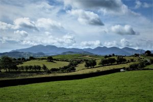
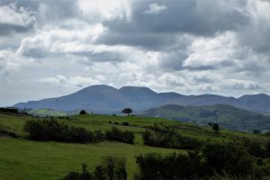
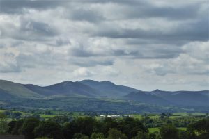
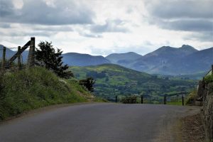
If there was an award for most scenic car park in Ireland, Lighthouse Road would be a strong contender for top honours. It enjoys an elevated setting with spectacular views of the Mourne Mountains. A display board nearby portrays all the mountains on view, naming them all in an east to west sequence.
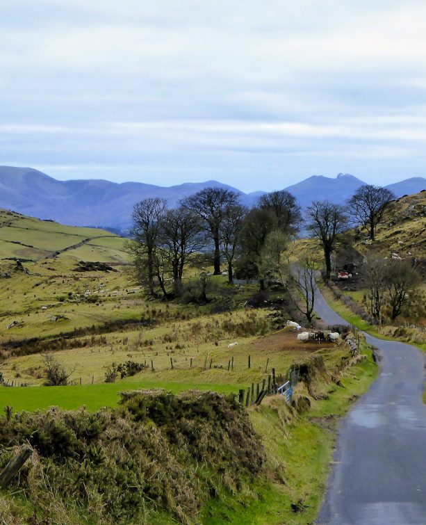
Begin the walk by turning left from the car park and walking along Lighthouse Road enjoying the views of the Dromara Hills on the right.
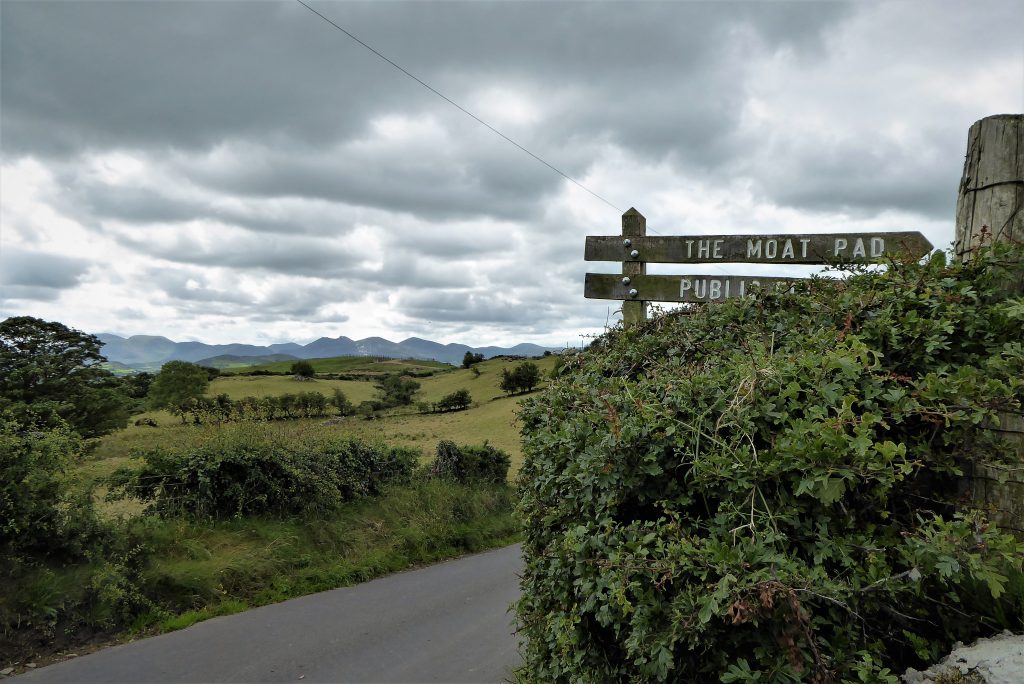
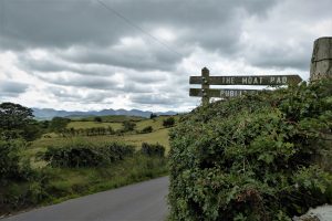
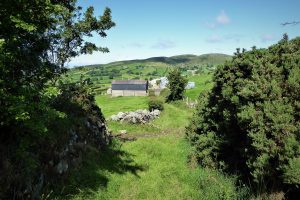
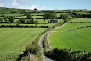
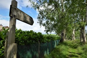
After 500m, look out for a sign for the Moat Pad on your left. Turn onto the pad and follow the concrete road as it passes a farm on the left before veering right. The road becomes a wide farm track as it climbs gently, roughly parallel to Lighthouse Road.

SHOP: Trek NI Tees, made from 100% organic cotton
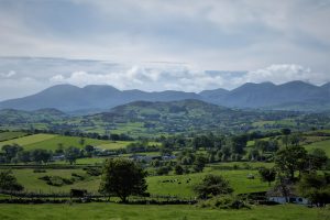
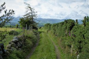
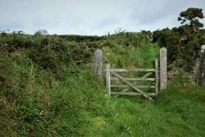
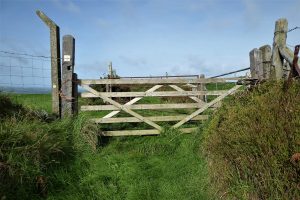
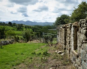
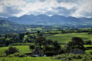
Find Out MoreAbout 500m further, turn left through a small wooden gate onto a much narrower track bounded by low dry-stone walls which have long since been enveloped by vegetation. The wall on the right is topped by a fence. The path climbs gradually and, as height is gained, splendid views of the Mournes develop on your left while Slievenaboley and the undulating Dromara Hills landscape catch the eye to the right.
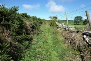
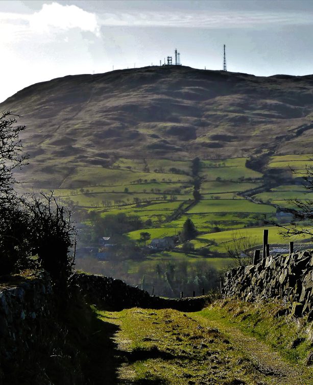
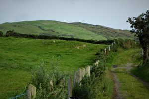
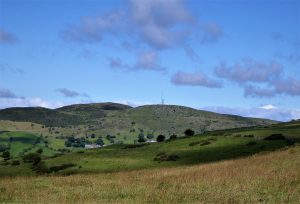
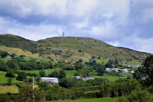
The path proceeds gently uphill until you reach a wooden gate where views of Slieve Gullion and Camlough Mountain take shape away to the west. Dehommed Mountain with its summit furniture begins to dominate the scene to the north-west.
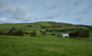
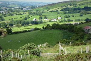
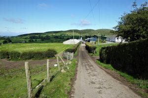
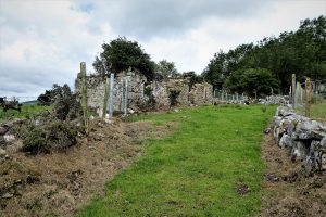
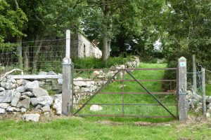
After negotiating another wooden farm gate, the path begins to drop downhill towards a farm. Walk straight through the farm and down the lane until you meet the B7, Rathfriland Road. You have arrived in the townland of Deehomed or Dechomet (arguably from the Irish Deigh-Choimhead, meaning “good prospect”).
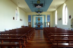
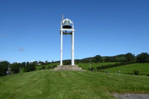
Turn left and walk the 300m into the small village taking care on the road, which can be quite busy. The Church of St Mary of the Angels is worth a look. Dating from the mid-nineteenth century, its modern interior is striking but restrained. The eye-catching church bell dates from 1856.
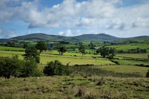
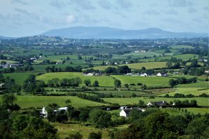
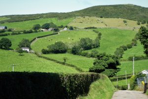
At the crossroads, take the Ballymackilreiny Road. The next 2.2km is punctuated by wonderful views of the Mournes from varied perspectives on one side and quiet, green countryside on the other. Walk the full length of Ballymackilreiny Road until it meets Millvale Road.
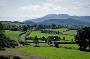
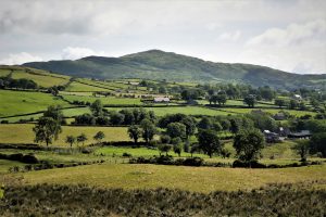
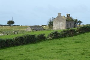
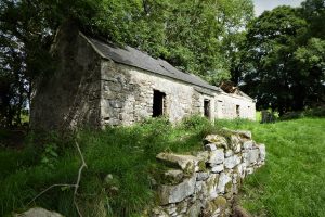
Turn left and, after a few metres, left again onto Adder’s Loanin. It’s surprisingly different in form and atmosphere from the Moat Pad, being wider and somehow more open and spacious. It also has more varied features with abandoned dwellings, trees and a number of twists and turns. The views are not as spectacular as those of the Moat Pad, but the Mournes still manage a few guest appearances.
The Loanin is about half the length of the Moat Pad and the farm that was passed at the beginning of the Moat Pad soon reappears as Loanin meets Pad.
After a few metres, a right turn and a short walk along Lighthouse Road brings you back to the car park and more fabulous Mourne Mountain views.
From Dromara, take the B7 for Rathfriland. Look out for Slievenaboley Road on the left after about 3½ miles (signposted for Finnis Souterrain and Legananny Dolmen). Go straight up Slievenaboley Road passing the Windy Hill car park at the brow of the hill. After about 1½ miles, just after a brown sign for Legananny Dolmen and Slieve Croob Scenic Loop, look out for a well-hidden right turn onto Lighthouse Road. Continue on Lighthouse Road for 1¾ miles and pull into the car park on the right. Again, it’s hard to spot – it’s just before a white house and is announced by a short stone wall on the right-hand side of the road.
Coming from the south, from Leitrim village take the Ballydrumman Road for 2½ miles and turn right onto Lighthouse Road and after less than half a mile, turn left into the car park.
8km (5 miles)
2½ hours
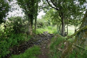
…if you enjoy a quiet, easy walk with superb views uninterrupted by any challenging aspects – the few gradients are gradual and gentle. It’s an interesting walk with varied landscapes in an area that has so far kept its charms largely hidden from the walking community. Wear a decent pair of boots as there is a (usually) small stream to negotiate at the start of Adder’s Loanin.
READ: The Story of the Backpack: Why Madlug?
Find Out MoreA loanin (or loaning) is an Ulster-Scots word roughly equivalent to the Irish “boreen”. According to Wikipedia: “To be considered a boreen, the road or path should not be wide enough for two cars to pass and has grass growing in the middle”. This description could certainly be applied to most of the loanins that form part of the off-road walking network in Northern Ireland. It seems that in Scotland a loaning was a piece of uncultivated ground where cows were milked and a loan was the path to a loaning. Many Scottish street names include Loan, as in “Dobbie’s Loan” in Glasgow.
A pad seems be another word for path, most paths known locally as pads being fairly rough and unformed but usable and normally open to the public. (other theories are available).

Derek, 76, spent 35 years working in national, academic and public libraries, followed by 14 years in the wine trade. He only began serious walking in his 60s, although he had previously travelled many miles on foot pursuing his favourite hobby of fishing. After retirement, he decided to give the fish a rest and bother the hills of Ireland and Britain instead. Derek regards walking as a simple pleasure to be enjoyed, not endured, and prefers a solo hike in quiet, remote surroundings.
 Belfast,Photography
5 scenic walks around Lisburn
 Mourne Mountains
Bearnagh: Chased the sunset, caught the rain
 Mourne Mountains
Camping in the High Mournes
 Fermanagh and Tyrone
Cuilcagh: Stairway to Heaven
 Features
Every Game of Thrones Location in Northern Ireland
 Mourne Mountains
Hen and Cock Mountains
 Mourne Mountains
Leganabrachan, Millstone and Thomas: Donard’s Seaside Bodyguards
 Mourne Mountains
Percy Bysshe and Cove Caves