Climbing Slieve Binnian from Carrick Little (for novice hikers)
Would you like to sponsor this article?

The walk begins and ends at the Water Service entrance gates on Quarter Road. The route passes beneath Round Seefin and crosses attractive countryside, traversing Spence’s River via a steep gorge, before ascending Spence’s Mountain (517m). After an optional brief look at Blaeberry Mountain and The Long Mountain, Chimney Rock Mountain’s 656m summit is gained. Descending to the Mourne Wall, the route veers east over Rocky Mountain (525m) and the Seefins back to Rourke’s Park and the Water Service gates. The walk is moderately strenuous, with Spence’s Mountain presenting a challenging approach. Map and compass are essential kit components as there are few paths on Spence’s to aid navigation.
SHOP: The Trek NI Mountain Mug – the perfect addition to your backpack
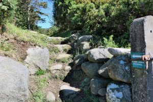
Find Out MoreAfter parking at the big red gates, turn left onto Quarter Road and carry straight on to the track at the sharp bend about 300m along the road. Ford a small stream and, about 250m further, turn left at a gate and climb a short set of steps at the sign pointing towards Round Seefin.
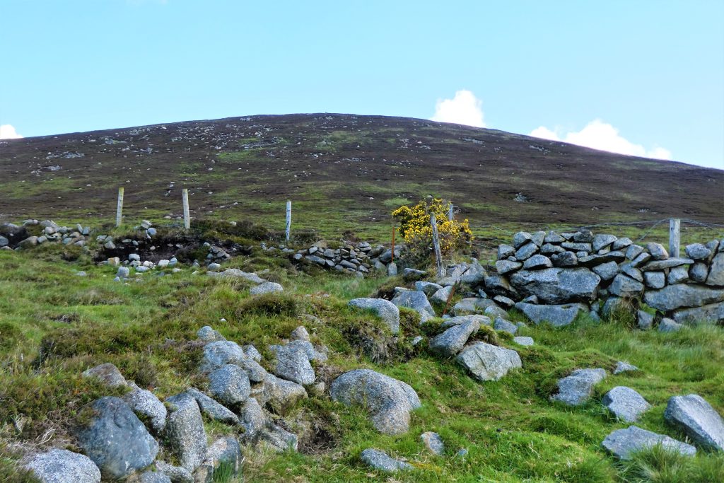
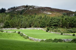
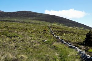
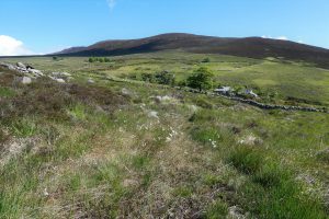
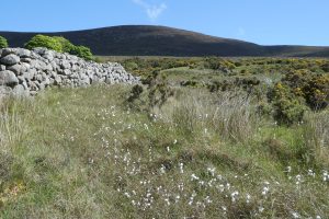
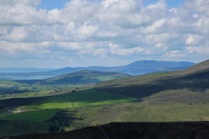
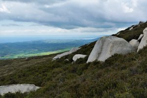
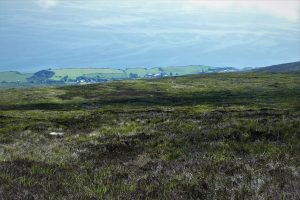
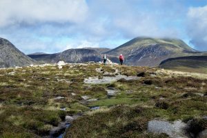
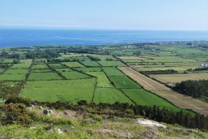
The scenery is typical of the lower Mourne slopes, perfect dry-stone walls dissecting the green fields with the mountains forming a lavish backdrop.
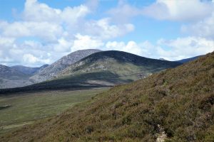
The path turns sharply right after about 500m and soon reaches a stile. Cross the stile and turn left up a rocky path to the foot of Round Seefin. Turn to the right, passing under Round Seefin in a north-east direction following the path as it skirts a steep embankment on the right. Soon, the path takes a sharp left turn and crosses a partially ruined stone wall. Turn right on a fairly clear path, still on a north-east trajectory, with the wall on your right and Spence’s Mountain far ahead.
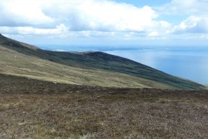
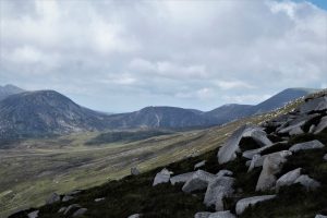
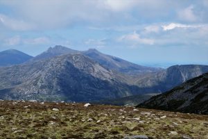
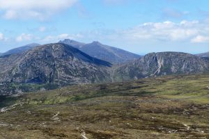
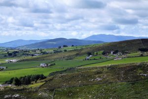
A westerly glimpse should pick out some of the High Mournes, with Binnian and Lamagan prominent. A look over the shoulder will depict the lowly peak of Round Seefin and beyond it the Irish Sea to the east.
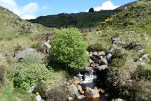
Continue walking parallel to the wall in the direction of a house. At a junction of walls, turn left and follow the wall as it travels north-west and uphill. When it arrives at a fence, turn right and follow the fence until it reaches the crest of a steep gorge that carries Spence’s River. Make your way carefully down the slope and cross the river, negotiating a couple of fences in the process.
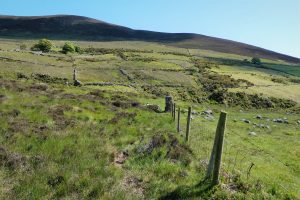
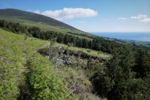
Climb up the other side of the gorge and follow a stone wall in the general direction of Spence’s Mountain. There are a few boggy sections to avoid, but the terrain is generally quite manageable. A spring or summer visit will be brightened by the presence of the usual Mourne wildflowers, mainly the blue milkwort and the little yellow tormentil, with boggy areas announced in advance by the white-headed bog cotton.

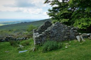
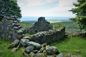
It’s worthwhile exploring one or two of the abandoned homesteads on the slopes beneath the mountain. The inhabitants would have enjoyed very pleasant views, but evidently struggled to eke out a livelihood from the land.
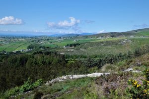
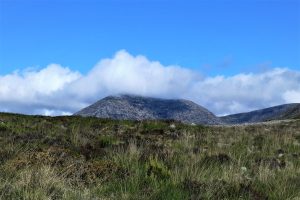
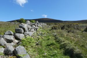
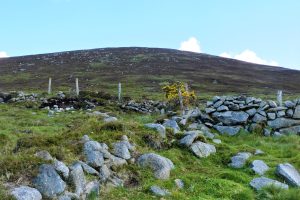
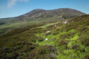
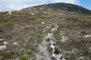
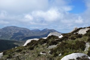
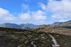
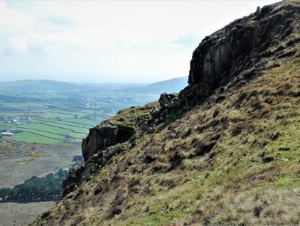
The stone walls peter out as they reach the mountain. The vegetation takes on a darker, brownish hue as the heather-clad slopes beckon. Cross a boundary fence to begin the ascent. The rocks are no longer assembled neatly into walls, but instead are scattered randomly, often hidden under the heather. There is no path to the summit and the thickness and depth of the vegetation can be quite energy-sapping. However, the changing views gradually open out to include the High Mournes, expansive vistas towards the coast and south to the Cooley Mountains of County Louth, offering tired hikers the opportunity for rest and reflexion.
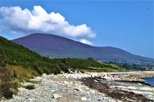
This walk was undertaken in early June before the heather had flowered. Later in the year, the heather blossoms resplendently, creating a spectacular study in purple as shown in the photograph taken in late August from Glasdrumman Port on the Mourne coastal path.
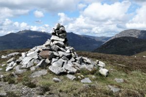
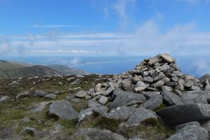
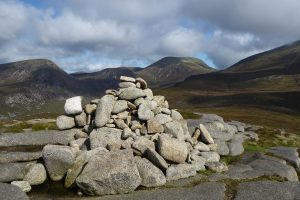
Arriving at the summit cairn, the views continue to expand with the coastline north of Newcastle augmenting the panorama.
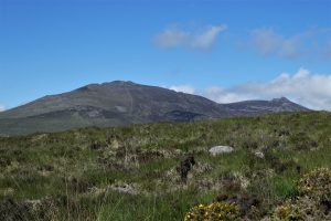
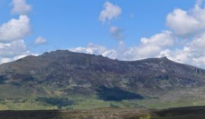
Straight ahead of Spence’s sits the peak of Chimney Rock Mountain, but at this stage of the hike, I decided to have a look at Blaeberry Mountain and The Long Mountain, for no reason other than curiosity and the fact that they are marked on the OS Mournes Activity Map, but not on the Harvey Map of the Mournes. I headed off in the direction of Slievenagarragh and at a point about 500m from the peak, walked back south-west towards Chimney Rock. Whether either Blaeberry or Long Mountain deserves its own appellation is doubtful as neither is recognisable as a separate peak. The area covered by Blaeberry Mountain on the map is obviously named after the widespread swathes of blaeberries (aka bilberries) and Long Mountain is indeed long, but topographically they both seem more like extensions of Chimney Rock.
The United Nations Environment Programme’s complex definition of a mountain does state that “… a hill of 1,000-3,300 feet (300-1,000m) that stands proud of its surrounding area by 300m can claim mountain status”. Regardless of topographical technicalities, the area is quite pleasant for walking and offers an alternative route to Spence’s via Bloody Bridge and Slievenagarragh, but is otherwise unexceptional.
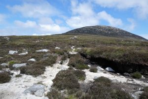
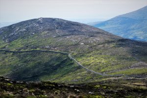
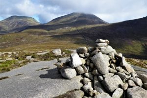
Back at Spence’s, an intermittent path leads to Chimney Rock. The path aims for the left of the peak and skirts round to approach the summit from the south. You can go directly ahead to reach the summit, but it’s a tough option involving quite a lot of bouldering. The left path also gives great views over the south and west.
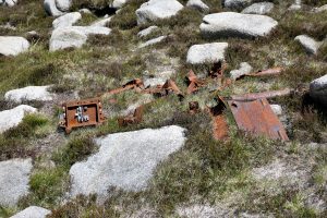
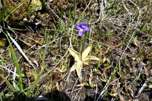
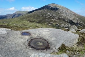
About 100m below the summit, sharp-eyed hikers might spot some of the wreckage of a B52 Marauder that crashed in April 1944 with the loss of all five American crew members. A commemorative plaque sits on a rock pile just below the summit cairn. On a more cheerful note, look out for one of our native carnivorous plants, butterwort, which seems to find this soggy environment to its liking. Its leaves exude a sticky fluid that lures unsuspecting insects to land and become its prey.
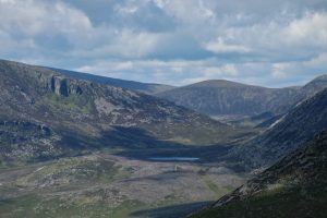
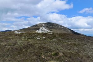
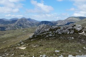
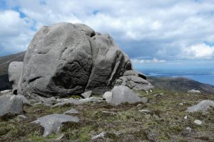
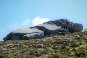
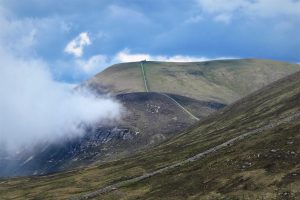
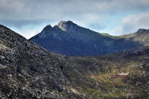
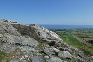
The summit cairn presents a commanding view over Murlough Nature Reserve and the coast as far as St John’s Point. A few metres from the cairn sits the peculiar rock feature that gives the mountain its name. The summit plateau stretches for about a kilometre with spectacular views the whole way.
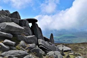
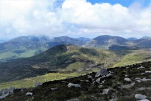
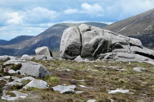
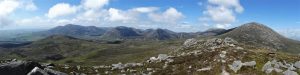
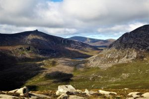
Arrival at the north-western tip of the plateau is greeted by Chimney Rock’s spectacular tors, which glint with a slate-grey shimmer in the sunlight. The area offers an unrivalled view over the Middle and High Mournes.
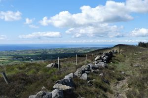
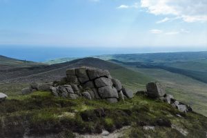
A clear path with several offshoots leads from the tors to the Mourne Wall and east to Rocky Mountain.
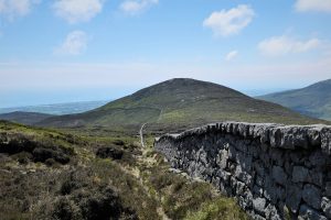
From the wall, turn left and head for the point where the wall takes an almost 90˚ turn to the left as it skirts the slopes of Rocky Mountain. Leave the wall and take the path up to the summit. Rocky Mountain shares its name with two other mountains in the Mourne range. This is the most northerly and, at 525m, also the highest.
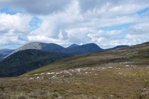
The summit presents views of the four highest peaks in the Mourne range, Slieves Donard (853m), Commedagh (765m), Binnian (747m) and Bearnagh (739m).
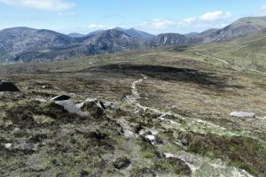
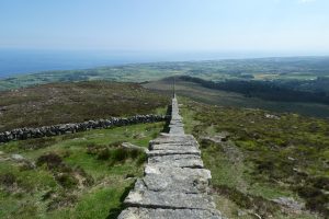
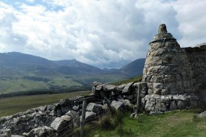
The descent from Rocky is straightforward, but steep. A clear track descends to the wall zigzagging through the heather between boulders and rock formations. Arriving at the wall, the choice of side to walk on depends largely on wind conditions, but the left (north) side is slightly more favoured by walkers. As the wall traverses Long Seefin and drops down towards Round Seefin, you will pass a small round tower that marks the intersection of the Mourne Wall and the wall leading to Round Seefin. If you are walking on the right hand side of the wall, cross the stile just before the tower. From the tower to the summit of Round Seefin is just under 1km of effortless walking.
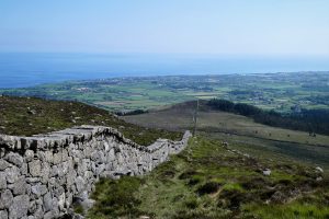
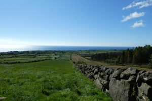
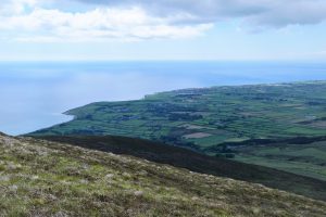
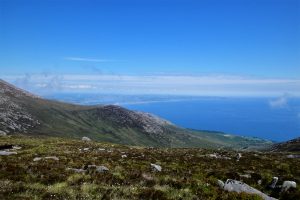
Round Seefin’s modest summit is capped by a rock platform with a fairly steep eastern flank. It’s possible to climb down directly from the top, but the safer option is to veer left to descend by a gentler path round the overhang and take the bracken-lined path followed on the way up at the start of the walk, enjoying the glorious palette of colours to the south created by the Irish Sea, the lower Mourne slopes, Knockchree and the distant Cooley Mountains.
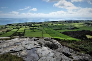
The path passes through a large rocky outcrop which bears the signs of former stone workings – Seefin’s fine-grained granite setts (blocks) were in high demand in the 19th century for use as paving slabs in the construction of roads and pavements in British cities. Complete the walk by reversing the course taken at the start as it reveals the many shades of green decorating the County Down countryside as it stretches down the coast to Annalong.
June 2022
From the north, take the A24 Newcastle Road, then the A2 towards Kilkeel. About 5½ miles after passing Newcastle Harbour, turn right onto Quarter Road at the sign for Silent Valley and shortly after a sharp left-hand turn, park at the Water Service entrance gates, BT34 4RL. If there is no space, limited roadside parking is possible in the area known as Rourke’s Park at the sharp corner back along Quarter Road about 300m from the gates.
A regular bus service operates between Newcastle and Kilkeel – check out http://www.translink.co.uk. If using the service, you’ll need to add 4km to the trip to allow for the walk to the start and back. The Mourne Rambler service run by Translink operates in July and August, Mondays excepted, with a stop at Rourke’s Park (info based on 2021 schedule).
The Mourne Shuttle Service offers a flexible year-round service for walkers and cyclists, weekends only in winter. You park your car at the end of your walk and they shuttle you to your start point. Contact via Mourne Shuttle Service | Facebook or, to book: T: 07516 412076.
READ: Slievemageogh via Pigeon Rock Mountain
Find Out More14km (8½ miles)
6 hours
Temp 12˚C – 14˚C; calm, dry, half sunny, half cloudy/hazy.
OSNI Activity Map: The Mournes (1:25000)
OSNI Discovery Series: Sheet 29 (1:50000)
Harvey Mourne Mountains, Superwalker XT25 (1:25000)
… you enjoy something a little different – this is not a route that is well publicised, nor does it involve any of the more glamorous peaks. However, I rank it as one of the best, covering a wide variety of landscapes and points of interest. Chimney Rock Mountain is also a personal favourite. It rarely attracts a crowd, unlike its rowdy neighbour. Its tors are spectacular and the views are superb.
Be prepared for a quite demanding hike – Spence’s Mountain is no doddle and Chimney Rock can be quite challenging. The Spence’s River gorge needs care and there are a couple of fences to be negotiated. However, a moderate level of fitness and flexibility should suffice.
As an alternative, Spence’s Mountain can be approached from Bloody Bridge via Slievenagarragh. Chimney Rock can be included, with a return to the start via the Crannoge quarry track. This is an easier, but less interesting option.

Derek, 76, spent 35 years working in national, academic and public libraries, followed by 14 years in the wine trade. He only began serious walking in his 60s, although he had previously travelled many miles on foot pursuing his favourite hobby of fishing. After retirement, he decided to give the fish a rest and bother the hills of Ireland and Britain instead. Derek regards walking as a simple pleasure to be enjoyed, not endured, and prefers a solo hike in quiet, remote surroundings.

Climbing Slieve Binnian from Carrick Little (for novice hikers)
Denvir’s of Downpatrick: The Perfect Base for Walkers and Explorers in County Down
5 Outstanding Late Winter Hikes in the Mourne Mountains
Willowtree Glamping: a Romantic, Rural Retreat in the Mournes
 Belfast,Photography
5 scenic walks around Lisburn
 Mourne Mountains
Bearnagh: Chased the sunset, caught the rain
 Mourne Mountains
Camping in the High Mournes
 Fermanagh and Tyrone
Cuilcagh: Stairway to Heaven
 Features
Every Game of Thrones Location in Northern Ireland
 Mourne Mountains
Hen and Cock Mountains
 Mourne Mountains
Leganabrachan, Millstone and Thomas: Donard’s Seaside Bodyguards
 Mourne Mountains
Percy Bysshe and Cove Caves
