Climbing Slieve Binnian from Carrick Little (for novice hikers)

Would you like to sponsor this article?

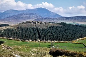
This is an interesting looped walk in one of the quietest areas of the Mournes. From Deer’s Meadow the walk follows Batt’s Wall to the first summit cairn of Pigeon Rock (534m), then takes a south-southeast course to the second summit cairn (also 534m). From there, the route runs south over a terrain of heather, thick grass, rocks, small ponds, peat hags and bog to reach an old quarry track that joins a path leading to the summit of Slievemageogh (316m).
The return journey follows the course of the Whitewater River upstream to arrive back at Deer’s Meadow. There is no path between the south-east summit cairn of Pigeon Rock and Slievemageogh. Although the walk is only moderately strenuous, route finding demands concentration and map and compass are essential kit. In wet weather, gaiters would be helpful as ground conditions can be quite boggy.
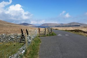
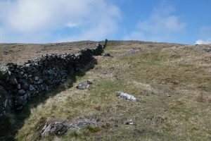
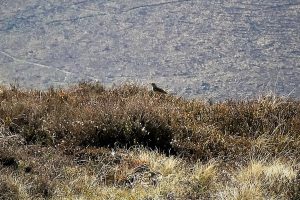
Park at the top of the road leading to Deer’s Meadow car park and cross the stile that faces Spelga Dam. Turn left and follow the wall up the slopes of Pigeon Rock. The well tramped path takes several detours to avoid boggy patches on the lower slopes, but the ascent is fairly benign with few steep inclines. In late spring and early summer you may be greeted by the frantic, staccato singing of skylarks as they ascend vertically and hover high above.

SHOP: The Trek NI Mountain Mug
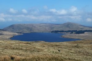
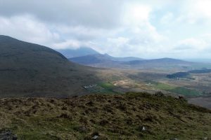
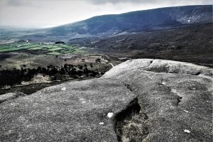
Find Out MoreFrom stile to summit is about 1.4km and should be doable in about 40 minutes. The views from the top are extensive with Slievemoughanmore, Pierce’s Castle, Rocky Mountain and the twin peaks of Cock Mountain all in focus to the west. Spelga and its nearby peaks populate the northern perspective with the massive bulk of Slieve Muck dominating the eastern outlook.
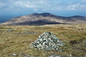
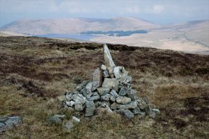
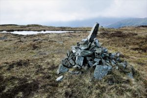
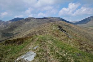
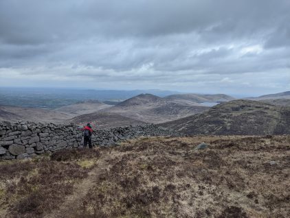
From the summit cairn you can choose which side of the wall to follow for the next short section of the walk. The right-hand side is more scenic, but does require scaling the wall at some point, whereas a stile at the summit gives access to the left side. After about 0.4km the wall takes a 90˚ turn to the right. Cross the wall (if you have chosen the right-hand side) and take a south-southeast course (more south than east) over rough ground to reach the second summit cairn. The cairn will be visible at various stages of the walk, making navigation easier. A faint, intermittent path avoids the boggiest areas. The cairn should be reached after about 0.4km.
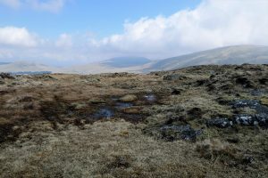
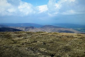
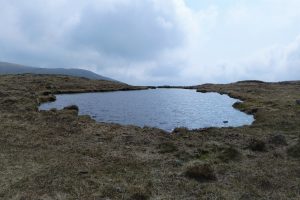
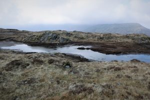
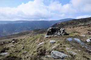
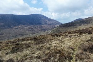
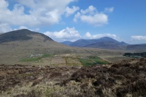
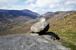
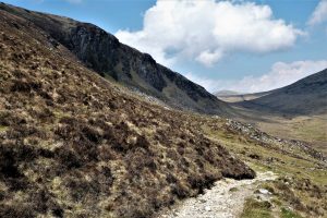
Pass a large pond just south of the cairn and continue due south, soon passing another pond. Slieve Muck presides over the views to the east, while Slievemoughanmore and Eagle Mountain command the westerly aspect. Your eye might be attracted by a prominent rounded crest to the south-west which could easily be mistaken for Slievemageogh. Ignore it and keep heading south over the terrain of heather, rocks, grasses and peat hags. As there is no path for the next 3km, map and compass are indispensable kit items on this part of the hike. Despite the challenging terrain, there is a beautifully remote, untouched atmosphere about the place, a feeling increased by the likelihood that you will have only yourself for company.
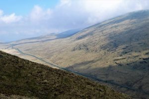
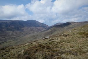
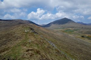
Eventually, the summit of Slievemageogh appears in the distance as the view expands to the east to include Slieve Muck, Slievenagore and Slievenaglogh with behind them, Moolieve, Wee Binnian and Slieve Binnian. Keep close to the foot of the cliffs on the right until you meet a track which peels off downhill to meet a path leading to Slievemageogh.
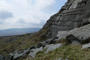
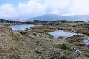
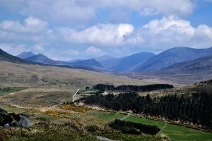
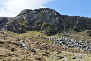
It’s worth exploring the area under the cliffs as it was the site of quarrying activity in the past. Estyn Evans, in his book Mourne Country *, mentions an area to the west of Pigeon Rock known as Millstone Hollow where millstones were cut. The views west are impressive with Eagle Mountain and Finlieve sweeping down to the valley of the Pigeon Rock River. Carry on down the track which soon connects to the narrow path that leads to the summit of Slievemageogh.
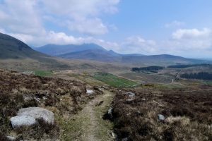
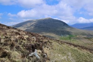
The walk to the summit passes some impressive cliff scenery as well as offering spectacular vistas extending to the High Mournes in the north-east. If walking in spring or early summer, look out for wheatears which will be pairing up to nest and breed, having migrated here from Africa.
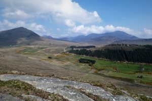
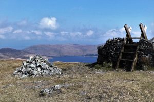
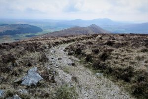
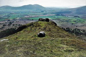
The summit affords excellent views extending south to Carlingford Lough, west to the Eagle Mountain/Finlieve ridge, east to Binnian and north to the Middle and High Mournes.
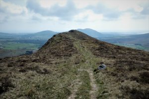
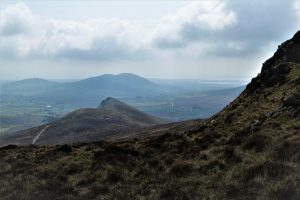
Returning along the ridge, the views continue to impress, perspectives changing as you walk north.
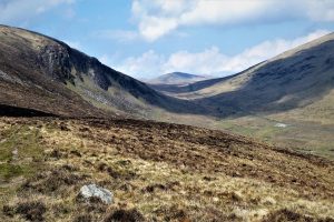
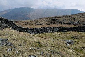
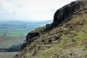
Keep straight on, ignoring any paths to the left. The track begins to descend as it winds along under the steep cliffs of the eastern escarpment of Pigeon Rock. Rock doves, wild ancestors of the feral pigeon, were known to nest here in the 19th and early 20th centuries, which may account for the name of the mountain.
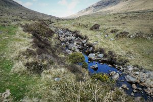
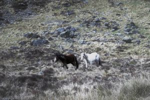
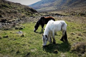
Leave the path when it reaches the Whitewater River and follow the course of the river upstream back to Deer’s Meadow. The ground can be boggy in parts and in wet weather gaiters would be useful. The riverside walk is often enlivened by the antics of grey wagtails, attractive yellow-breasted birds of fast flowing streams. I didn’t see any on this visit, but I was pleased to be joined by a pair of horses for part of the journey along the riverbank.
* Evans, E E Mourne Country: landscape and life in South Down. 2nd ed. Dundalgan Press, 1967
READ: 7 Miles, 7 Mountains: a Western Mournes adventure
Find Out MoreApril 2021
If approaching from the north, head for Spelga Dam and look out for a right turn shortly after passing the dam. The road leads down to Deer’s Meadow car park, but on weekdays there is usually ample parking at the top of the road near a stile that leads on to Pigeon Rock
10km (6¼ miles)
4 hours
…you enjoy spending time in a quiet area of the Mournes covering some relatively remote terrain. The section between the south-east summit of Pigeon Rock and Slievemageogh can be a little boggy and the thick vegetation and peat hags make for some tough walking conditions. Lack of any clear path calls for competent navigation so this probably isn’t a walk for beginners.
OSNI Activity Map: The Mournes (1:25000)
OSNI Discovery Series: Sheet 29 (1:50000)
Harvey Mourne Mountains, Superwalker XT25 (1:25000)
Walk No 21 The Pigeon Rock Ridge in Andrew McCluggage’s excellent publication The Mourne Mountains: the 30 best hikes, hand-picked by a County Down local, covers the section of the walk between Pigeon Rock and Slievemageogh. (Knife Edge, 2019. ISBN 978-1-912933-03-7).
If you wish to visit Slievemageogh only, use the car park on Moyad Road, about a mile further on from the turn off for Deer’s Meadow. The car park gives access to the track to Slievemageogh.

Derek, 76, spent 35 years working in national, academic and public libraries, followed by 14 years in the wine trade. He only began serious walking in his 60s, although he had previously travelled many miles on foot pursuing his favourite hobby of fishing. After retirement, he decided to give the fish a rest and bother the hills of Ireland and Britain instead. Derek regards walking as a simple pleasure to be enjoyed, not endured, and prefers a solo hike in quiet, remote surroundings.

Climbing Slieve Binnian from Carrick Little (for novice hikers)
Denvir’s of Downpatrick: The Perfect Base for Walkers and Explorers in County Down
5 Outstanding Late Winter Hikes in the Mourne Mountains
Willowtree Glamping: a Romantic, Rural Retreat in the Mournes
 Belfast,Photography
5 scenic walks around Lisburn
 Mourne Mountains
Bearnagh: Chased the sunset, caught the rain
 Mourne Mountains
Camping in the High Mournes
 Fermanagh and Tyrone
Cuilcagh: Stairway to Heaven
 Features
Every Game of Thrones Location in Northern Ireland
 Mourne Mountains
Hen and Cock Mountains
 Mourne Mountains
Leganabrachan, Millstone and Thomas: Donard’s Seaside Bodyguards
 Mourne Mountains
Percy Bysshe and Cove Caves
