Climbing Slieve Binnian from Carrick Little (for novice hikers)

Would you like to sponsor this article?

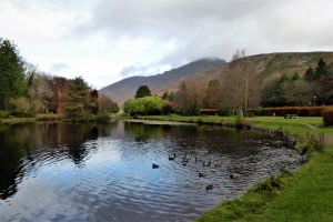
This is a circular walk from Silent Valley, visiting three mountains, Moolieve (332m), Wee Binnian (460m) and Slieve Binnian (747m) with a return trip along the banks of Silent Valley Reservoir. The walk calls for a good level of fitness, the ascent of Slieve Binnian from Wee Binnian providing a tough challenge for the hardiest of hikers. This is not a walk for the inexperienced and should not be attempted in poor visibility. Sturdy footwear, sound waterproof clothing, map and compass are essential kit. You will be rewarded with spectacular views throughout the walk with Slieve Binnian in particular offering some of the most pleasurable visual experiences in the Mourne range.
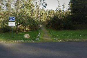
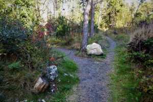
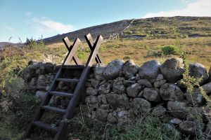
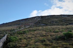
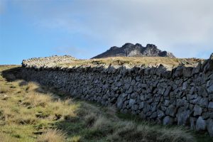
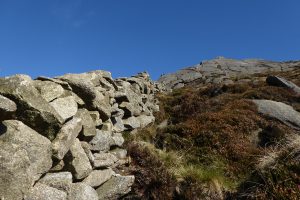
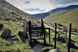
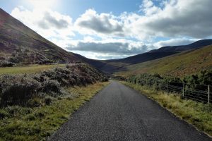
From the car park, walk north past the toilet block and veer right just before a small lough. At the road junction, go straight across the road and take the path opposite through a wooded area. Turn left a few steps up the path and continue for about 300m until you reach another path junction. Turn sharply right and walk along a grassy path for a few metres to reach a stile. Cross the stile and follow the wall up Moolieve. The vegetation can be fairly thick on the lower slopes of the hill, but it thins out as height is gained. About 200 metres further, cross another stile and carry on up the slope, with the wall now on your right.
SHOP: Organic cotton hoodies – eco-friendly comfort for your outdoors adventures
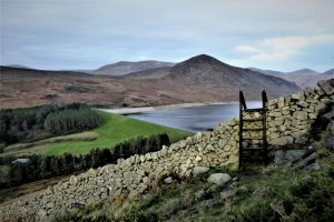
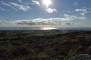
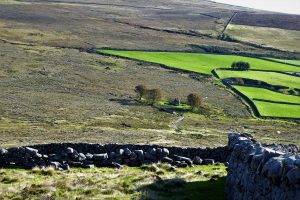
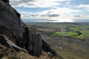
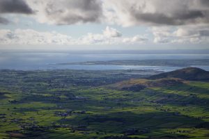
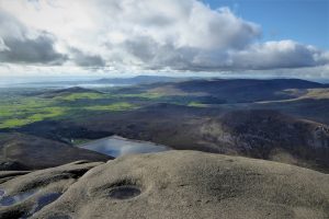
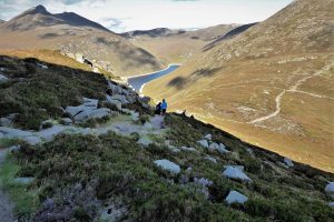
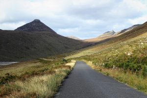
Find Out MoreAlthough the stile sits at a mere 230m, it seems higher as the view of Silent Valley extends west and north to include Slievenaglogh, Slieve Muck, Slieve Loughshannagh, Doan and the Meels (Meelbeg and Meelmore). Soon, the rugged tors of Slieve Binnian begin to appear as the summit cairn of Moolieve approaches. When pictured from the cairn, Wee Binnian resembles a small carbuncle by comparison with its big brother. To the east, the fields of County Down stretch like a green carpet towards the Irish Sea.
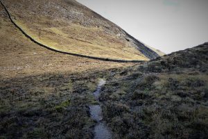
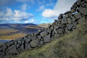
Continue alongside the wall to the saddle between Moolieve and Wee Binnian passing an old, partially ruined wall which runs off to the left. An iron gate gives access to the right-hand side of the wall, which offers an optional, but tricky, approach to Wee Binnian’s tors. The easier option is to keep the wall on your right.
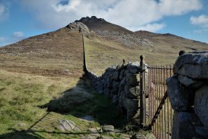
Pass through the saddle, which can often be slightly boggy. Before the wall terminates just below the rocky summit of Wee Binnian, take the faint path that passes to the left of the rock outcrops. Determined peakbaggers will undoubtedly make for the summit, but others will wish to conserve energy for the assault on Slieve Binnian. The path skirts the summit and descends to a stile. Cross the stile to begin the ascent of Slieve Binnian.
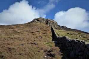
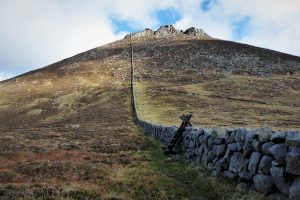
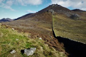
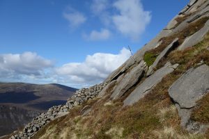
Keeping to the right of the wall, the first 150m of ascent is straightforward, as a well tramped grassy path makes for easy walking. However, the going soon gets tough with large rocks, no clear path and an increasingly sharp gradient impeding progress. If you enjoy scrambling, you’ll be in your element as picking a suitable path will involve much stretching and manoeuvring, with all four limbs being deployed to maintain contact with the challenging terrain. Take time for frequent rests and enjoy the spectacular views to the south.
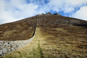
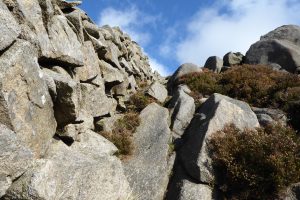
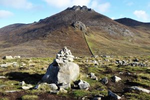
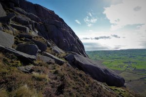
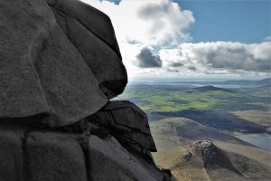
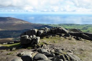
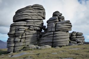
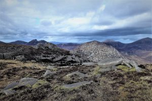
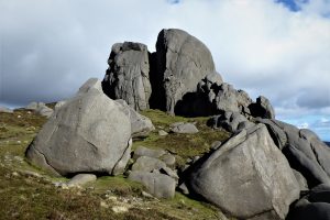
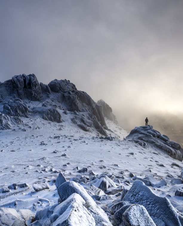
The wall peters out as it meets a large smooth rock outcrop. A glance to the left emphasizes the steepness of the gradient. Take care and tread very carefully as a trip or slip at this stage of the ascent could be dangerous. The vistas are of course superb, particularly to the south and south-east. There are several faint paths on the steep slopes most of which lead to gaps between the rock formations. You can explore the South Tor, marked by a metal pole, by heading in a south-easterly direction from the wall. The tors and the various weird rock formations, along with the breathtaking views, are what makes Binnian one of the most characterful and popular peaks in the Mournes.
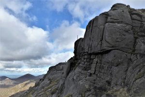
The Summit Tor, to the north of the South Tor, offers some of the most splendid views. It can be accessed with a bit of a scramble and some judicious footwork. The whole summit plateau is a playground for photographers, amateur and professional, the challenge being to find an image that hasn’t been replicated many times before.
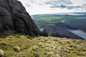
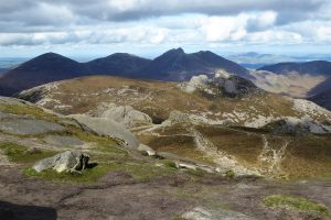
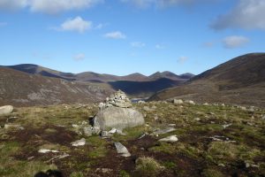
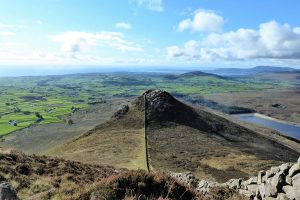
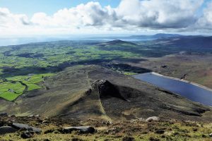
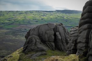
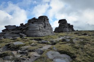
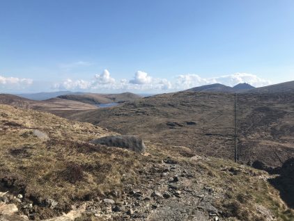
From the summit tors, follow the obvious path north along a broad ridge, descending gently towards several curious, wrinkled rock formations known as the Back Castles, by-products of the gouging progress of vast ice sheets thousands of years ago. The expansive views from the ridge feature most of the High Mournes.
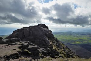
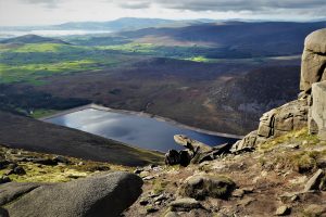
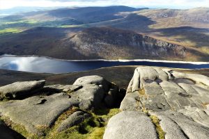
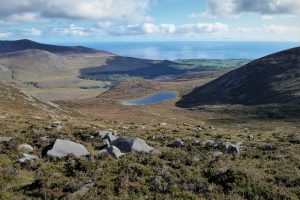
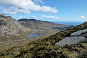
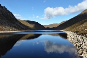
As the path heads towards the North Tor, Binnian Lough appears invitingly to the east. The kidney shaped lough must be the highest body of water in the Mournes. The massive bulk of the North Tor, sitting at 670m, is an equally impressive sight. Apparently it can be climbed without too much difficulty, although I have never seen it attempted.
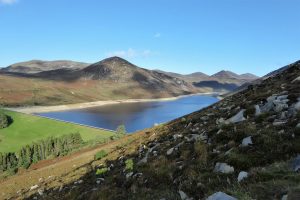
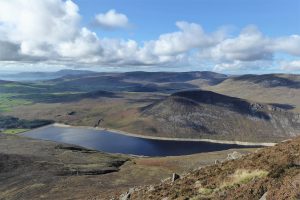
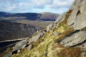
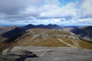
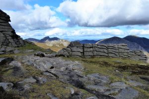
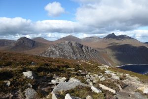
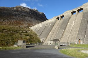
Shortly after leaving the North Tor, the path begins to descend to the col between Binnian and Slieve Lamagan. It begins fairly smoothly, but soon becomes a little tricky, although Mourne Heritage Trust have done sterling work improving the path while ensuring that it blends in with its surroundings. The views west are expansive, taking in Doan, Bearnagh and the rugged summit of Ben Crom Mountain, with Slieve Loughshannagh and the Meels in the background. Blue Lough and Slieve Lamagan sit to the east while further to the north-east, Rocky Mountain leads on to Chimney Rock Mountain. The view of Ben Crom Dam from the descending path is one of the most iconic Mourne scenes.
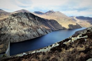
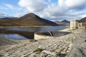
Arriving at the col between Binnian and Lamagan, turn left at the path junction and make your way down the narrow, rocky path towards the head of Ben Crom Dam. Cross the stile at the end of the path and descend a formidable number of steps to arrive at the foot of the retaining wall of the dam.
READ: Denis Rankin Round: Stage 3 & 4
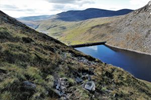
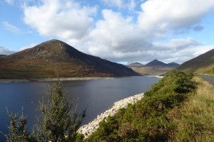
Find Out MoreA tarmac road runs from Ben Crom to Silent Valley making for a very pleasant and picturesque final few kilometres of the walk. Look out for the outflow of the Binnian Tunnel as it tops up the Silent Valley with water from the Annalong Valley. When you arrive at a point just past the dam, leave the road and descend a flight of steps to return to the car park.
OSNI Activity Map: The Mournes (1:25000)
OSNI Discovery Series: Sheet 29 (1:50000)
Harvey Mourne Mountains, Superwalker XT25 (1:25000)
… you would enjoy a slightly unconventional route to one of the most popular venues in the Mournes, second only to Slieve Donard in visitor numbers. You’ll need to be prepared for a strenuous day’s hiking over demanding terrain, but you’ll be rewarded with wonderful views and a great variety of scenic gems.
The walk described corresponds closely to Walk No 24, Moolieve and the Binnians in Andrew McCluggage’s book, published in 2019, The Mourne Mountains: the 30 best hikes, hand-picked by a County Down local.
From the north, take the A24 and A2, turning right about a mile on the Newcastle side of Annalong up Quarter Road and onto Head Rd. After about 6 miles, you reach Silent Valley where there is ample parking at a fee of £5 (Dec 2021). It’s advisable to check opening and closing times before setting out.
12km (7½ miles)
5 hours
Silent Valley National Park offers several walking trails of varying length and degrees of difficulty: The Silent Valley Trails – Northern Ireland Water (niwater.com)

Derek, 76, spent 35 years working in national, academic and public libraries, followed by 14 years in the wine trade. He only began serious walking in his 60s, although he had previously travelled many miles on foot pursuing his favourite hobby of fishing. After retirement, he decided to give the fish a rest and bother the hills of Ireland and Britain instead. Derek regards walking as a simple pleasure to be enjoyed, not endured, and prefers a solo hike in quiet, remote surroundings.

Climbing Slieve Binnian from Carrick Little (for novice hikers)
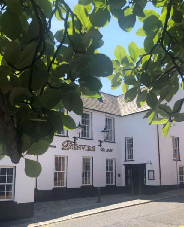
Denvir’s of Downpatrick: The Perfect Base for Walkers and Explorers in County Down
5 Outstanding Late Winter Hikes in the Mourne Mountains
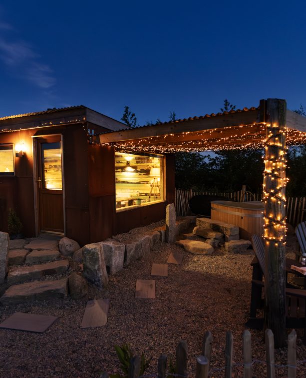
Willowtree Glamping: a Romantic, Rural Retreat in the Mournes
 Belfast,Photography
5 scenic walks around Lisburn
 Mourne Mountains
Bearnagh: Chased the sunset, caught the rain
 Mourne Mountains
Camping in the High Mournes
 Fermanagh and Tyrone
Cuilcagh: Stairway to Heaven
 Features
Every Game of Thrones Location in Northern Ireland
 Mourne Mountains
Hen and Cock Mountains
 Mourne Mountains
Leganabrachan, Millstone and Thomas: Donard’s Seaside Bodyguards
 Mourne Mountains
Percy Bysshe and Cove Caves
