
Climbing Slieve Binnian from Carrick Little (for novice hikers)
Would you like to sponsor this article?

Ballypatrick forest is a great location for a walk. If you just have time for a quick hour’s worth of fresh forest air, or you would like a four-hour walk in the woods, this is the place. And apart from at the carpark, you are not likely to meet too many other walkers.
The Park is located on the A2 between Ballycastle and Cushendall. There is a carpark, signposted off the main road, to the left, coming from Ballycastle, just after the signs for the Water Top Farm. At present the Forestry Service is conducting tree felling at the southern end of the park, close to the access trail from the carpark, which is why it is temporarily closed (October 2021), probably for another month or so.
SHOP: Northern Ireland: The Unmissable Walks
Find Out MoreThere is a great temporary carpark in place, probably bigger than the regular one, and this one is located virtually opposite the Water Top Farm entrance, that is, on the right-hand side of the road, coming from Ballycastle. It is signposted.
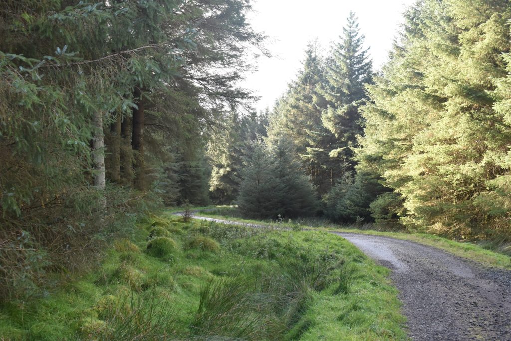
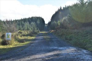
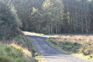
From the temporary carpark, there is a gravel track leading into the forest. The entire route is on this sort of surface, apart from a short section on grass, but with a couple of trees and roots to cross.
After around 300 metres or so, there is a road off to the left. This is a long straight track which will be your return at the end of the walk.
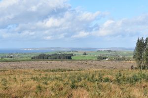
You continue straight on, over the brow of the low incline to see an open vista towards Gleshesk and Knocklayd, and to your right, Rathlin Island.
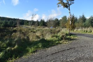
Continue for another 1000 metres until you see another road fork off to the right.
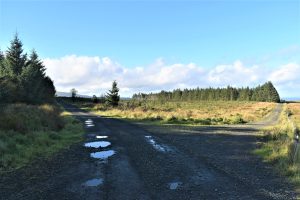
Do not turn here, but continue around the bend and stay on the right hand track now.
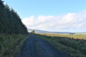
You are now walking through a pine forest.

If you look carefully at the trunks of the smaller trees, you may see sections near the ground with the bark peeled off. The sign of deer! In some parts of the forest, you will see numerous trees like this. If you are quiet as you move along, you may well be lucky enough to spot a deer or two. I rarely walk here without seeing any.
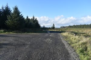
After another nearly 1000 metres the track turns left. Some of the forest has been cleared on your left.
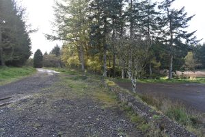
This is a commercial forest, trees are taken out, new ones are planted in. after around 500 metres or so, the road splits. You turn right, down a slight hill and you should be facing a small lake, nearly covered over by gravel and grass. Behind you is a decent car park. This was once a picnic site when this was open as a sightseeing drive.
Today, the picnic tables have rotted away and been cleared out. Still, it is a nice tranquil spot for lunch and for spotting some spectacular dragonflies if the season is right. If it is too early for lunch, continue past the site, along the small river, now actually doubling back on yourself, but just lower down and long a soft, cushioned grassy track. For the next few hundred yards, this is the only section which cannot be accessed by wheelchair due to the roots and a few fallen trees.
The nice, mixed forest opens out to open ground where the river bends indecisively to and fro. There is a T-junction here.
Turn right, then left and you are on your way back to the carpark the way you came in. For the rest of the walk, turn left, over the bridge and head across the open ground towards more pine forest. It will be around 400 metres before you see a bend in the track and you follow this around to your left. It is around 1700 metres before you now see a bend in the road.
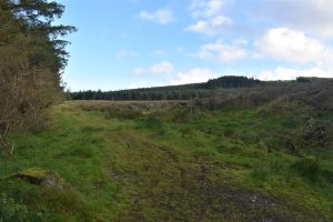
Part of this forest was felled last year, it is now ready for replanting. There is a dogleg to the left, a couple of hundred metres and then a right turn which after a good 500 metres will take you over a small bridge. You will have forest on your left, and open newly cut open land on your right. Another nice spot for a break. We have seen deer in this area.
Due to the tree cutting we do not recommend you take the right hand trail which you will see shortly after the bridge. If you do, it will take you right into the area where they are working. This is currently blocked off. Once opened up again, the first right, followed half way up the hill by a left turn, will take you onto tarmac leading you directly, after a left turn onto the long track back to the car park (alternatively, when the main carpark reopens, you continue left for only 250 metres before turning down right – this will lead you below the A” and back to the carpark).
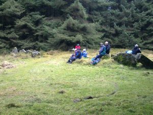
Instead, a slightly shorter route, is to continue straight ahead, past the first right turn, over the hill and past the second right hand track. Continue, with forest on your right; the trail splits, but you stay on the right track with is also signposted past the Double-Horned Cairn, a Megalithic Burial site about 5-6000 years old.
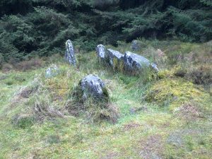
You will see the access path to the Cairn off to your right just after you have passed the track that turned off to the left. The site is only about 50 metres off the track and is well worth seeing.
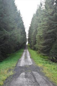
Once back on the trail, continue straight ahead. After around 700 metres you will see a track off to the left. Do not take this one, continue straight ahead for around another 1200 metres or so. You are now at another T-junction. This is so close to the A2 that you may well hear the traffic. If you, at this point turn right, continue onto the tarmac track, and take the first left, you will continue below the arch under the A2 road and back to the permanent carpark which is currently (October 2021) closed.
For us, we turn left, along the fairly straight track. After around 1700 metres, we are back at the T-junction we saw at the outset. The carpark is now a mere 300 metres away to your right.

READ: Aughrim Hill and Knockchree
Find Out MoreThis is a route which can be done any time of the year. Each season will offer different experiences of the smells, the leaves, the colouring and the views. It is a route which in total is around 8 miles if you do the longest alternative including where the tree cutting is currently going on. The alternative, described here is approximately 7 miles.
As always, bring a basic First Aid kit, and as some of these trails have been known to confuse those who are not familiar with them, bring navigational aids or even a map and a compass! The latter is far more fun. The walk takes around 3-4 hours to complete. It is a good idea to bring a pack lunch, and you should never do any walk without enough water to keep you hydrated.
It is a good idea to trace this walk on Google Earth before walking it.

Magne Haugseng, walking enthusiast based in North Antrim. Big fan of the International Appalachian Trail which nearly runs past his door.
 Belfast,Photography
5 scenic walks around Lisburn
 Mourne Mountains
Bearnagh: Chased the sunset, caught the rain
 Mourne Mountains
Camping in the High Mournes
 Fermanagh and Tyrone
Cuilcagh: Stairway to Heaven
 Features
Every Game of Thrones Location in Northern Ireland
 Mourne Mountains
Hen and Cock Mountains
 Mourne Mountains
Leganabrachan, Millstone and Thomas: Donard’s Seaside Bodyguards
 Mourne Mountains
Percy Bysshe and Cove Caves
