Climbing Slieve Binnian from Carrick Little (for novice hikers)
Would you like to sponsor this article?

This is a circular walk starting at sea level, visiting three medium-sized hills in the southern end of the Mourne Mountain range, Slievemeen (472m), Slievemartin (485m) and Crenville (461m) before returning to the start point on forest tracks. Slievemartin is one of the most popular venues in the Mournes. Its accessibility and the availability of ample car parking, combined with good paths and wonderful views ensure a loyal following among local and visiting walkers. Slievemeen by contrast is often ignored, but it is a very pleasant hill with views only a little less spectacular than its better known neighbour. Both peaks would be ideal for beginners and family groups. Crenville, however, is best left to the more adventurous hillwalker who can draw upon well-developed navigational skills backed up by considerable stamina and tenacity.
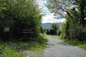
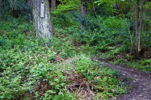
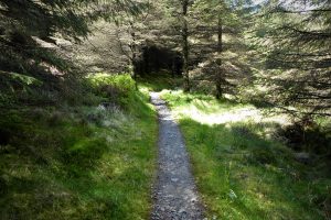
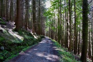
I parked just a few metres from the entrance to Kilbroney Park, Rostrevor, beside a red-brick building on the right. If there is no space, plenty of parking is available in the next car park a short drive up the road. I made my way back a few metres towards the entrance and took a path to the left, signed Rostrevor Oakwood. After about 500m of uphill walking through attractive woodland, a left turn was indicated by the sign for Fiddler’s Green. The underwhelming site of Fiddler’s Green is one of the locations for the annual festival of the same name, one of the longest-running and most respected music events in the Irish festival calendar.
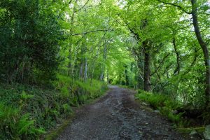
About 400m further, I took a left turn at a path junction and continued for about 250m before turning right at an ageing Viewpoint sign attached to a tree. The path rose steeply through trees and ancient rocks. This was the Cloghmore Trail, which I was taking in reverse.
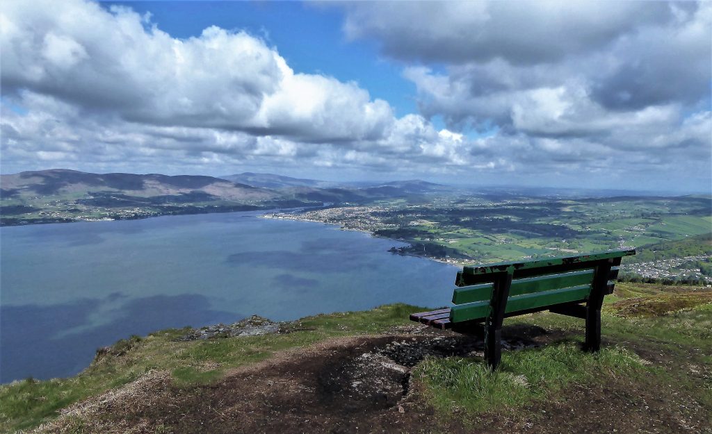
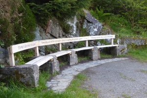
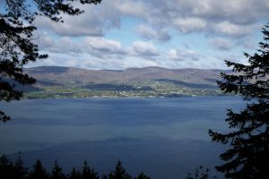
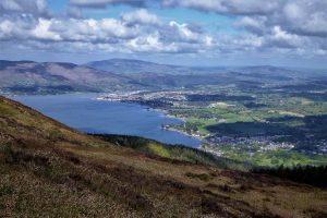
The viewpoint came as a pleasant surprise after an arduous uphill walk. Wooden benches refreshed tired legs while breathtaking views of Carlingford Lough and the Cooley Mountains of County Louth nourished the soul. The benches are inscribed with quotations from CS Lewis. As a boy, the writer spent his holidays in the Mournes, and Rostrevor in particular, prompting his imagination to later create the magical world of Narnia, with The Chronicles of Narnia selling over 100 million copies. Lewis is reported to have written a letter to his brother in which he wrote, That part of Rostrevor which overlooks Carlingford Lough is my idea of Narnia.
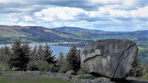
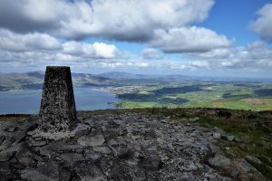
I continued to follow the path uphill until it arrived at the site of Cloghmore (from the Irish An Chloch Mhór, ‘the big stone’).
SHOP: Beanie hats made from 100% organic cotton. 4 colours available
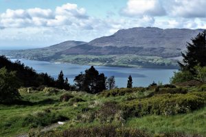
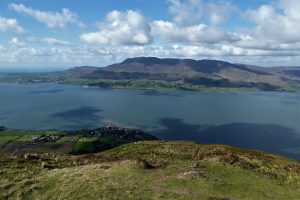
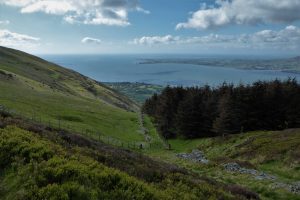
Find Out MoreThe views surpassed those from the CS Lewis viewpoint, with sweeping, uninterrupted vistas of Carlingford Lough, Slieve Gullion and the Cooley Mountains, with the rugged peak of County Louth high point Slieve Foye casting its shadow over the town of Carlingford.
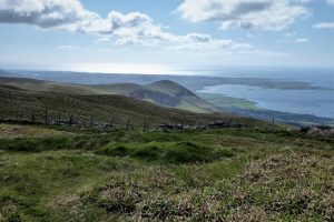
I made my way south-east and headed up to the obvious gap in the trees that led to a very steep incline. It looked more daunting than it was and progress was aided by a clear path. The views to the west expanded to reveal more of Carlingford Lough and the towns on its shoreline, Rostrevor and Warrenpoint in County Down and Omeath in County Louth.
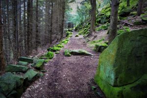
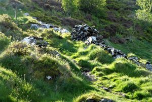
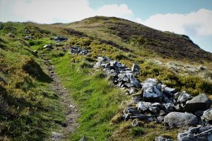
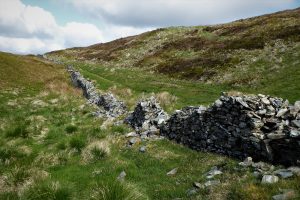
The path rose to reach an old, crumbling boundary wall at the edge of the tree line. The wall, or what remained of it, ran very close to the path. For much of the route, it resembled no more than a stone path, though at various junctures it staged a resurgence towards wall status.
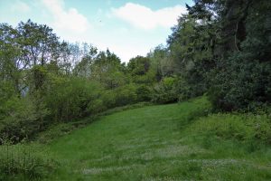
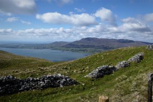
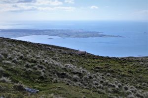
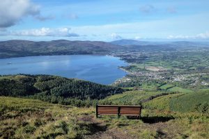
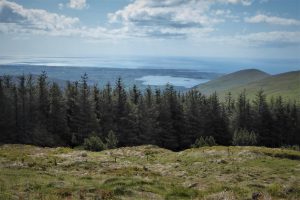
At about 390m, an offshoot led off on the right to a small spur of Slievemeen which, surprisingly, sported a bench. The views from the area were glorious, with the Irish Sea in sight as well as the County Louth coastline as far as Greenore. Just east of the bench, a beautifully quiet spot amid blaeberry bushes, just above a conifer plantation, afforded shelter from the strengthening wind.

A path led back from the spur to the track which was now separated from the wall by a fence. A glance back at the little hill with the bench showed just what a superbly scenic position it graces.
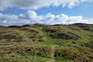
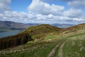
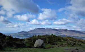
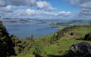
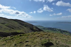
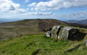
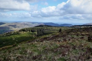
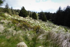
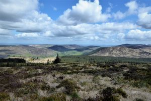
The path wound on through rough moorland with Slievemartin now visible to the north. To the east, Slieve Fadda and the rounded peak of Knockshee swept down to the northern side of Carlingford Lough and a bay bounded by a short peninsula that ended in Greencastle Point. The summit of Slievemeen was marked by a rather miserable cairn.
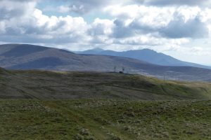
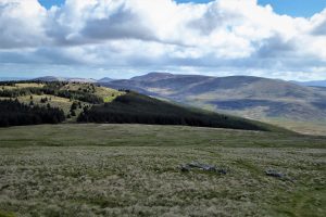
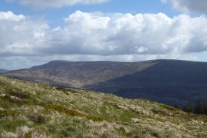
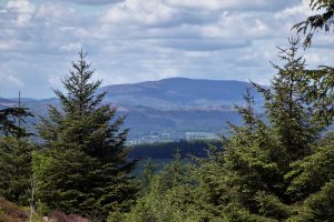
Shortly, the path veered slightly to the left until it was facing north and heading straight for Slievemartin. To the north-east, the high Mournes imposed themselves in the distant view with Binnian’s rugged summit leading on to Slievelamagan and Cove Mountain as Donard peered over their shoulders. As the path began to drop down to the col between Slievemeen and Slievemartin, the views south-west embraced Rostrevor, Warrenpoint and Newry.
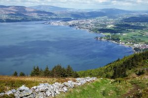
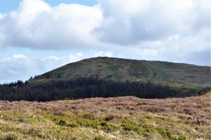
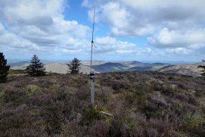
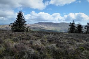
There were one or two boggy patches on the path to the col, but nothing that called for gaiters. The route to Slievemartin’s summit was obvious and straightforward and the view from the top is legendary. Another bench provided rest for weary hikers. The view south took in Slievemeen while to the north, several of the smaller southern Mourne peaks including Leckan More and Slieve Roosley made an appearance.
At this point in the walk, only inveterate peak baggers, adventurers or masochists should proceed to Crenville – it’s a challenging proposition with demanding terrain and virtually no paths. However, it’s doable with care and well-honed navigational skills. Gaiters would be a useful aid.
To make your way back to the start, take any of the well-trodden paths from the summit. The most straightforward, also the most scenic, is the route that returns via Cloghmore through the upper car park and down the road to the lower car park.
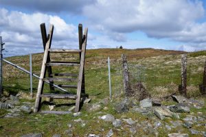
To reach Crenville, I walked north from the summit and crossed a stile. I made for a gap in the trees that marked a likely access point for the hill. Ground conditions were reasonable on the wide, grassy sheep field that sloped gradually downhill towards Crenville. At the end of the field, a boggy area and stream required an awkward leap to get across the stream. There was little improvement in the terrain as I made slow, enervating progress through the long, tangling grass and tussocky heather. Each step had to be taken gingerly as bog holes were a constant feature. I followed the residue of a fence, with only the rotting posts remaining, to make upward progress. To reach the summit (at Grid Ref IG J 207186), I had to leave the line of fence posts and alter course to the left (west).
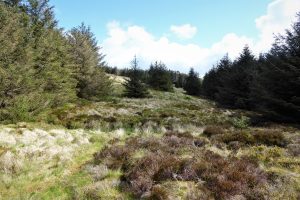
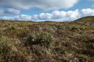
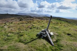
Ground conditions improved slightly as I headed for the summit, with fewer bog holes and grass that was merely thigh high. The summit was marked by a post with a cane tied to it. Obviously, no one had tried to build a cairn; indeed, there were very few stones or rocks in evidence apart from a couple of small rocky outcrops. The place had a peculiar feel, unlike any other Mourne hill, but the views were good, especially to the east with Eagle Mountain and the Shanlieve ridge. Slievemeel and Tievedockaragh sat to the north beyond Rostrevor Forest while to the north-west, Leckan More, Slieve Roosley and Gruggandoo lined up to form part of a scenic road route signed from Rostrevor as Roosley Scenic Loop.
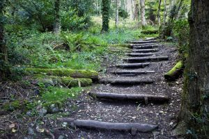
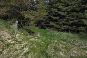
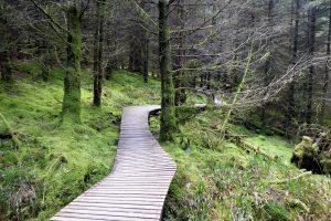
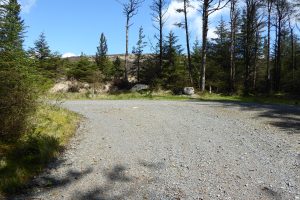
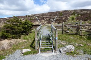
Having found the summit, the next hurdle was to extricate myself from Crenville. Walking downhill towards the north-west and reaching dense forestry, I skirted the tree line as it drifted north-west until I found a gap. The gap was not overly obvious, but a lone fence post acted as a marker. I walked through the trees on a clear path which soon joined another well-defined track. I turned left and carried on to a short boardwalk which seemed incongruously luxurious after the rigours of Crenville. The path soon arrived at another junction marked by a stone and post where I turned left. (I could have turned right, as the paths join later).
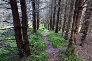
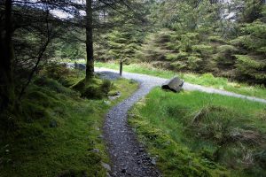
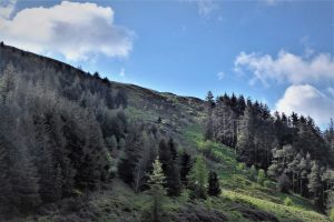
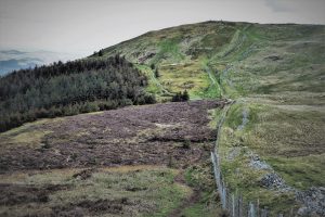
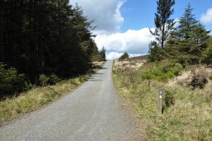
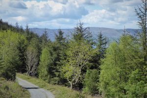
The rest of the walk took place on forest tracks within the vast Rostrevor Forest. The first 2km followed a forest road through a dense conifer plantation before arriving at a clearing and track junction under the slopes of Slievemeel (not to be confused with Slievemeen). I veered left at the junction and continued on the open forest road with Slievemeel on the right complete with its unusual stile that accommodates cyclists while deterring sheep.
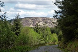
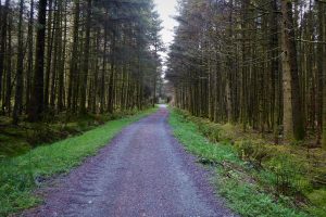
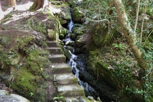
The road continued west for about a kilometre before veering left and entering fairly dense forestry. There was enough variety in the planting and the topography to maintain interest; several mountain streams flowed under the path and gaps in the mixed forestry offered the occasional glimpse of the landscape beyond.
READ: Sloe Picking at the Giant’s Ring, Ballynahatty
Find Out MoreThe screech of a jay interrupted what would otherwise have been a very quiet journey. I reached the finish point soon after passing a camping and caravan site and the main Kilbroney car park.
OSNI Activity Map: The Mournes (1:25000)
OSNI Discovery Series: Sheet 29 (1:50000)
Harvey Mourne Mountains, Superwalker XT25 (1:25000)
you enjoy a fairly easy walk with spectacular views, followed by a tough, challenging walk in ground conditions that veer between bog and deep, unforgiving undergrowth. There are no clear paths on Crenville and successfully finding your way to the track that leads through Rostrevor Forest demands good map reading skills and the ability to take a compass bearing. Inexperienced hikers – and as some might suggest, more sensible hikers – would be advised to restrict the walk to Slievemeen and Slievemartin. There are several clear tracks from Slievemartin back to the car park.
As an easier alternative to the suggested starting point of the route, after turning into Kilbroney Park take the narrow road signed Forest Drive. After less than a mile, arrive at the upper car park where you are already at an altitude of about 230m. Follow the sign for Cloghmore at the upper end of the car park where a short uphill walk takes you to the big stone.
From Rostrevor, turn left along the shore road as if heading for Killowen/Kilkeel and turn left at the sign for Kilbroney Park.
12km (7½ miles)
4 hours
Cloghmore
Legend claims that the stone was hurled from the Cooley Mountains by Fionn Mac Cumhaill (Finn McCool). However, geologists insist it is a glacial erratic that was detached from the higher mountains by an Ice Age glacier and deposited in its present position as the ice melted.
For more on the legend, click here.

Derek, 76, spent 35 years working in national, academic and public libraries, followed by 14 years in the wine trade. He only began serious walking in his 60s, although he had previously travelled many miles on foot pursuing his favourite hobby of fishing. After retirement, he decided to give the fish a rest and bother the hills of Ireland and Britain instead. Derek regards walking as a simple pleasure to be enjoyed, not endured, and prefers a solo hike in quiet, remote surroundings.

Climbing Slieve Binnian from Carrick Little (for novice hikers)
Denvir’s of Downpatrick: The Perfect Base for Walkers and Explorers in County Down
5 Outstanding Late Winter Hikes in the Mourne Mountains
Willowtree Glamping: a Romantic, Rural Retreat in the Mournes
 Belfast,Photography
5 scenic walks around Lisburn
 Mourne Mountains
Bearnagh: Chased the sunset, caught the rain
 Mourne Mountains
Camping in the High Mournes
 Fermanagh and Tyrone
Cuilcagh: Stairway to Heaven
 Features
Every Game of Thrones Location in Northern Ireland
 Mourne Mountains
Hen and Cock Mountains
 Mourne Mountains
Leganabrachan, Millstone and Thomas: Donard’s Seaside Bodyguards
 Mourne Mountains
Percy Bysshe and Cove Caves
