Climbing Slieve Binnian from Carrick Little (for novice hikers)
Would you like to sponsor this article?

Shanlieve (626m), the underrated second highest peak in the Western Mournes, is one of my favourites. On a clear day it offers great views of the high Mournes to the east and Carlingford Lough and the Irish Sea to the south. The name Shanlieve is most likely derived from Sean Sliabh meaning “old mountain”. You certainly get that sense of an old mountain looking across to the younger, rockier high Mournes, or perhaps that’s too romantic of a notion!
Due to its central location, there are a number of routes available to summit the peak, each of varying length, terrain and suitability to both hikers and trail runners. Personally, I find Leitrim Lodge just south of Hilltown to be an excellent starting point for approaching Shanlieve and the Western Mournes in general, with good opportunities for (5-10km) short out and back routes or larger loops (15-25km).
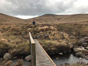
I parked at Leitrim Lodge car park, which is becoming an increasingly popular parking spot so I would recommend an early start, particularly on a weekend with good weather! Passing through the stile at the bottom of the car park, I crossed Shanky’s River and into the open mountain, the site of another Northern Ireland Game of Thrones filming location!
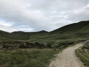
A clear path meanders its way up the hill in front of you, and after about 500m there is a route to the right – ignore this and keep on the main path climbing gently. The gravel/stony path continues, passing an old water service site on your right-hand site. Continue after this for approximately 1.5km.
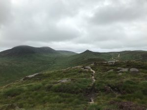
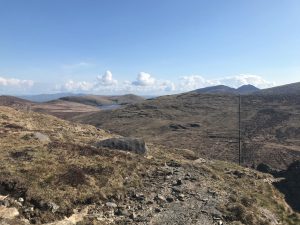
At this point the path forks in two – take the left-hand path. From here there is a slight detour option which I took; I continued straight on this path taking me up to Pierces Castle, which offers great views of the Western Mournes and beyond into the high Mournes. Alternatively, after taking the left-hand fork you will immediately come upon a number of paths to the right (south) – take any one of these, they all lead south!
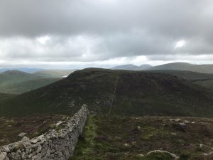
Continue on your chosen path through an area known as the Castle Bog, which becomes progressively wetter and boggier as you move towards Batts Wall and Shanlough. Batts Wall runs approximately west to east across the Western Mournes so as long as you head roughly south from your chosen path you can’t miss it!
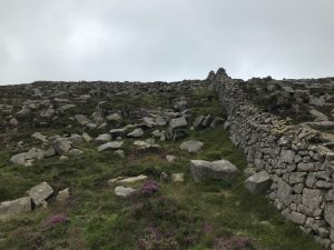
Batts Wall runs all the way from Sandbank Road to the top of Slieve Muck where it meets the Mourne Wall. The wall was constructed by Narcissus Batt of the Batts Estate in the mid 1800s, so it interestingly predates the Mourne Wall!

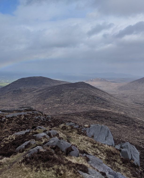
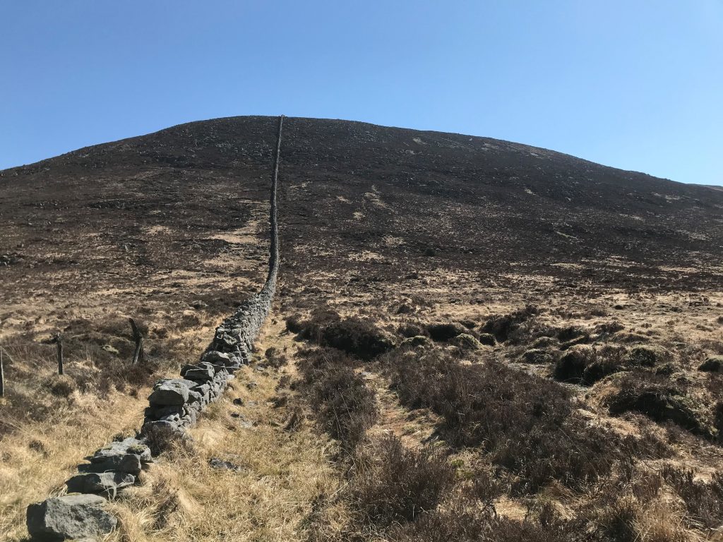
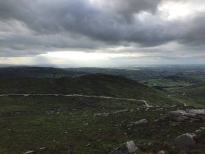
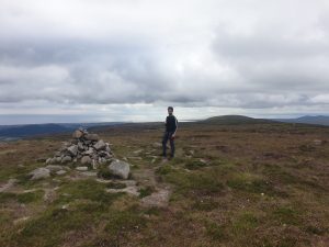
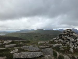
Upon reaching Batts Wall turn left (east) and follow the wall up the steep climb. The initial boggy section is quickly left behind as you ascend – it’s easier to climb on the right hand (south) side of the wall as there is more of a trail on this side. Whilst the climb is quite steep with boulders and heavy vegetation in parts, it is relatively short. The summit of Shanlieve, marked by a small cairn of stones, offers views to make the steepness well worth enduring.
From the summit of Shanlieve there are a number of options you can take: firstly you can return back to Leitrim Lodge, retracing your steps for a 9.3km hike; alternatively, you can continue along Batt’s Wall to Eagle Mountain. I selected the latter.
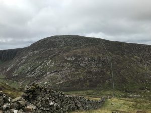
Eagle Mountain, at 638m, is the highest peak in the Western Mournes. Along the eastern side of Eagle lies the Eagle Mountain crags, extensive crags and cliff edges upon which eagles once made their home, hence the name. Unfortunately, however, the eagles are long since gone.
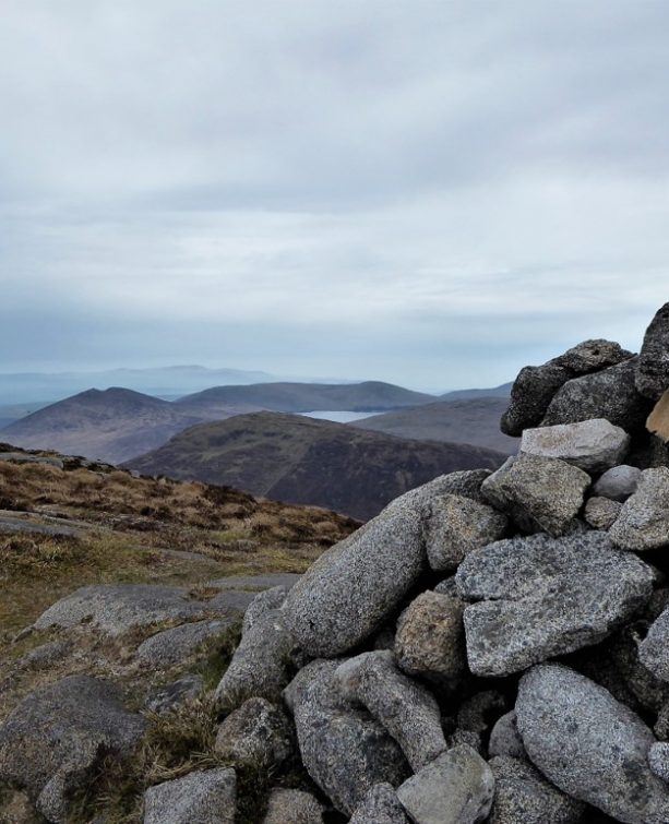
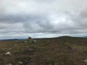
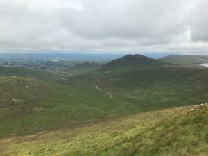
The route from the summit of Shanlieve to Eagle Mountain is short (approximately 250m) and straightforward, following Batts Wall to the east. The summit of Eagle Mountain is also marked by a small stone cairn and it also offers great views of the high Mournes and the Irish Sea. Again, from this point if you wish you can retrace your steps back to Leitrim Lodge, or you can continue to complete a larger loop.
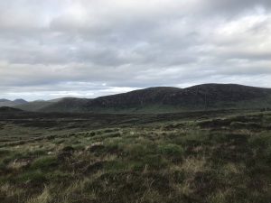
I continued along Batts Wall, descending from Eagle Mountain towards the Windy Gap, the low point along the wall between Eagle Mountain and Slievemoughanmore. Descending, I find it easier to keep to the right hand (south) side of the wall as the way down can be quite tricky in parts, with heavy concentrations of rocks and boulders. Windy Gap itself is wet and boggy at the best of times so you may need to be careful to avoid getting too wet!
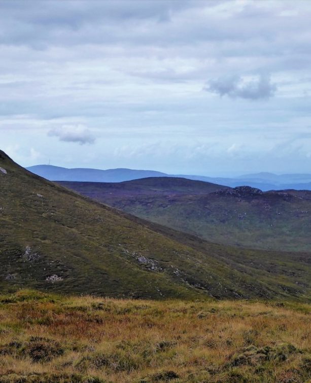
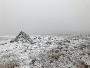
From Windy Gap I climbed to the summit of Slievemoughanmore, another steep but relatively short climb. Make sure to climb on the left hand (north) side of the wall as this side offers a much better track with less boulders and heavy vegetation. The view from the summit offers great views of Spelga Dam to the northeast.
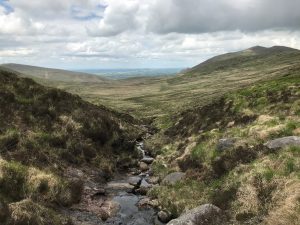
I continued along Batts Wall, descending Slievemoughanmore on the eastern side to the gap between it and Pigeon Rock Mountain. This gap contains a stile – at this stile I turned left (north west), away from the wall. Very quickly after leaving the wall you come upon a stream – the Rowan Tree River. Follow this river, keeping it on your left. As you walk a loose trail becomes more and more obvious and after about 700m a trail is very clear, so continue along this route.
After about an 500m the Ulster Way crosses the trail – take the Ulster Way to the left. Be careful at this point as the Ulster Way is very faint in comparison to the main trail. The best way to keep yourself right is to cross to the other side of the Rowan Tree river and keep the river on your right as you walk along it. After about 500m you will see the confluence of the Rowan Tree River and Rocky Water with a footbridge over the Rocky Water to the left of the confluence.
READ: Sallagh Braes circular: a stunning route in the Glens of Antrim
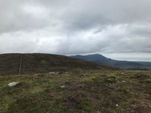
Find Out MoreCross the bridge here and follow the Ulster Way up the gentle slope between Tornamrock and Rocky Mountain. After about 1.5km the Ulster Way will bring you back to the trail you started on near Leitrim Lodge, just down from the old water service site. Follow the trail back to the car park for a total distance of 11km.
For me personally, I love this route as it gives a big variety of terrain, from stony trails to bog and steep rocky technical slopes to rolling grass meadow slopes. The route is also suited both as a hiking route and as a trail running route. Typically, the route tends to be relatively quiet and offers some really spectacular views in clear weather.
Having done this route in both summer and winter and both as a hike and as a trail run, it is suitable for all seasons. Average fitness levels should be sufficient. Take care around The Castle Bog and Windy Gap as they can very wet and boggy particularly after periods of wet weather. The stretch from Shanlieve to the Windy Gap, as the name suggests, is also prone to high winds!
For the most part this route is straight forward to navigate in clear weather with clear trails and Batts Wall as a “handrail” for most of the route. The section from the Slievemoughanmore / Pigeon Rock Mountain gap back to Leitrim Lodge does require some navigation so I wouldn’t attempt in poor visibility unless you’re comfortable navigating in such conditions. As always, a map, compass, sensible clothing, and footwear are essential.
From a trail running perspective, the route offers a lot of variety, making it an excellent training route. Take care around the slopes of Shanlieve and Eagle as the rocks and boulders make these sections quite technical.
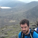
Andrew Goulding, 32-year-old civil engineer living in Belfast. Adventure racing, trail running and hiking enthusiast. Currently progressing through Mountaineering Ireland Mountain Skills courses and training for attempts at the Mournes 600 and 500 in summer 2021. Insta: @thegreenmountaingoat.
 Belfast,Photography
5 scenic walks around Lisburn
 Mourne Mountains
Bearnagh: Chased the sunset, caught the rain
 Mourne Mountains
Camping in the High Mournes
 Fermanagh and Tyrone
Cuilcagh: Stairway to Heaven
 Features
Every Game of Thrones Location in Northern Ireland
 Mourne Mountains
Hen and Cock Mountains
 Mourne Mountains
Leganabrachan, Millstone and Thomas: Donard’s Seaside Bodyguards
 Mourne Mountains
Percy Bysshe and Cove Caves