Climbing Slieve Binnian from Carrick Little (for novice hikers)
Would you like to sponsor this article?

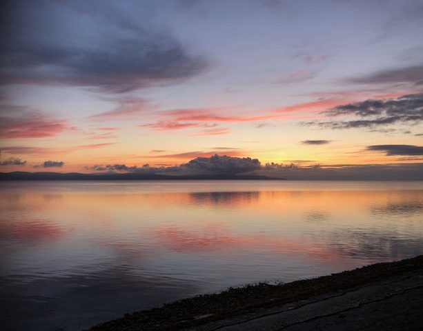
Binevenagh is a mountain situated near Limavady, with stunning cliffs that overlook Lough Foyle – it is part of the Binevenagh Area of Outstanding Natural Beauty. It is an area that is used by walkers, mountain bikers, fishermen and families who enjoy the forest walks. When the conditions are right, gliders and paragliders soar in the air above . It’s also 25 minutes away from my home and one of my favourite local places to walk.
The mountain area can be accessed from a number of points, through Ballycarton Forest situated between Limavady and Magilligan or from the scenic Bishops Road. I chose to start my walk on a beautiful October morning from Leighery Road (C703 313) where there is a layby for parking for a number of cars.
I walked from here along the road for a very short distance downhill and then turned into the forest entrance on the left. Almost immediately there is a fork in the path beside a blue signpost, but I continued straight onwards at this stage as the path on the left would be my return route.
SHOP: Trek NI sweaters – made from 100% recycled material
Find Out More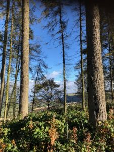
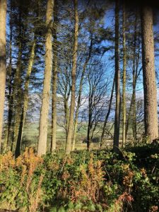
It was a beautiful autumn morning and after a few minutes of walking along a tree lined path, breaks appeared in the treeline, already promising beautiful views below. About 10 minutes into the walk, the path divided again and I took the left turn leading onto a gravel track below the cliffs.
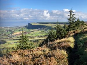
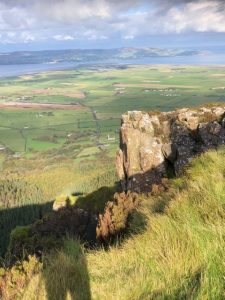
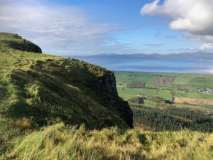
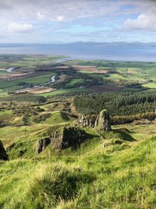
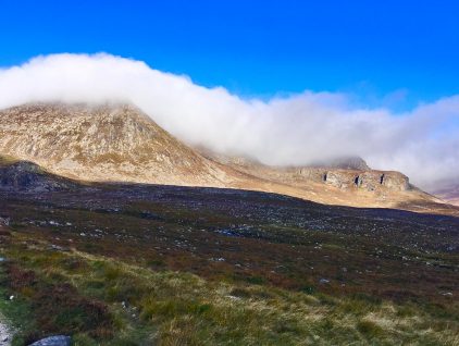
It was now very easy to see the open area below the cliffs straight in front of me. The cliffs were created from molten lava millions of years ago and the resulting basalt precipice is very impressive. Like many other places in Northern Ireland, this area was used as a film location for “Game of Thrones”.
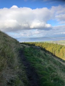
Very shortly after turning onto the gravel track, I could see several obvious trails on the left hand side ascending up the hillside so at this stage I left the track and started climbing upwards over open ground. This ascent is quite steep in places and is well used by mountain bikers so can be mucky and slippy especially after rain. Boots are a definite and a hiking pole or two are extremely useful. It was a fairly short, steep ascent following the grassy, muddy trail until the top was reached.
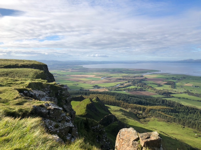
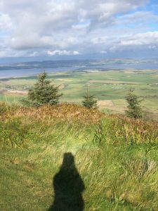
Exiting the dense vegetation at the top of the cliff, the views were fantastic. Looking east it was possible to see across to the headlands surrounding the Bishops Road to Downhill. Straight ahead was the wonderful vista across Lough Foyle to Inishowen and to the west it was very clear to see the River Roe winding through the countryside. It was such a clear morning that I could even see some of the Scottish coastline in the distance.
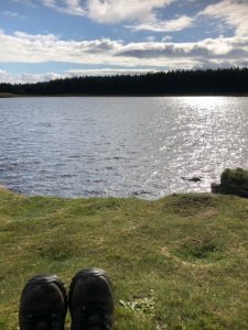
I headed right and followed the grassy path along the cliff edge now on relatively flat, easy terrain enjoying the views to my right for around a mile before reaching the lake at the summit. This is popular with fishermen as the lake is stocked with rainbow trout and is accessible by road so it was a bit of a shock after having complete solitude to suddenly see cars and people!
I skirted south west around the lake and headed to the right of the trees that lie on the southern side of the lake. Heading south from here brought me to a fence line. It is possible to cross the fence and head upwards following the fence to the trig pillar (which doesn’t actually have that great a view). It is also possible from here to cross the fence and head downwards and follow a trail that brings you below the cliffs and back into the forest.
There was a great view from here into the Roe Valley and across to Inishowen with the distant Derryveagh mountains visible. That day, I had a different plan so retraced my steps back to the lake for a great lunch spot. A perfect place for a sandwich and flask of coffee.
Duly refreshed, I skirted the lake again now on the eastern side to follow the main forest road leading downhill. After about half a mile there was a path leading off left into the forest again. This went straight ahead and then sharply veered right and then downhill back to the blue signpost passed earlier. From there it was a few minutes back to the car.
READ: Snapshot Trek: Bloody Bridge to Carrick Little via Beg, Cove and Lamagan
Find Out MoreThis route is just over 4.5 miles (including a bit of dandering about the lake!) with an ascent of 800ft so after the initial climb, it’s quite flat before heading downhill again. It took me a very leisurely 2.5 hrs including lots of photo stops and lunch so it’s a nice easy morning or afternoon walk but easily extendable by adding in paths within Ballycarton or Binevenagh forests below. Benone beach is also only 10 minutes away if you fancy a beach walk after the forest and hills.
I would definitely recommend choosing a good day for this walk as the views are incredible. The terrain is mixed with some forest trails, roads and tracks and some grassy paths of which some can be muddy and slippy. It is easily navigated however and would be a straightforward walk for any moderately fit walker.
A great morning walk in a really special location.
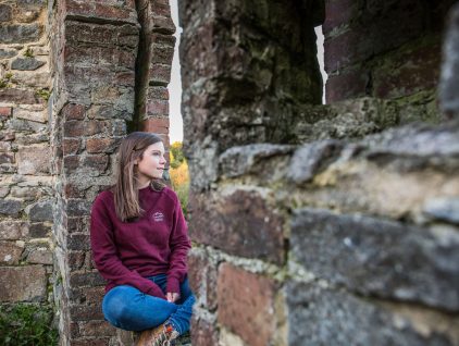
I live in the north west with my husband, two teenage children and a very lazy cat. I work as an Accountant in the health service but love nothing better than getting away from spreadsheets either to get out in the fresh air and walk or to sing with my local choir. I love walking around the Causeway Coast and County Donegal and am never happier than when I can hear the sea.
 Belfast,Photography
5 scenic walks around Lisburn
 Mourne Mountains
Bearnagh: Chased the sunset, caught the rain
 Mourne Mountains
Camping in the High Mournes
 Fermanagh and Tyrone
Cuilcagh: Stairway to Heaven
 Features
Every Game of Thrones Location in Northern Ireland
 Mourne Mountains
Hen and Cock Mountains
 Mourne Mountains
Leganabrachan, Millstone and Thomas: Donard’s Seaside Bodyguards
 Mourne Mountains
Percy Bysshe and Cove Caves