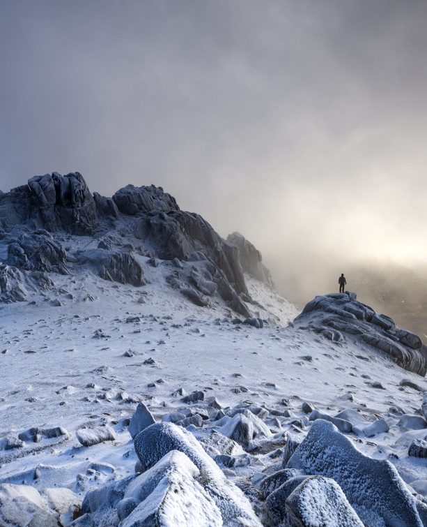
Climbing Slieve Binnian from Carrick Little (for novice hikers)
Would you like to sponsor this article?

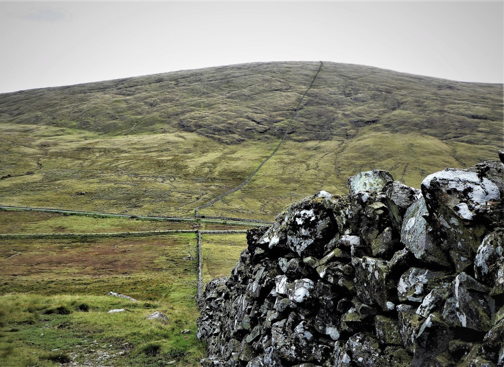
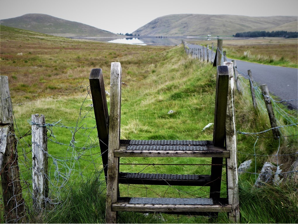
The Spelga to Attical walk follows Batt’s Wall as far as Windy Gap. It begins at the stile at the southern end of Spelga Dam at the start of the narrow road that leads down to Deer’s Meadow car park (GR J270253).
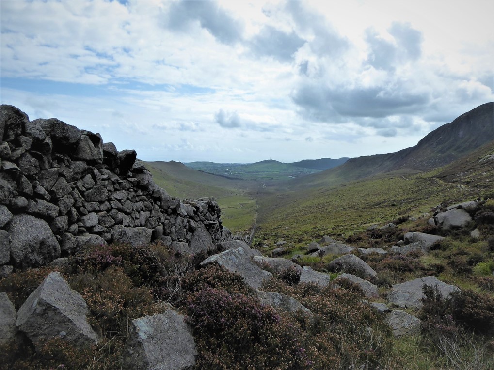
Sidenote: Narcissus Batt, a wealthy Belfast banker and landowner, bought the Leitrim Estate in 1834 and some years later set about constructing the eponymous wall which marked the boundary of his estate. Running from Tievedockdaragh to the summit of Slieve Muck, the wall remains in pretty good condition considering that it pre-dates the Mourne Wall by about eighty years.
READ: Bearnagh: Chased the Sunset, Caught the Rain
I was travelling by public transport and the obliging driver of the Mourne Rambler dropped me right beside it (unfortunately the Rambler only runs in July and August).
To compensate for my lamentable sense of direction, I came armed with Mournes Activity Map, compass and Garmin eTrex 10 tracker (basic, but great for telling you exactly where you are).
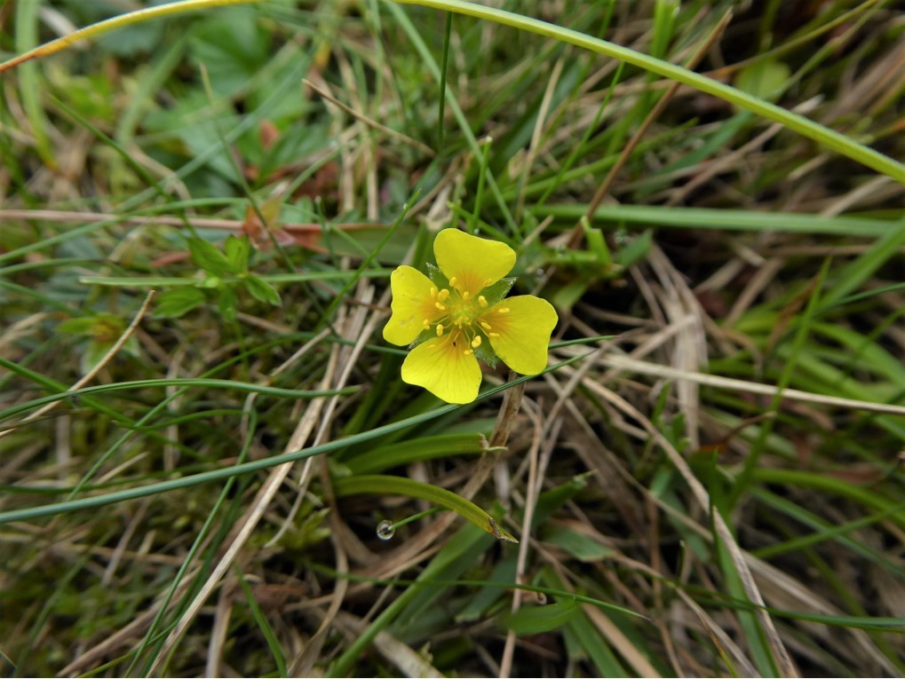
The walk up Pigeon Rock was easy, following the line of the wall with a few obvious diversions to avoid boggy sections. Fluffy white swathes of bog cotton and the delicate yellow flowers of Tormentil added sparkle to the boggy vegetation while meadow pipits took startled flight from their hiding places in the grass as I approached.
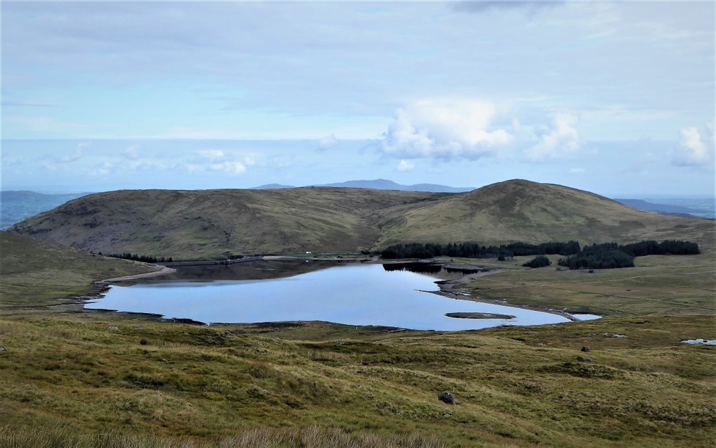
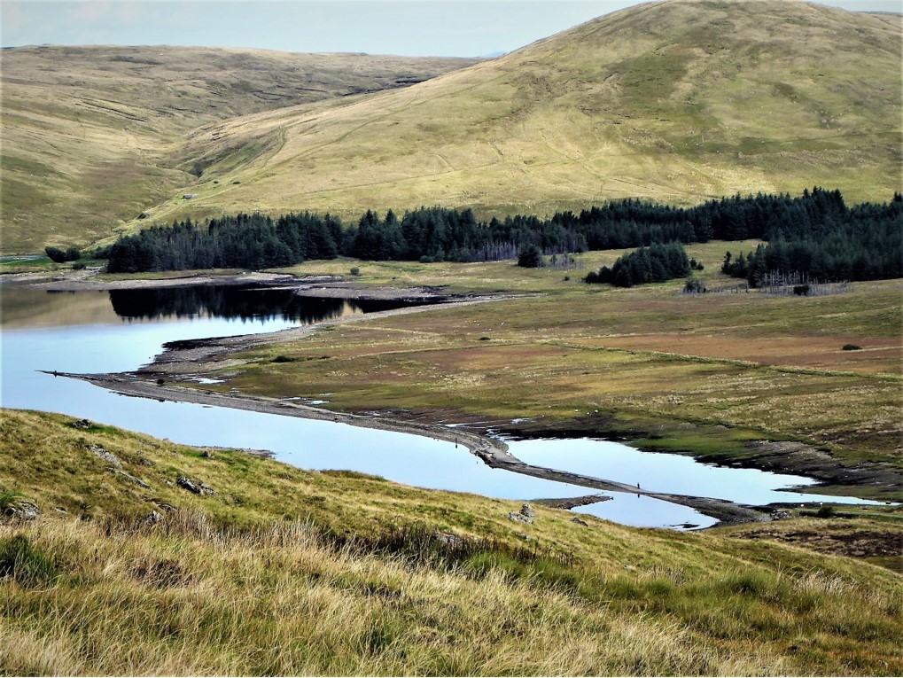
The ground was still fairly dry, but I would recommend gaiters in wetter conditions – they’ll come in handy further on in the walk. The views were superb and with every few metres of upward progress, another distant peak would come into view. The full expanse of Spelga gradually unfolded, complete with the usually submerged road and bridge, which were exposed after the recent protracted spell of dry weather, attracting hundreds of visitors. However, Spelga’s transformation to major tourist attraction seems to have been mercifully short-lived.
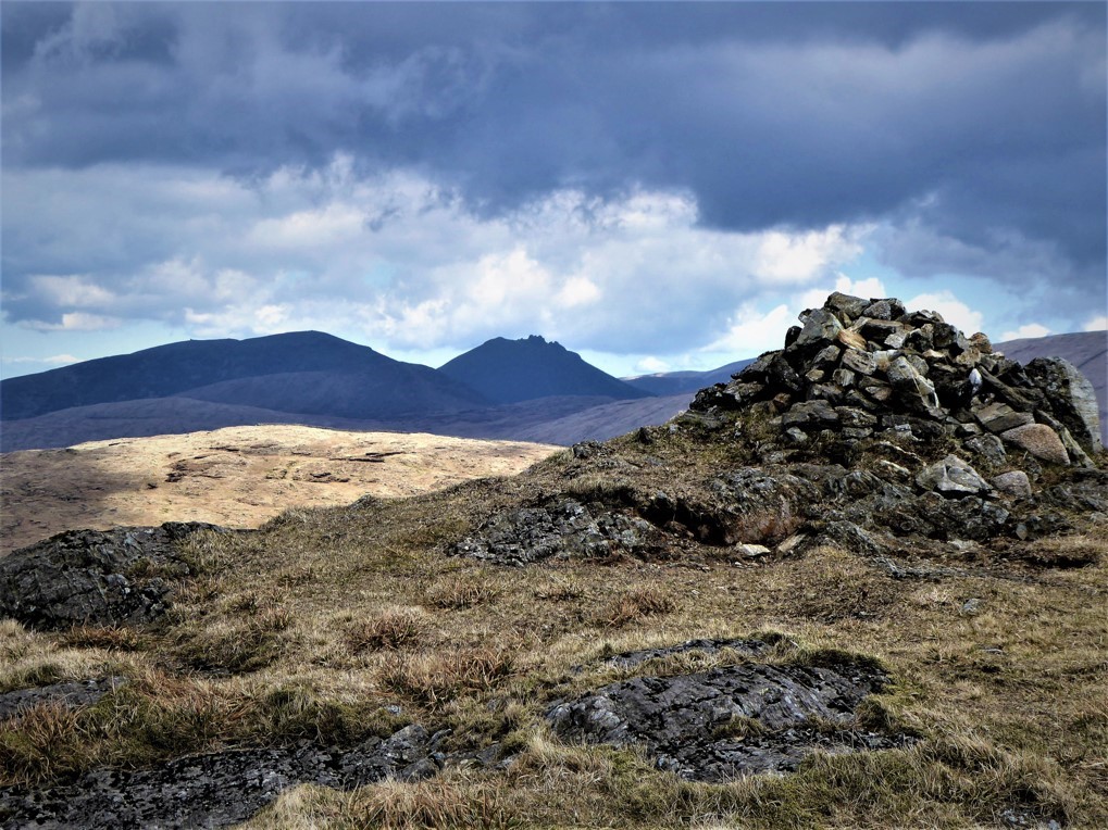
After about twenty minutes, at the point where Batt’s Wall takes a sharp left turn, I reached the cairn indicating the north summit – there is a south summit of equal height (534m) marked by a small cairn about 350m to the south-east, adjacent to two large, boggy ponds.
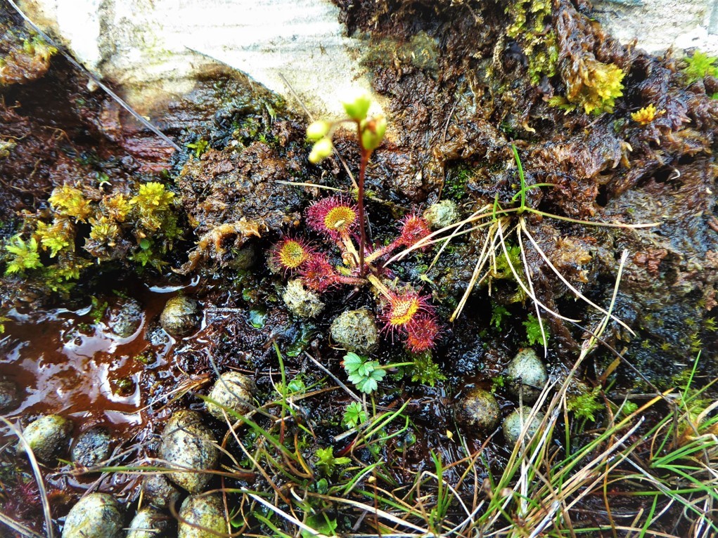
A cursory exploration of the summit area revealed several sundews – carnivorous plants whose sticky leaves trap insects, which are digested to supply nutrients to the plant.
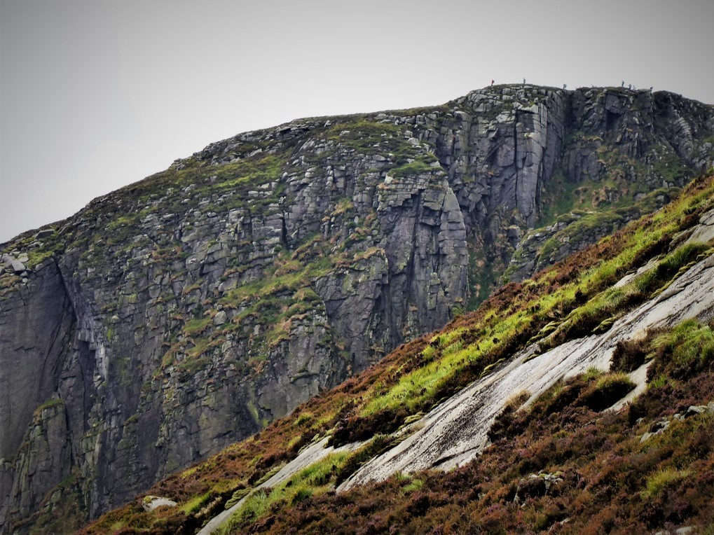
The descent from Pigeon Rock was straightforward and obvious with the added attraction of some interesting rock formations. The mountain was once a main source for quarrying the massive grindstones used in the local cornmills – at one point in the 19th century, there were sixteen working mills in the Annalong area.
The Rowan Tree River was down to a trickle and fording it presented no problems. The walk up Slievemoughanmore was a more challenging proposition than Pigeon Rock. A lot more leg stretching was needed to negotiate the rocks, some of which were slippy and lacking footholds. There was a track of sorts hewn out of the rough terrain by sheep and humans that avoided most of the more difficult areas.
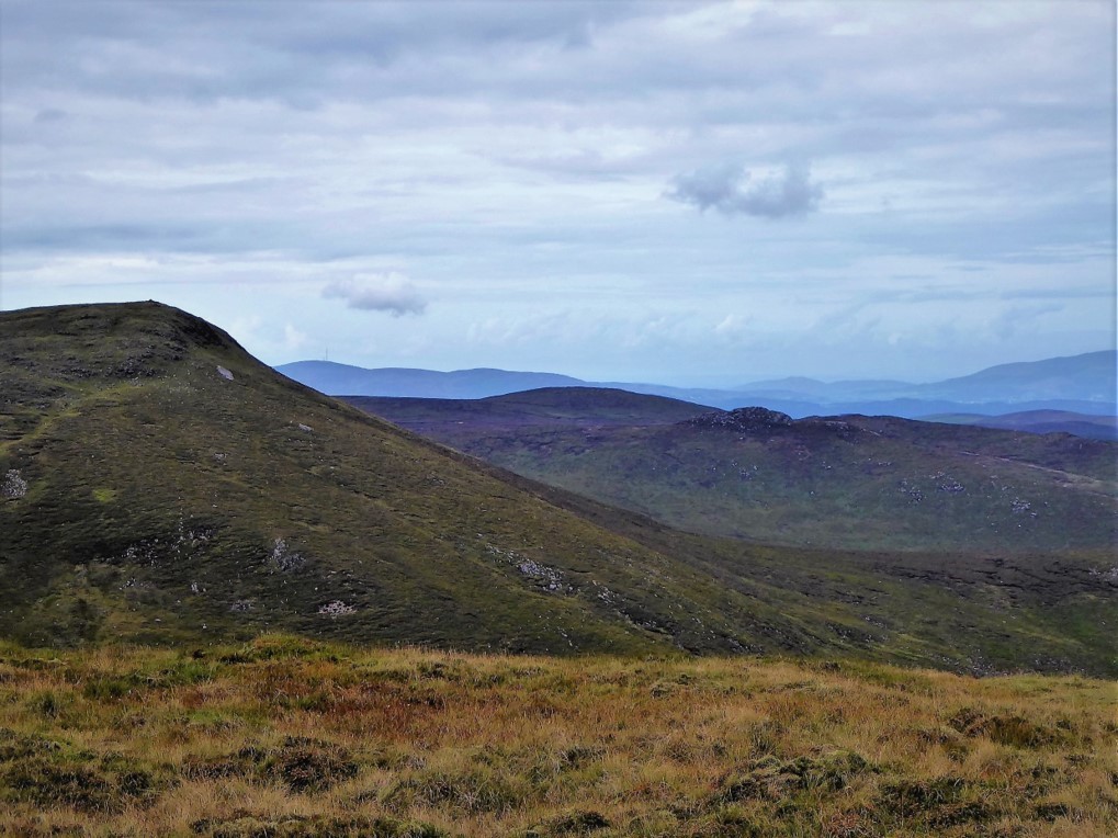
The summit was reached by turning right as the slope flattened out, then walking another 150m north-west. There are two cairns and the slightly higher one marks the top at 559m. Views from the summit are breathtaking with most of the western Mourne peaks visible and, in the distance, the Cooley Mountains and Slieve Gullion.
Other views to the northeast are dominated by the jagged peak of Bearnagh, but the most dramatic vista lies to the south-west where the great bulk of Eagle Mountain looms ominously.
The walk down to Windy Gap was steep, but easily managed although it became quite boggy close to the Gap. Batt’s Wall is partially ruined and fenced off for about 20m before the Gap. After crossing the stile, I followed the path along another wall towards the Windy Gap River for about 150m before transferring to a wider quarry track on the right (GR J248235).
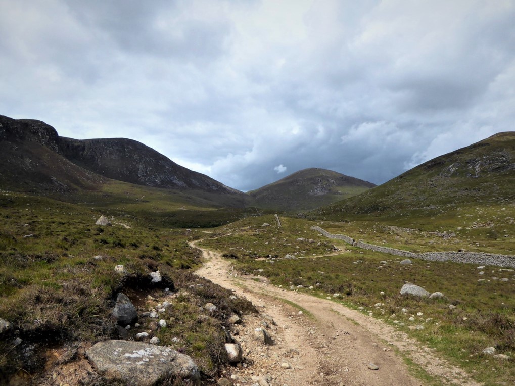
The next 2.5 km ran gradually downhill with the rugged slopes of Eagle Mountain and its spectacular Great Gully to the right and the Windy Gap River valley to the left.
On reaching Sandy Brae, I was fairly much back in civilisation, passing by the GAA grounds on the right before turning left onto Tullyframe Road and on to Attical, stopping briefly to have a look at the Whitewater River, notable for its seatrout and salmon fishing. The Mourne Rambler arrived dead on time to transport me back to Newcastle.
30 August 2018.
From Newcastle I took the 10am Mourne Rambler (Service No 405) alighting at the Pigeon Rock stop. Returned to Newcastle on the Rambler from Attical at 15.08pm. Unfortunately, Service No 405 ends on 2 September and presumably will not resurface until July 2019. Before then, the only practical way of accomplishing the trek is to use two cars – so no good for lone hikers. It is possible to get to Attical from Newcastle and back by bus (via Kilkeel), but timings and frequency rule it out as an option for day walkers.
13km (8 miles).
4½ hours (although I took it very easy in the knowledge that I didn’t need to reach Attical until 3pm).
Temp 10˚C – 16˚C; calm, mainly cloudy with some sunny breaks.
All year round, given favourable weather. If you’re heading out in the evening, give yourself plenty of time to get back. Windy Gap to Attical is about an hour’s walk. Bear in mind that the Mourne Rambler only runs in July and August (based on 2018 schedule), so outside those months, deploying two cars is the only practical way of accomplishing the trek.
…you’re the type of hiker who enjoys peace and quiet. The western Mournes are generally a lot more tranquil than their eastern counterparts. As long as you don’t crave company, this trek will suit you. It’s only moderately strenuous and could easily be completed in 3½ to 4 hours. That said, a reasonable degree of fitness would help.
The views and the sense of tranquility.
Gaiters would be helpful at most times of the year as parts of the trek are quite boggy. Apart from that, all the usual commonsense advice applies re clothing, navigational aids, weather checking etc.

Derek, 76, spent 35 years working in national, academic and public libraries, followed by 14 years in the wine trade. He only began serious walking in his 60s, although he had previously travelled many miles on foot pursuing his favourite hobby of fishing. After retirement, he decided to give the fish a rest and bother the hills of Ireland and Britain instead. Derek regards walking as a simple pleasure to be enjoyed, not endured, and prefers a solo hike in quiet, remote surroundings.

Climbing Slieve Binnian from Carrick Little (for novice hikers)
Denvir’s of Downpatrick: The Perfect Base for Walkers and Explorers in County Down
5 Outstanding Late Winter Hikes in the Mourne Mountains
Willowtree Glamping: a Romantic, Rural Retreat in the Mournes
 Belfast,Photography
5 scenic walks around Lisburn
 Mourne Mountains
Bearnagh: Chased the sunset, caught the rain
 Mourne Mountains
Camping in the High Mournes
 Fermanagh and Tyrone
Cuilcagh: Stairway to Heaven
 Features
Every Game of Thrones Location in Northern Ireland
 Mourne Mountains
Hen and Cock Mountains
 Mourne Mountains
Leganabrachan, Millstone and Thomas: Donard’s Seaside Bodyguards
 Mourne Mountains
Percy Bysshe and Cove Caves
