Your No-Nonsense Guide to Visiting the Giant’s Causeway in Summer
Would you like to sponsor this article?

This walk tracks the rugged coastline from Bloody Bridge to Annalong. It involves quite a lot of clambering over rocks which can be slippy in wet weather. Sturdy footwear is advised as legs, feet and ankles will come under pressure from the often rough terrain. It’s very likely that you will have only your own company once the first section of about a mile is completed.
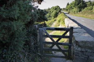
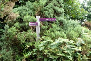
The walk begins at Bloody Bridge Car Park. Walk a few metres from the southern end of the car park and go through a small wooden gate just off the main Kilkeel Road.
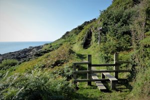
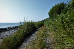
Go straight ahead over the Bloody Bridge River and follow the sign for the Coastal Path. This part of the path is well maintained by the National Trust with steps and stiles when necessary providing easy access and comfortable walking conditions. There are also several well placed seats along the way.
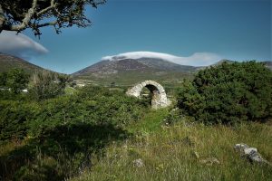
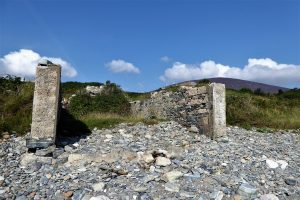
After a short downhill section, you arrive at a stile followed by a sign for St Mary’s Church. It’s well worth the short uphill walk to see the remains of the medieval church, dating from around 1100 and believed to be one of the first Christian churches built in Northern Ireland. Only the chancel arch remains, but the atmospheric ruin and its magnificent setting has attracted the attention of artists, antiquarians and archaeologists for many years. The path back down from the church gives great views of the coastline to the north.
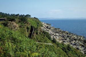
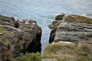
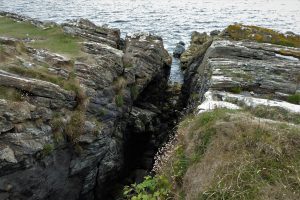
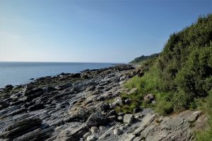
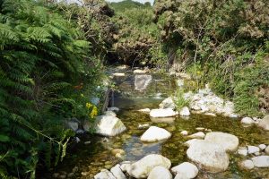
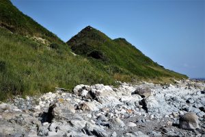
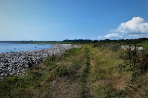
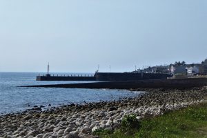
The main path continues south past rocky platforms, indented with gaping fissures. After passing a part of the shore known as William’s Harbour, said to be the landing site of the Williamite forces in 1689, the path, and National Trust stewardship, ends as the roughhewn, open shoreline beckons.
The map names several locations along the route as Harbour or Port, but don’t expect piers, marinas or ice cream stalls – the terms merely describe places where landing and launching of sea-going vessels is possible. Many of the landings along this section of coast would have been associated with smuggling expeditions, the contraband goods disappearing into hiding places, later to make their way clandestinely up the hills and along the Brandy Pad to various destinations.
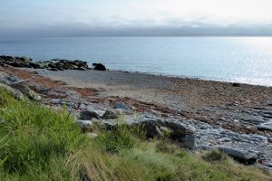
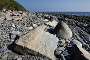
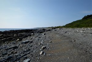
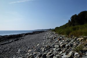
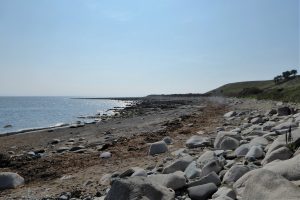
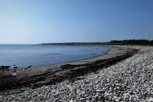
There is some tough going along the first few hundred metres of the beach, over and between tilted rock slabs with shingle pathways in between. Although it is not always possible, try to keep close to the grassy edges that back onto the beach as you make progress. There are a few short-lived grassy paths skirting the beach, but most of the walk will be on rocks, shingle and pebbles of varying shapes, sizes and colours. You will notice a small amount of seaborne litter, mainly fuel containers, fish boxes and netting. The first part of the shoreline also collects a number of lobster pots of various designs, presumably dislodged by storms.
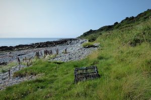
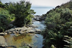
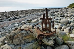
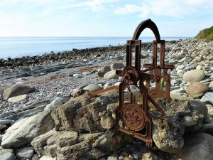
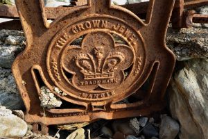
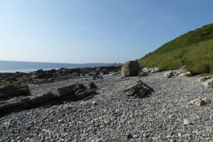
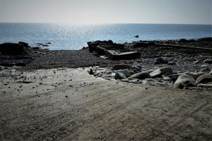
Just over a kilometre of beach walking brings you to the Crock Horn Stream which makes its way to the sea from Spence’s Mountain. Just south of the stream, look out for the remains of an old boat winch. The device has unfortunately suffered damage in the last few years, as shown by the pictures taken when it was last seen in 2018 – unfortunately no longer The Crown Jewell.
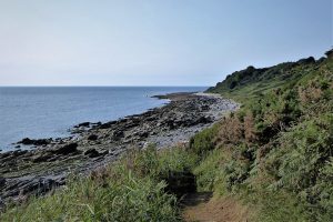
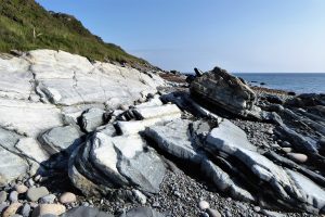
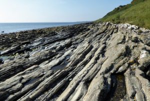
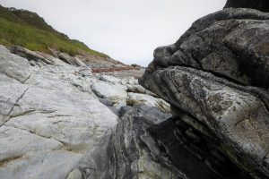
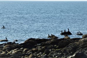
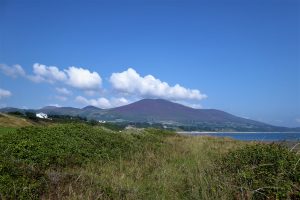
A shingle beach south of the stream is followed by large boulders and ridged bands of rock which reveal interesting shapes and colours. The abundant birdlife includes fulmars, black guillemots, curlew, oystercatchers, gannets and the ubiquitous cormorants which spend a lot of their time perching on rocks at the sea’s edge. Seals can often be seen basking on the rock platforms and, just occasionally, a pod of dolphins will add to the spectacle to create a really memorable walk.
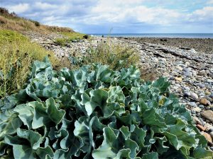
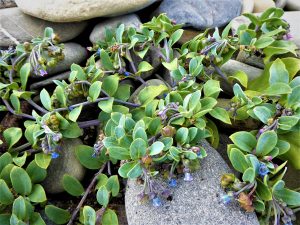
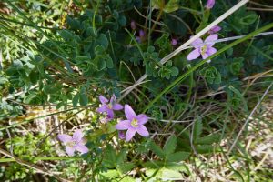
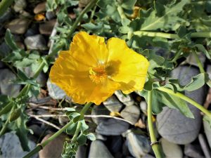
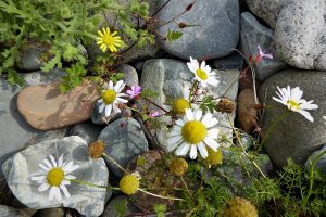
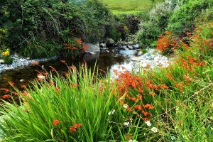
The range of wildflowers in the area depends on the season, with spring and summer displaying the widest range of colours. Plants include Sea Kale, Montbretia, Mayweed, Oysterplant, Sea Spurrey and the unusual Yellow Horned-poppy.
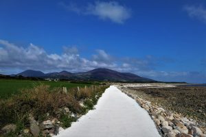
After passing under Dunmore Head, the terrain gradually changes from rugged and rocky to a fairly gentle shingle before a grassy track leads past a private property to an area known as George’s Quay.
Shortly after George’s Quay, cross Spence’s River and begin the next leg of the trek around Glassdrumman Port and its shingle beach. The port was the scene of a skirmish in the late 1700s when gunfire was exchanged between a gang of smugglers and local exciseman Captain Alexander Chesney. The remainder of the walk takes place on a mostly flat surface which calls for very little clambering over rocks.
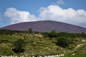
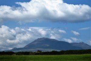
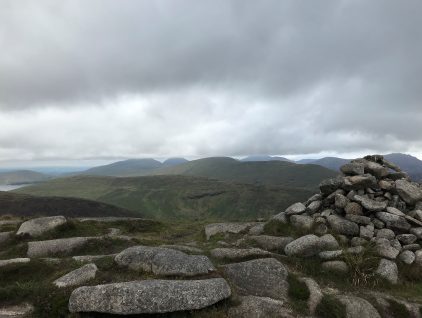
Spence’s Mountain appears to the west as the beach turns eastward towards Mullartown Point. A faint grassy path at the edge of the beach takes you some of the way round the point, but it becomes overgrown and impenetrable at several points. However, the beach is made up of easily negotiated pebbles. The views back to the north and west open out to include the mountains, with Spence’s Mountain and The Long Mountain featuring strongly.
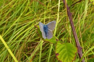
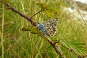
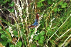
The area between Glassdrumman Port and Springwell Port is very attractive to butterflies, particularly Common Blues which can be present in large numbers in warm summer weather.
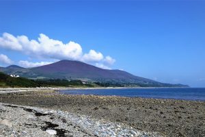
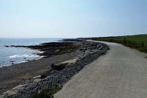
A grassy path leads most of the way around tranquil Springwell Port although several sections have been partially eroded. Views of Wee Binnian and Slieve Binnian appear on the right with the village of Annalong straight ahead. The path leads on to a flat concreted section protected from the ravages of the sea by rock-filled gabions. A look back reveals a magnificent vista of the Mournes.
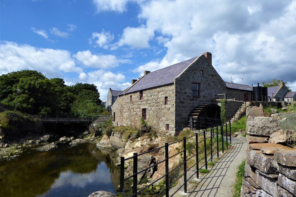
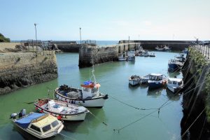
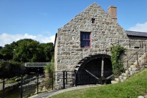
Arriving at Annalong Harbour, a path runs to the right of the harbour wall and meets the refurbished cornmill. A new bridge crosses the Annalong River and leaves you at the harbour beside the welcoming Harbour Inn. The restored cornmill can be visited, but must be booked in advance. Unless you relish a return walk, a regular bus service runs roughly hourly between Kilkeel and Newcastle, with a stop at Bloody Bridge. If you have time and energy to spare, another attractive coastal path runs south of Annalong for a couple of miles.
READ: Shanlieve from Leitrim Lodge
Find Out MoreAlexander Chesney
Chesney was a fascinating character who, aged 17, had emigrated with his parents and eight siblings to America in 1772. Chesney fought for the British in the War of Independence reaching the rank of Captain. After a series of adventures and reversals, he returned to Ireland in 1782 where he joined the Customs Service and ended up as Revenue Officer at Annalong the next year.
There followed a series of confrontations and skirmishes with local smugglers as Chesney and his men sought to establish their authority. Such were Chesney’s successes against the smugglers that a combination of boatmen and smugglers started a failed campaign for his removal in 1789.
With the formation of the United Irishmen and rebellion in the air, Chesney, loyalist to the end, obtained a commission to raise a yeomanry corps in which he served until August 1798, the year of the United Irishmen’s rebellion. This was followed by a period as a coastguard at a well-known smugglers’ cove, Wreck Port, just south of Annalong.
Chesney died in 1843 having raised a family of eight children while serving a total of thirty-five years in the Irish Customs. One of Chesney’s children, Francis Rawdon Chesney explored and mapped the Euphrates and the Tigris rivers and was instrumental in formulating the route of the Suez Canal. He was named “Father of the Suez Canal” by its builder Ferdinand de Lesseps.
A Smuggler’s paradise
The coast of County Down was a favoured haunt of smugglers during the 18th century and the early part of the 19th century. With its lonely beaches and nearby mountains, contraband could be moved quickly and surreptitiously into the shelter of the hills.
British and foreign boats took part in smuggling and American boats loaded with tobacco were frequently involved, but it was the proximity of the Isle of Man that played the most significant role in the proliferation of the smuggling trade. Up until 1765, Isle of Man customs duties were so low that the Manxmen could make a tidy profit by shipping goods to Britain and Ireland. With Britain’s acquisition of Manx Customs in 1765, Manx smugglers, already well versed in the art of customs evasion, would avoid their home island and attempt to land their cargoes on the British and Irish coasts.
Smuggling continued apace with cargoes of wine, spirits, tobacco, tea, coffee, leather, silk and spices finding their way at night into caves and other hideaways for later transportation. Small ponies carried the goods through the mountains on the Brandy Pad for distribution to various locations. Hilltown was a favourite handling centre, evidenced by the fact that in 1835 the village’s total of twenty-one houses included ten pubs.
The authorities had a difficult adversary, as the smugglers enjoyed the tacit support of the local public. In 1835 there were nineteen coastguard stations in County Down staffed by fifteen officers and 127 men. Substantial rewards were offered for information, but the dictum of ‘whatever you say, say nothing’ applied in the 19th century as strictly as it did in the following century.
Today, the smugglers take a different route and the Brandy Pad performs a less clandestine purpose, ferrying thousands of hikers on a scenic journey along the slopes of the two highest peaks in the Mournes, Slieve Commedagh and Slieve Donard.
25 August 2021
Bloody Bridge car park is about 2½ miles outside Newcastle on the A2 Kilkeel Road. It can be very busy at weekends and holiday periods. An early start is recommended. The car park also provides toilets, picnic tables and information panels. This is a linear walk and, unless you’re using a two car strategy, Ulsterbus Service No 37 can be used to get back to Bloody Bridge if you run out of energy for the return walk.
9km (5½ miles)
3½ hours
Temp 14 – 22˚C; sunny, calm
OSNI Activity Map: The Mournes (1:25000)
OSNI Discovery Series: Sheet 29 (1:50000)
… you enjoy a quiet walk with only the sound of the sea and the birds for company. You’ll need to be prepared for some rough conditions underfoot and boots with good ankle support are recommended. It’s advisable to check the tide tables to avoid a high tide, which you can do via EasyTide and Tideschart. It’s best to undertake the walk on an ebbing tide to avoid any potential embarrassment.

Derek, 76, spent 35 years working in national, academic and public libraries, followed by 14 years in the wine trade. He only began serious walking in his 60s, although he had previously travelled many miles on foot pursuing his favourite hobby of fishing. After retirement, he decided to give the fish a rest and bother the hills of Ireland and Britain instead. Derek regards walking as a simple pleasure to be enjoyed, not endured, and prefers a solo hike in quiet, remote surroundings.
 Belfast,Photography
5 scenic walks around Lisburn
 Mourne Mountains
Bearnagh: Chased the sunset, caught the rain
 Mourne Mountains
Camping in the High Mournes
 Fermanagh and Tyrone
Cuilcagh: Stairway to Heaven
 Features
Every Game of Thrones Location in Northern Ireland
 Mourne Mountains
Hen and Cock Mountains
 Mourne Mountains
Leganabrachan, Millstone and Thomas: Donard’s Seaside Bodyguards
 Mourne Mountains
Percy Bysshe and Cove Caves