Climbing Slieve Binnian from Carrick Little (for novice hikers)
Would you like to sponsor this article?

A moderately long circular walk using roads, loneys (lanes or loanins) and pads (paths) in the north of the Lecale Peninsula. The walk begins in the village of Ballyalton, two miles from Downpatrick. Using a network of paths connected by road sections, the walk circles Lough Money and continues on narrow country lanes and quiet roads through attractive countryside, passing a couple of antiquities on the way, until it reaches a short section of Saint Patrick’s Way. The middle section of the walk proceeds on roads before reaching Lough Money again and returning to Ballyalton on a short segment of the Lecale Way.
There are no obvious hazards; however, about a third of the walk takes place on public roads. A small amount of traffic can be expected on Ballyculter Road but the rest of the road walking should be largely traffic free.
The car park at the Roadhouses is currently (May 2023) undergoing some construction activity and is not available for parking. If visiting in the near future, you can either begin and end the walk at the car park beside Lough Money or find somewhere to park elsewhere in the village. See alternative route suggestion under Supplementary Information at the end of this route description.
Recent forestry operations have contributed to an increase in muddiness in the area around Lough Money, particularly on the stretch between Ballystokes Loney and Carrowvanny Road. Sturdy, waterproof boots are recommended.
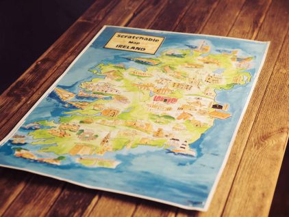
SHOP: With 62 of the best places to visit in Ireland, Scratchable Map Ireland is a unique souvenir and an eye-catching talking point when mounted.
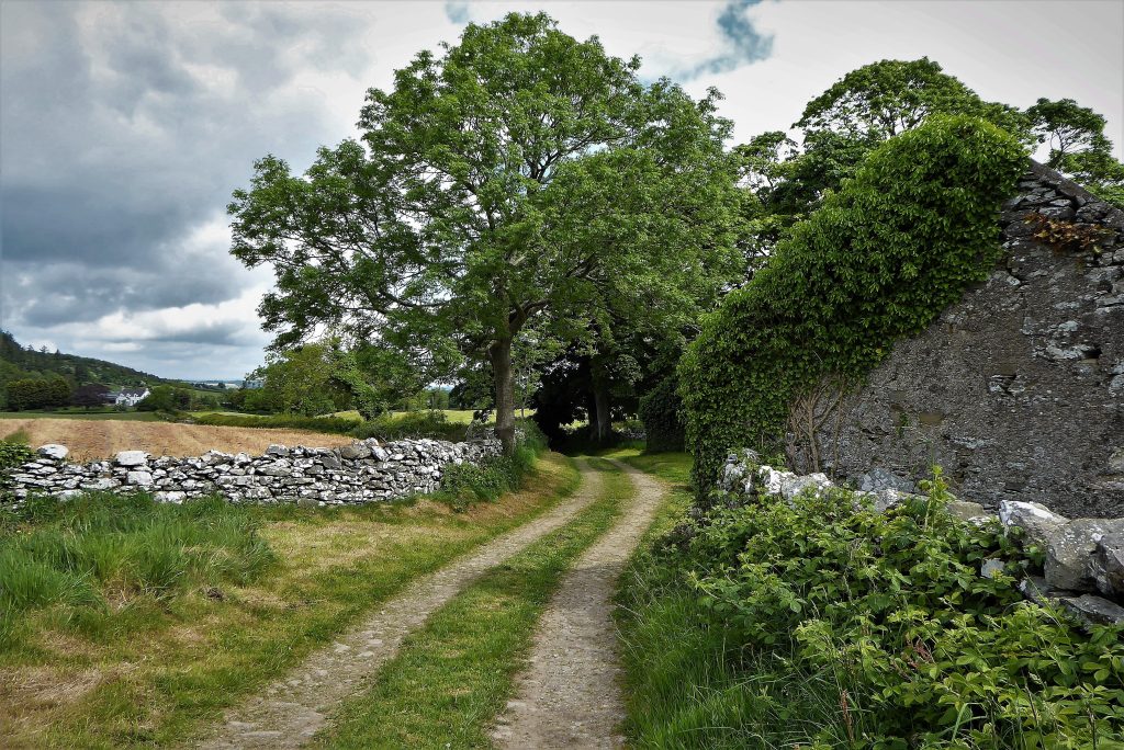
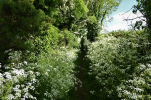
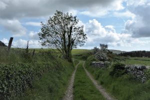
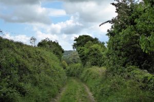
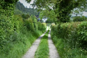
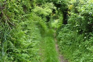
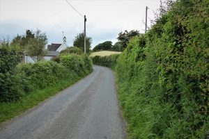
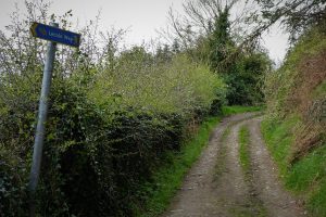
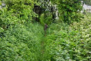
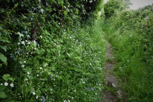
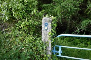
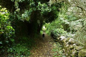
Find Out More1. Park at the Roadhouses Bar, Ballyalton, BT30 6RJ. Cross the road and turn left for a few metres to reach the Lecale Way sign. Cross the stile and take the narrow path known as Green Loney. The path is narrow and can become a little overgrown in summer. When you arrive at a junction of paths go straight ahead Pics 1-3.
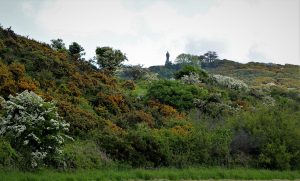
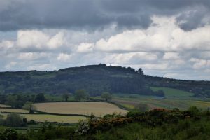
2. The map will indicate that you are now on a section of Saint Patrick’s Way, although there is no signage to indicate this. At first, the path is enclosed by hedging on both sides but it soon opens out onto green, unspoilt countryside with a view of the statue of Saint Patrick on top of Slieve Patrick on your right. Built in 1932 to celebrate the 1500th anniversary of St Patrick bringing Christianity to Ireland, this 30 foot high structure is the tallest statue of the saint in the world.
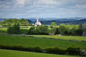
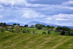
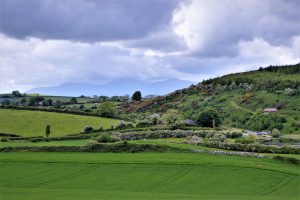
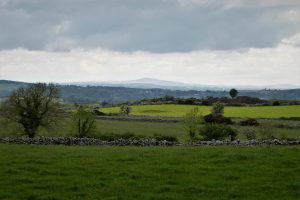
3. Just under 2km after leaving Ballyalton the path reaches a stone stile leading onto Mearne Road. Looking back along the road to the west, the spire you see belongs to Saul Church. The site is known as the Cradle of Christianity in Ireland. Tradition has it that St Patrick landed at the mouth of the Slaney River, a few miles from here, in 432AD. The church building was erected to commemorate the 1500th anniversary of St Patrick’s arrival and was opened on All Saint’s Day 1933; it replaced a very simple structure that had been built in 1788. As Mearne Road makes its way towards the village of Ballystokes, the saint’s statue commands the view to the left, while the Mourne Mountains and Slieve Croob draw the eye to the right.
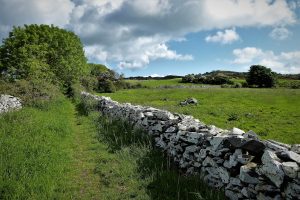
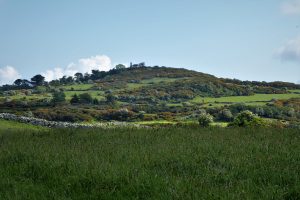
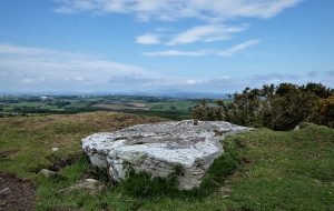
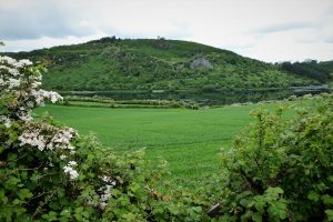
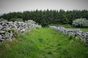
4. A walk of 900m brings you to the hamlet of Ballystokes. Follow the sign for Lecale Way as it directs you left and onto Ballystokes Loney. The first stretch of the loney is surrounded by rolling countryside criss-crossed by dry-stone walls. On the right, the hill of Slievenagriddle, covered in conifers, rises above the fields. On its summit, on private land, sits a cairn, described by archaeologists as “a rare example of an intact, unexamined hilltop tomb of which only the large capstone can be seen”. High hedges line the path as it runs downhill towards Lough Money.
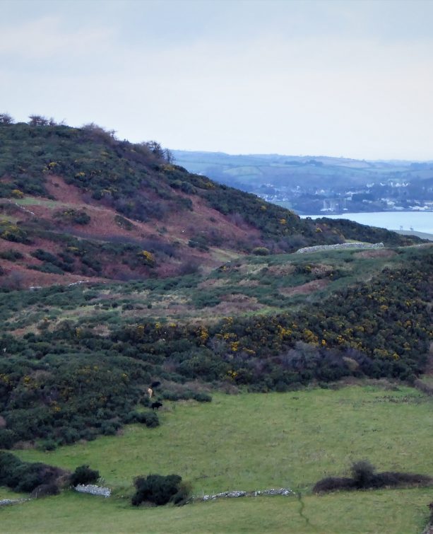
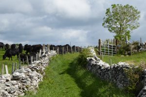
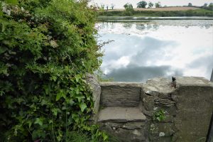
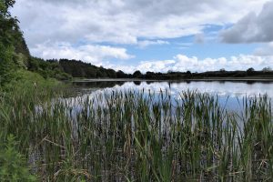
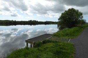
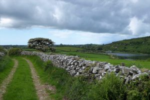
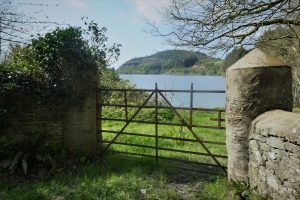
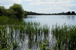
5. If the gate to the path around Lough Money is closed, a stone stile gives somewhat awkward access with a slight risk of ending up in the water. Lough Money is the source for the River Slaney, which flows to the reputed landing place of Saint Patrick on Strangford Lough. Lough Money’s water is remarkably clear as befits a facility once used as a reservoir for supplying the people of Downpatrick. The remains of the disused pumping station still stand on the island in the middle of the lough. Make your way around the bank to reach the car park taking care as you pass anglers on the fishing stands along the edge of the lake. The lough is stocked with rainbow trout, pike and perch, the fishing season running from February to December.
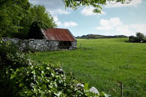
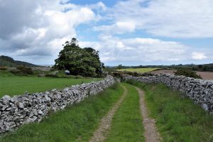
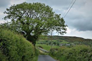
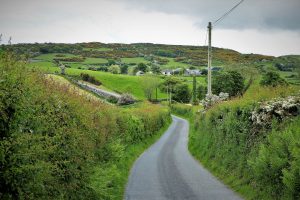
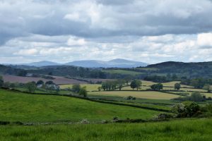
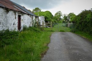
6. From the car park, turn left onto Ballyculter Road and walk for about 500m to reach a farm track on the left, known as Uppertown Loney. The track offers good views of Lough Money and Slievenagriddle. A look back to the south should reveal a view of the Mourne Mountains if visibility permits. The loney is about 1.3km in length; ground conditions are generally good apart from one short section near the start which rarely seems to dry out completely. Several abandoned dwellings line the route, symbols of the challenges faced by rural communities in times past Pics 24-30.
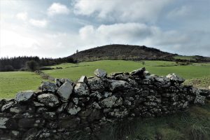
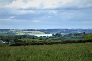
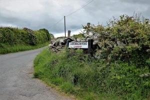
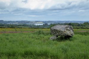
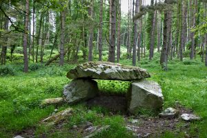
7. At the end of the loney turn right onto Carrowvanny Road. Soon you will get your first view of the waters of Strangford Lough as the quiet road runs gently uphill until it meets a junction. Before continuing straight ahead onto Carrownacaw Road, take a few minutes to inspect Loughmoney Dolmen.
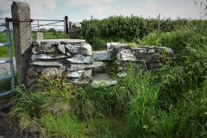
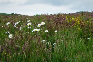
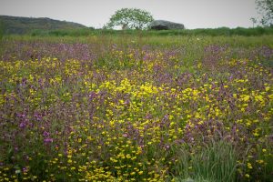
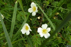
8. To the left of the start of Carrownacaw Road, there is an opening into a field which in summer is bedecked with wildflowers. It is also the site of Loughmoney Dolmen. Two side stones with a hefty boulder on top are all that is left of the original structure. Although not enough of the dolmen is left for archaeologists to be certain of its purpose, it is believed that it could be the remains of a wedge tomb.
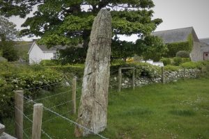
9. Carrownacaw Road makes its undulating way through attractive countryside passing another megalith, a Bronze Age standing stone known as The Long Stone. As the road peters out, look out for a rusted sign pointing east. The barely legible inscription on the sign reads ‘Saint Patrick’s Way’. Follow the narrow path for all of its 800m until it reaches Ballyculter Road.
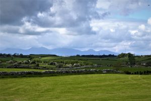
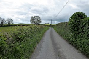
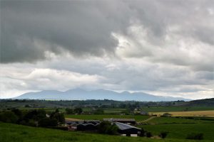
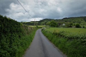
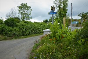
10. Turn right onto Ballyculter Road and enjoy the extensive views, the Mourne Mountains, Dromara Hills and Slieve Patrick creating an eye-catching line-up. Stroll along Ballyculter Road in a mainly downhill course for about 1km before turning right onto the heavily hedged Loughmoney Road.
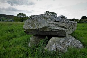
11. Turn left when Loughmoney Road meets Carrowvanny Road and continue towards the north end of Lough Money. Take a left turn as the road narrows and mutates into a farm track. Pass a modern, counterfeit copy of Loughmoney Dolmen before taking Ballystokes Loney in a retracing of the section covered earlier in the walk.
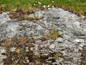
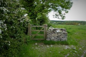
12. Follow the Lecale Way sign on arrival at Ballystokes. The tiny village was part of a thriving community in the 18th century, but the area was hit hard by the Irish famine. Cross a couple of wooden stiles and keep to the right until meeting a gate and the next Lecale Way marker. The field to the right of the gate contains the Ballystokes Inscribed Stone. Unfortunately, the stone has not aged well and is often covered in dirt and vegetation that partially obscure the Bronze Age cup and ring markings.
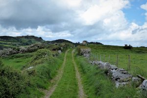
13. Ballystokes Loney is quite narrow and can become slightly overgrown depending on the season. However, it supports a wide range of wild flowers and also gives excellent views over the attractive landscape of dry-stone walls and green fields as far as the Belfast Hills.
14. After about 1km, Ballystokes Loney reaches its junction with Green Loney. Turn left and complete the walk back to Ballyalton on Green Loney.
READ: 8 Great Places to Stay in County Fermanagh.
Find Out MoreFrom the north, take the A7 to Downpatrick. Drive straight through the town, up Irish Street and down Stream Street to the traffic lights. Continue for a short distance on the B1 towards Ardglass/Killough before taking the road on the left signed for Bishopscourt. Carry on for about 2 miles until arriving at Ballyalton.
June 2021
12km (7½ miles)
3 to 4 hours
…you enjoy a quiet, peaceful walk in very pleasant countryside with very few gradients. Ground conditions are quite good for most of the walk, but expect the occasional muddy section – a short stretch of the Lecale Way on Ballystokes Loney seems to be permanently muddy and often flooded, but is passable by sticking to the verge. The track between the north end of Lough Money and the Ballystokes Loney can also be muddy and wet. The roads are not traffic free, but are rarely busy, although a small amount of traffic can be expected on Ballyculter Road.
OSNI Activity Map: Strangford Lough (1:25000)
OSNI Discovery Series: Sheet 21 (1:50000)
The Pads of North Lecale, by Councillor Cadogan Enright and Duane Fitzsimons, commissioned by the Kilclief Residents Association and funded by Newry, Mourne and Down Council, 2019, provided the inspiration for this walk. Unfortunately, the publication is out of print.
There are no other formal in-print sources, but the parts of the walk that coincide with the Lecale Way are described in Section One of the Lecale Way Lecale Way – WalkNI
Alternative route suggestion starting and ending at Lough Money car park.
Drive through Ballyalton and on the outskirts of the village turn left onto Ballyculter Road at the sign for Lough Money. Lough Money’s car park is not huge, but is rarely full. Begin the walk by following the route description as described from paragraph 6 and continue until paragraph 11 (ignore the last few words in para 11 “in a retracing of the section covered earlier in the walk”).
From Ballystokes, don’t turn left; instead, continue on Mearne Road until reaching the stone stile that leads onto Green Loney. Carry on down Green Loney, taking the left stile at a junction with two gates. You are now on Ballystokes Loney which will lead to Ballystokes and onward to Lough Money and the car park.
This is 2 to 3 day walk of 76km from Downpatrick to Newcastle mostly on flat ground. The walk covers some wonderful countryside encompassing castles, tower houses and ancient monuments. The coastal sections of the walk offer the contrasting features of Strangford Lough and the Irish Sea with a huge range of flora and fauna to observe. A considerable amount of road walking is involved, mostly on quiet country roads, but also some quite busy roads where care is necessary. The signage leaves a little to be desired at various points and parts of the walk suffer from neglect. Therefore all the usual navigational aids are essential kit. Further information at Lecale Way – WalkNI
The landscape of the area is suffused with echoes and reminders of Ireland’s patron saint. The main town is named after him and it is appropriate that his memory is maintained in Downpatrick’s Saint Patrick’s Centre, Saint Patrick’s Square, Market Street, BT30 6LZ Home – Saint Patrick Centre. The Centre, winner of Tourism NI’s most Innovative Tourism Business in 2022, has recently (2023) launched its new Saint Patrick Exhibition, created in association with Ireland’s leading exhibition designer Tandem Design and Dublin’s creative digital production team, NoHo. The Centre claims to be the only permanent exhibition in the world about Ireland’s Patron Saint. It is a superb resource for those wishing to explore the life and influence of the saint. The Centre also arranges a series of walks exploring parts of the surrounding area associated with the saint. For further information, check the website or T: 028 44661 9000 or email info@saintpatrickcentre.com

Derek, 76, spent 35 years working in national, academic and public libraries, followed by 14 years in the wine trade. He only began serious walking in his 60s, although he had previously travelled many miles on foot pursuing his favourite hobby of fishing. After retirement, he decided to give the fish a rest and bother the hills of Ireland and Britain instead. Derek regards walking as a simple pleasure to be enjoyed, not endured, and prefers a solo hike in quiet, remote surroundings.
 Belfast,Photography
5 scenic walks around Lisburn
 Mourne Mountains
Bearnagh: Chased the sunset, caught the rain
 Mourne Mountains
Camping in the High Mournes
 Fermanagh and Tyrone
Cuilcagh: Stairway to Heaven
 Features
Every Game of Thrones Location in Northern Ireland
 Mourne Mountains
Hen and Cock Mountains
 Mourne Mountains
Leganabrachan, Millstone and Thomas: Donard’s Seaside Bodyguards
 Mourne Mountains
Percy Bysshe and Cove Caves