Belmore Court: Your next best stay in the West

Would you like to sponsor this article?

The Mourne Mountains for me are where I experience tranquillity, peace of mind and true contentedness. As a busy professional, the importance of self-care is so vital, particularly in the current climate, compounded by the global pandemic. Thankfully I live close to the Mournes so I have been able to regularly utilise their beauty and quietness to offer me comfort. I walk for miles, taking in the beautiful surroundings, breathing fresh, calming air. This is where my mind is clearest and I think of nothing, no intruding stressful thoughts, nothing, my serenity.
I always change my route to experience something new and no two walks are ever the same, (variety is the spice of life after all) but I have a few favourite areas I return to regularly. I particularly love to plan a loop which takes in a number of mountains on route back to the car. This one is a great one and starts in Leitrim Lodge car park which provides adequate parking, picnic benches and some information about the surrounding area.
SHOP: Trek NI sweaters – made from recycled material, available in 10 awesome colours!
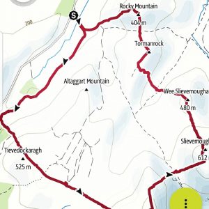
Find Out MoreThe walk begins by following the Ulster Way, crossing the small stream and heading towards Batts Wall. The path gradually ascends after the forest and can be a little mucky after crossing the stream. Once the wall is reached, this is where the hike really begins! Whilst a smaller mountain, Tievedockaragh at 473 metres takes you by surprise as Batts wall leads you straight up at quite a gradient in places to get there. Depending on my mood and the weather, I sometimes look across to the cross and say a prayer to keep me going but on a good day the surrounding views are spectacular and that has been enough to ensure my return.
This route is better in dry conditions but even if it hasn’t rained in a few days, it still can be marshy so good footwear is essential. The next stage follows Batts wall up to Shanlieve Mountain. Marshy land is a given here between the wall break where the Yellow water river runs towards Shanlough. This is where you bring out your best moves to avoid an epic fail (spare socks may be required after this section), give yourself a pat on the back if you avoid a sludge hole, (honestly, this is a good hiking route!). Once you see the wall again (phew!), the only way is up (how many of you are singing right now?) ….baby.
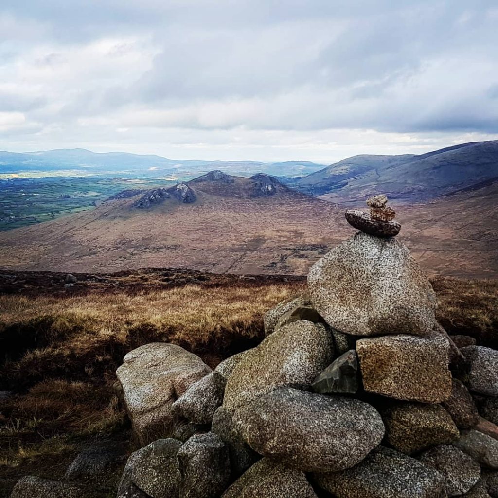
At the top, Eagle Mountain is in your sights and you can be at the top of it in less than 10 minutes so hold off on your tea break, you’ll enjoy it more knowing you have conquered three mountains. You are then following the wall until you reach the top of Slievemoughanmore. Once you are off Eagle, climb over the stile at the windy gap to hike on the left hand side of the wall otherwise you will need to climb over it to reach the summit of Slievemoughanmore. At the summit look for a rock with my name on it and at the views over Pigeon Rock, Cock and Hen mountains (hopefully it’s not too windy and you get to enjoy them!).
Navigate to descend towards Wee Slievemoughan being careful with your footing as the terrain down to Rocky water can be challenging, (try having a seat and sliding if you have good trousers on). On a calm day, it is so peaceful at the river and if you are a fan of running water like me, it is a lovely place to sit and reflect on how privileged we are to have such beauty on our doorstep and to look for sturdy stepping stones to cross the river (otherwise your second pair of spare socks might be required).
The climb up Tormanrock can feel like you are in Super Mario land (according to my friend) so again be careful and take your time but once at the top, a path becomes available and navigating is much easier. Between Tormanrock and Rocky can again be marshy but on a dry day should be fine. Once you reach the peak of Rocky, you’ve done it, seven peaks (maybe seven smaller peaks in closer distance to one another but seven all the same!). Look back (hopefully it’s clear) and you will be able to view the route you have just conquered. Find the path at the top of Rocky and follow it back down to the car park.
READ: Ireland County Peaks Challenge: 32 summits in one weekend
Find Out MoreThis route is just under 13km and takes around 4 hours at a comfortable hiking pace – remember all great achievements take time! It would suit seasoned hikers although novice hikers could give it a go and finish the walk earlier if required (by meeting the Ulster Way). Whilst not overly long in kilometres, there are a lot of ups and downs on route to conquering all seven peaks so energy is required. Bring lots of snacks, drinks and all the usual hiking safety equipment. Spare socks are a must as are your most waterproof footwear. Oh, and look out for the wild horses, they are always about at some part of this area and can take you by surprise or take your sandwich, I have experience of both issues.

 Belfast,Photography
5 scenic walks around Lisburn
 Mourne Mountains
Bearnagh: Chased the sunset, caught the rain
 Mourne Mountains
Camping in the High Mournes
 Fermanagh and Tyrone
Cuilcagh: Stairway to Heaven
 Features
Every Game of Thrones Location in Northern Ireland
 Mourne Mountains
Hen and Cock Mountains
 Mourne Mountains
Leganabrachan, Millstone and Thomas: Donard’s Seaside Bodyguards
 Mourne Mountains
Percy Bysshe and Cove Caves