Climbing Slieve Binnian from Carrick Little (for novice hikers)
Family-Friendly Mourne Mountains
Would you like to sponsor this article?

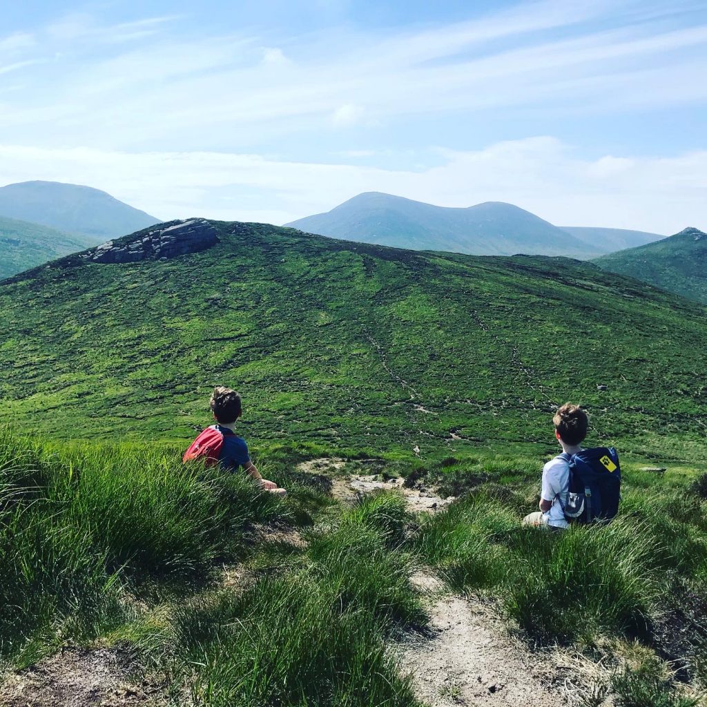
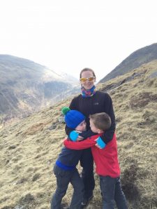
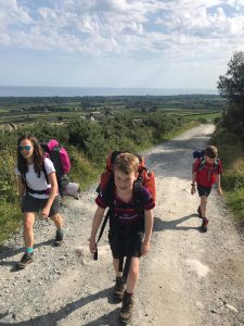
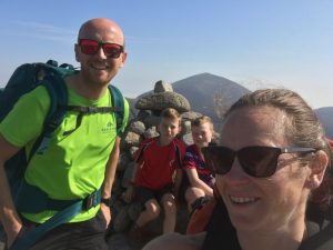
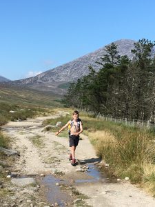
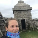
We love to explore the beautiful Mourne Mountains, whether it is a family hike with our boys aged 13 and 10, a mountain run, race training session or a Hill and Dale race, and we are always looking for new route ideas. We can easily lose a couple of hours studying an OS map of the Mournes and plotting and planning new routes. As the boys get older we have been able to increase the distance of our walks and be a bit more adventurous. They are little mountain goats and it is getting to the stage where they have to stop and wait for us at times! This summer they climbed Binnian to complete their 7 7’s which was kicked off with Commedagh in 2015. My youngest son loves to name all the peaks he has come to recognise over the years of hiking.
SHOP: Organic cotton hoodies in a range of colours and sizes!
Find Out MoreWhen the boys were little we started with walks at places like Murlough, Oxford Island, Castlewellan and Tollymore and as they got older we were able to walk in places like Slieve Croob, Divis or Cave Hill. Now they can comfortably manage a 10-12km mountain hike as long as there is plenty of food, some sugary treats and a few pitstops! We’ve been able to climb Munros in Scotland, Wainrights in the Lake District and Bens in Connemara along with peaks in our beautiful Mournes.
These are our three most memorable hikes from the last couple of years.
Distance: 12.5km / 7.7 miles
Elevation: 733m / 2405 ft
Moving time: 3.5 hours
This hike is memorable more for the events during and afterwards rather than the hike itself as it involved the discovery of a World War 2 unexploded shell and subsequently the expertise of the Army Bomb Disposal unit!! This walk will always be known as ‘the one where we blew up the Mournes’.
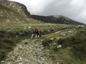
We had planned an epic hike to take in some summits we hadn’t climbed so far. A friend bought me the Cassie’s Challenge book by Harry Teggarty as she knows how much we love a Mournes adventure. It is a 93.4km/58 mile route covering 50 mountains to be completed in under 24 hours. Although we have no plans to take on this challenge in one go we have been picking out routes and are working our way through the 50 peaks. So far we have managed 23 of them. This hike gave us four peaks in one go so we were very excited to tick them off.
We parked at Leitrim Lodge car park and headed straight up the trail to the summit of Rocky. This is steep but reasonably short and the views of the Hen and Rocky River Valley are great. On the ascent we spotted quite a few of the wild ponies huddled in to the side of Rocky. After a short break and a selfie at the summit we descended to the saddle below Rocky and down part of the Mourne Way into the valley. We did this in June after plenty of dry weather but this area can get very boggy after wet weather.

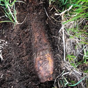
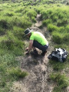
We crossed the bridge over the Rowan Tree River and a few hundred metres past it my husband, Stuart, spotted the shell right beside the path. He had a brief dig around and quickly decided the shell looked very intact and was possibly dangerous. There went our plans for an awesome momento from the Mournes!
We decided to carry on with our walk and, as it was Sunday, planned to phone the police and notify them the following morning just in case it was dangerous. Luckily we made the right decision as the police phoned us back on Monday to say the shell had been live and the Bomb Disposal Unit ventured up the Mournes to make it safe or take it away. The ‘What3Words’ app was really useful for informing the police of the location of the shell.
That evening, on Facebook, we saw pictures of the bomb disposal vans up the Hen track working at the shell which was exciting but also a little scary. I have since been told that the American Army used the Hen Valley for target practice on their way to fight in Europe during WW2. If you come across anything similar please be careful.
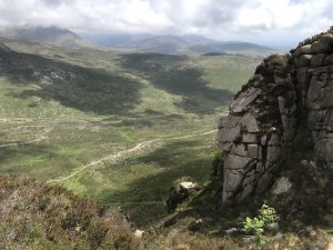
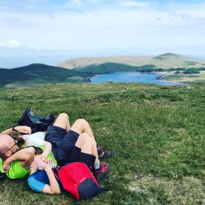
The rest of the walk was less eventful as we continued to follow the Rowan Tree River heading for the stile at the wall between Slievemoughanmore and Pigeon Rock. We turned left and followed the wall to the top of Pigeon Rock where we had a picnic with a stunning view over Spelga.
Retracing our steps back to the stile we continued to follow the wall up to the summit of Slievemoughanmore. To reach the cairn you need to head right from the wall for a few hundred metres but be sure to follow the faint trail and return to the wall as there are a few steep drops.
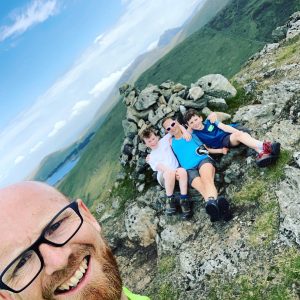
The descent is steep but the views looking towards Eagle Mountain are pretty spectacular. Once we made it to the Windy Gap we followed the Pigeon Rock River towards Tornmarock. We found it difficult to pick up a trail here as we were walking through thick heather until we hit Rocky Water and the climb up to Tornmarock along the ridge. After our now obligatory ‘summit selfie’ (which doesn’t always thrill my now-teenage son), we headed down for the saddle between Tornmarock and Rocky and followed the trail back down to Leitrim Lodge.
This walk was great as it took in so many peaks and the loop gave amazing views from different directions. It was probably a record for the most Percy Pigs consumed on a walk too!
Distance: 12km / 7.5 miles
Elevation: 550m / 1800ft
Moving time: 3hr 45mins
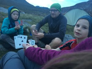
Stuart and the boys have had a few wild camping adventures with a friend and his kiddies but this was my first time doing it since doing my Duke of Edinburgh as a teenager and I’m pretty sure we didn’t call it wild camping back then.
Earlier that day I had raced the Mourne Triathlon at Castlewellan Forest park so a night wild camping was met with mixed feelings. However I loved it and the fact that we had the most stunning weather certainly helped.
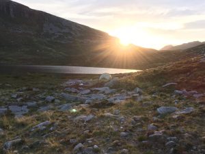
We paid to use the car park up Carrick Little lane knowing the car would be safe overnight and walked the 2 miles or so up to the Blue Lough. There were no other tents there so we were able to pick a nice, flat-ish spot on the far side of the Lough right at the base of Lamagan.
After a tasty dinner followed by the essential s’mores and hot chocolate we had a twilight dander around Blue Lough before a bit of stargazing on a lovely clear night. The four of us squeezed in to our Vango Cairngorm three-man tent and had a surprisingly good nights sleep.
The next morning we were treated to the spectacular sight of a small plane flying really low, right up the middle of the valley towards Ben Crom. Sometimes the things you see and witness in the mountains really take your breath away.
After fuelling the troops we left the tent, which meant we only needed our daysacks, for a walk around the base of Lamagan towards Lower Cove. En route there were a few climbers on the slabs at Cove.
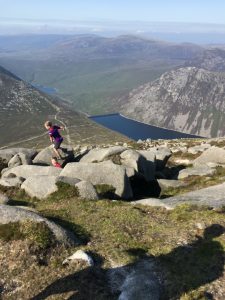
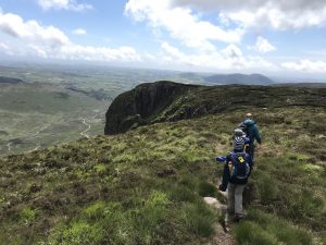
We continued along the trail to the saddle between Lamagan and Cove and turned left to climb Lamagan. This side is easier to climb than the Binnian side as there are fewer boulders and a more distinct trail. The views over Ben Crom, Silent Valley, towards Binnian and towards Carlingford Lough are beautiful.
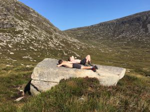
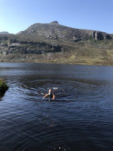
We made the rocky descent to meet the path back down to Blue Lough and back to the tent. This walk was about 5.5km / 3.5 miles and the weather was perfect for a dip in Blue Lough to cool off afterwards. When we were packing up the tent we were excited to spot a lizard taking shade under it. Cooled off and rucksacks loaded, we made the walk back down the path to Carrick Little, racking our brains for more suitable wild camping spots.
Distance: 10.2km / 6.3 miles
Elevation: 571m / 1874ft
Moving time: 2.5 hours
When lockdown restrictions were lifted back in May/June the Mournes became a very popular place to visit and the well-known peaks were unbelievably busy. We chose this walk as we thought it would be much quieter and it really was. We only met a handful of people during the whole walk on a beautiful day in June.
We wanted to climb Eagle and chose Walk 22 from the Knife Edge Outdoor Guidebook of the Mourne Mountains by Andrew McCluggage. The route is really well explained with a detailed map to follow also.
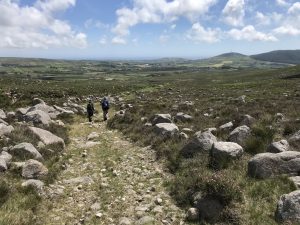
We parked up at the top of Sandy Brae near Attical and after walking past a few farm buildings and sheep pens we followed the trail all the way to the stile at Windy Gap between Slievemoughanmore and Eagle Mountain. From here it is steep but easy to follow the wall all the way to the summit.
On the way up we spotted a few little frogs along the path. After a lunch stop we made a short detour from the route in the book to summit Shanlieve. It was so close we thought it would be a shame not to tick another summit off our 50 peaks.
Re-tracing our steps, we turned left to pick up the trail which follows the ridge below Eagle Mountain. Not far from the summit there are some cliffs which we ventured towards, much to my youngest sons horror. He wasn’t impressed at Mum and Dad going too close so we didn’t hang around here for too long. The route back down descends gradually and you can see the farm buildings getting closer. These were a useful landmark when the boys asked, “Are we nearly there yet!”
This part of the Mournes was so quiet when we visited and gave amazing views of most of the Mournes range from the South.
For kiddies and anyone new to hiking in the Mournes, or anywhere, it is a good idea to build up distances and climbing gradually being aware of your limits. Research and plan your route carefully bearing in mind the weather conditions. As conditions can change so quickly go prepared with extra clothing (even if you don’t think you need it), maps, compass, whistle, survival blanket and good footwear. Most importantly leave no trace and enjoy your time in the mountains.
Feel free to follow our adventures on Instagram @the_martins_adventures.
I am a teacher from Dromore, County Down, married to Stuart and we have two boys age 13 and 10. We are a very active family and love to hike, bike, camp, run, swim, SUP, race triathlon and generally anything that involves exploring the great outdoors in NI and further afield.

Climbing Slieve Binnian from Carrick Little (for novice hikers)
Denvir’s of Downpatrick: The Perfect Base for Walkers and Explorers in County Down
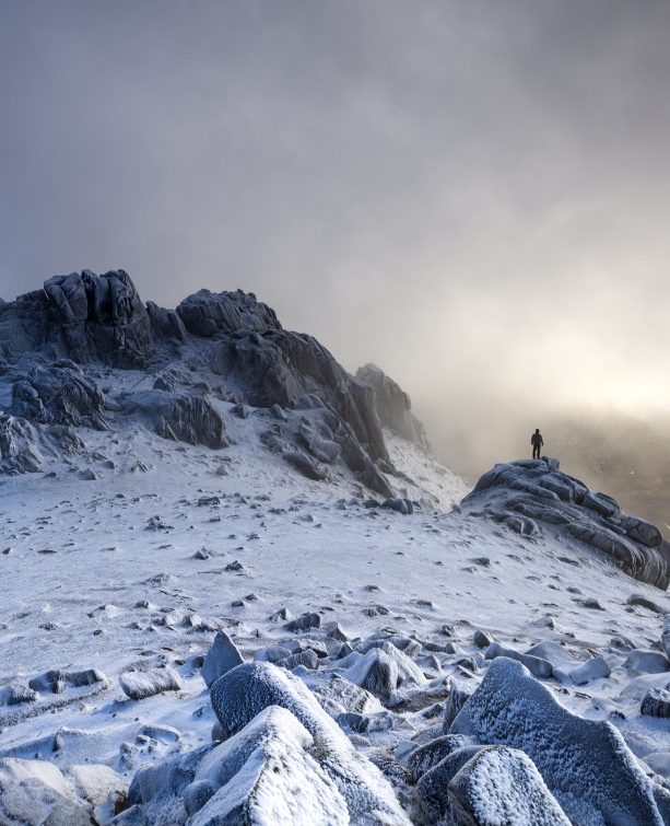
5 Outstanding Late Winter Hikes in the Mourne Mountains
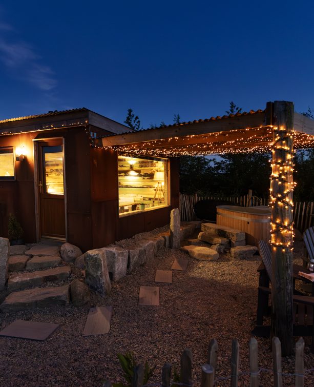
Willowtree Glamping: a Romantic, Rural Retreat in the Mournes
 Belfast,Photography
5 scenic walks around Lisburn
 Mourne Mountains
Bearnagh: Chased the sunset, caught the rain
 Mourne Mountains
Camping in the High Mournes
 Fermanagh and Tyrone
Cuilcagh: Stairway to Heaven
 Features
Every Game of Thrones Location in Northern Ireland
 Mourne Mountains
Hen and Cock Mountains
 Mourne Mountains
Leganabrachan, Millstone and Thomas: Donard’s Seaside Bodyguards
 Mourne Mountains
Percy Bysshe and Cove Caves
