Climbing Slieve Binnian from Carrick Little (for novice hikers)
Would you like to sponsor this article?

Date: 16th November 2019
Location: Scawt Hill, Cairncastle, Co Antrim
Elevation: 378m
Trekkers: Simon Gray, Gary Gray
Highlight: Views of the Sallagh Breaghs, the Antrim coast and Scotland in the distance
A few weeks ago my dad and I decided to take a run out to the Antrim Hills for the morning. We aimed for the car park above Cairncastle on the Feystown road which already offers an amazing view down the glen and out over the Irish Sea. We left the car there and headed north following the Antrim Hills Way.
This is a route that I want to explore more; it runs all the way from the iconic hill of Slemish, along the cliffs of the Sallagh breaghs and ends in the beautiful village of Glenarm. We were just going to do a section of it today and get a taste of the landscape.
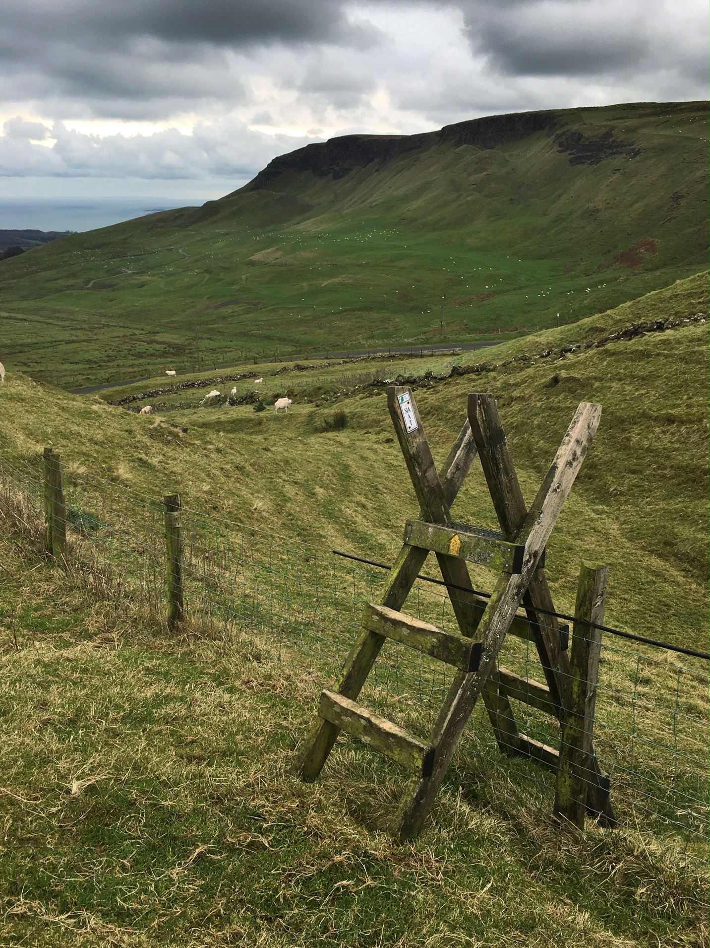
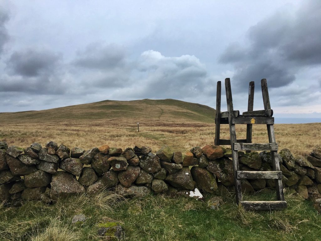
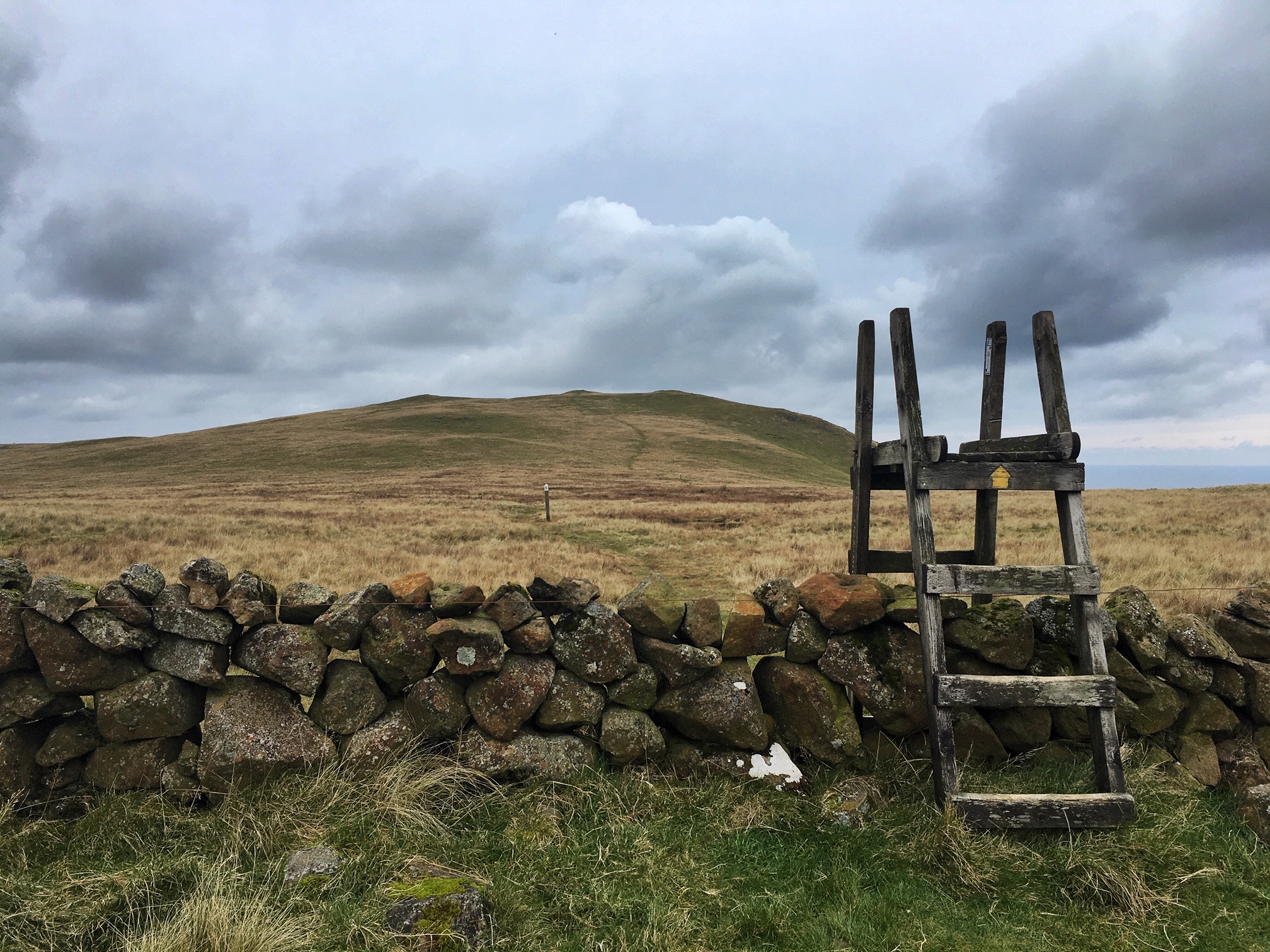
We crossed the road and climbed the stile to start up the edge of Scawt Hill, the first of a low ridge of hills that runs north towards Glenarm ending with Black Hill.
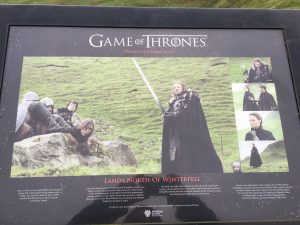
As we headed further up and crossed another stile we turned round to look back down the glen. It’s an impressive landscape and others have clearly thought so because just below those cliffs was the setting for the first episode of Game of Thrones!
The only cast of characters to be seen on that day was the staggering mobs of sheep that grazed the glen to its knees. It made me wonder what different kind of landscape we might have been walking through if there weren’t quite so many mouths out there nibbling away.
READ: 4 Easy Walks for Kids in the Mourne Area
Find Out MoreThe hill flattened out and looking west we could see the unique outline of Slemish jutting above the surrounding landscape. At only 437m Slemish isn’t the highest hill around but this remnant volcanic plug sits proud of the surrounding farmland like a sentinel.
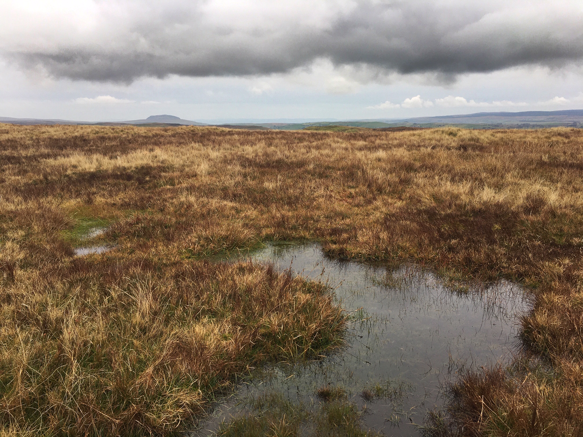
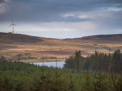
We followed the waymarker posts and the trodden path until we reached another stile, this time lifting us up and over a beautiful dry stone wall that seemed to stretch out west for as far as we could see. It dropped us into what looked like a different world entirely; we left the short-cropped grass behind and entered a more primitive landscape, a wilder place. The lush green lawn was replaced with a party of sedges, grasses, mosses and heather, a pallet of reds, browns, yellows and orange.
We danced round bog pools surrounded by sphagnum, following the tracks of walkers before us. We could see the line of the trail winding up to the top of Scawt Hill ahead of us.
READ: Visiting Slieveanorra Forest
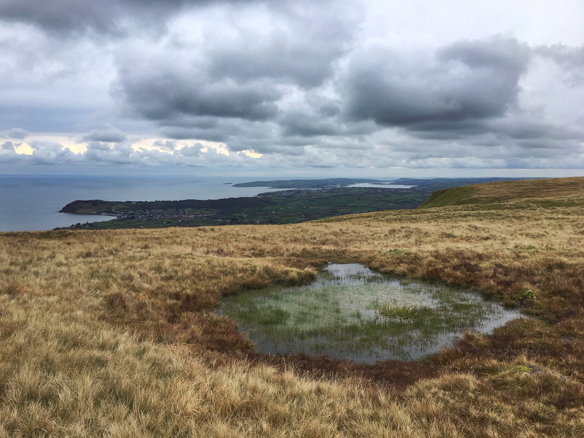
Find Out MoreAs we reached the top the views out to the east really opened up, we spent the next 15 minutes deciding where was where! Directly east the picturesque village of Ballygally lay in its sheltered bay. Behind it out to see sat The Maidens, a tiny clan of rocky islets on which two lighthouses rest. The mountains of Galloway with their snow capped peaks stood in sharp contrast to the flat calm of the Irish Sea. To the south Larne Lough and the Isle of Muck were the features by which we orientated ourselves. Finally to the north the Mull of Kintyre reaching out towards Antrim with its outstretched hand and the knife like peaks of Arran biting at the sky.
We were short on time so we made this our turning point and vowed to come back another day to explore the route all the way to Glenarm. Maybe in summer when the air above the pools would be filled with dragonflies and the skylarks would be singing in the sky.
You can follow Simon on Twitter.
I work in conservation so I spend a lot of my time outdoors. When I’m not trudging across bogs I head out to the Sperrins, the hills of West Fermanagh or the mountains of Donegal. I’m interested in walking, wilderness, and wildlife.
 Belfast,Photography
5 scenic walks around Lisburn
 Mourne Mountains
Bearnagh: Chased the sunset, caught the rain
 Mourne Mountains
Camping in the High Mournes
 Fermanagh and Tyrone
Cuilcagh: Stairway to Heaven
 Features
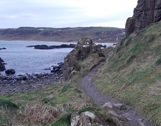
Every Game of Thrones Location in Northern Ireland
 Mourne Mountains
Hen and Cock Mountains
 Mourne Mountains
Leganabrachan, Millstone and Thomas: Donard’s Seaside Bodyguards
 Mourne Mountains
Percy Bysshe and Cove Caves