Climbing Slieve Binnian from Carrick Little (for novice hikers)

Would you like to sponsor this article?

An easy walk with a couple of moderately strenuous sections, visiting five hills in the western Mournes. The walk begins with the tough ascent of Altataggart, including a look at the Mass station, followed by Tievedockaragh, Pierce’s Castle, Tornamrock and Rocky Mountain. All five peaks are under 500m and apart from the steep ascent of Altataggart and a somewhat tricky descent from Pierce’s Castle, the challenges are few. However, you will be rewarded with the quiet, serene atmosphere that pervades this less visited area of the Mournes, especially at the Mass station and on the old bog road between Tievedockaragh and Pierce’s Castle.
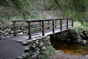
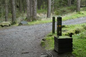
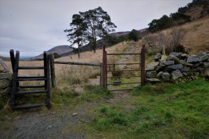
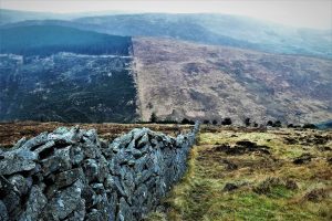
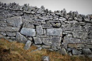
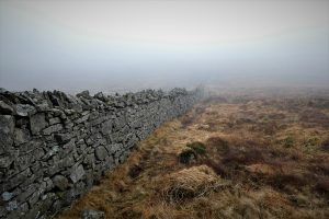
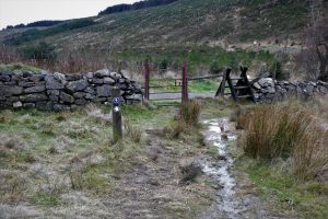
The walk begins at Yellow Water picnic area, where there is ample parking. Cross a couple of footbridges and follow the signs for the Mourne Way heading north. After about 1.8km, a stile and gate announce your arrival at the foot of Batt’s Wall, which makes its way up Altataggart, separating it from Tievedockaragh. The name Altataggart translates from the Irish, Alt an tSagairt as ‘Hill of the Priest’, reflecting its significance as a site of clandestine religious worship during the imposition of penal laws in the 17th and 18th centuries.
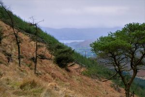
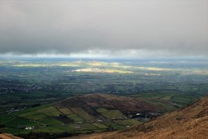
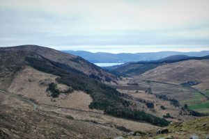
Keep to the left of the wall, enjoying the views which extend south to Carlingford Lough and north towards Rocky Mountain.
SHOP: Trek NI beanies, made from 100% organic cotton
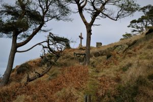
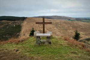
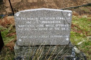
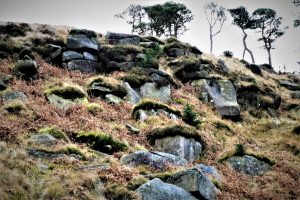
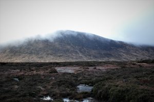
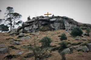
Find Out MoreAs you get closer to the Mass station, at a height of about 370m, a path leads off to the left and climbs steeply towards the site which is located on a rocky crest topped by a grassy platform at an altitude of about 410m. To the rear of the cross, a boulder-strewn slope affords a degree of shelter. One of the commemorative stones celebrates the visit to Ireland of Pope John Paul in 1979. The other memorialises the martyrdom of Father O’Hagan and his congregation during mass. According to tradition, Father Eoghan O’Hagan and a number of those who were assisting at the Mass were murdered by a Colonel Whitechurch and his soldiers in the middle of the 17th century (info from www.clonduffparish.com).
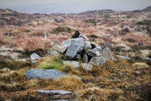
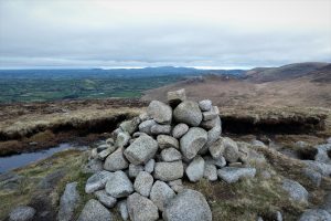
To access the summit cairn of Tievedockaragh, take a southerly course back to the wall and cross at one of the gaps. With the views expanding as height is gained, ground conditions are fairly good, with a firm surface mostly of grasses and heather. Continue heading south and keep on the lookout for a small pile of stones marking the 473m summit, which is easy to miss, especially in poor weather. The Grid Reference is IG J 222 232. After failing to marvel at the underwhelming cairn, return towards the wall and follow it on its east-south-east (more east than south) trajectory. The design and durability of the wall is remarkable, given that it was built about eighty years before the Mourne Wall.
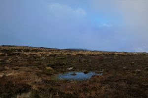
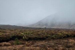
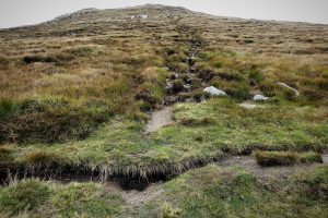
After a short distance, the wall ends abruptly and is replaced by a fence. Continue beside the fence until the wall reappears. Cross the fence just before the reinstated wall and follow a path north through peat hags. The path is firm underfoot and generally quite dry; there are a few soggy patches but they are easily avoided. After about 450m the path joins an old bog road.
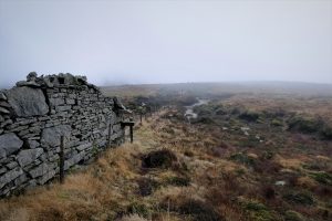
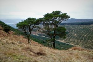
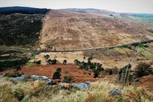
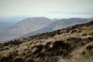
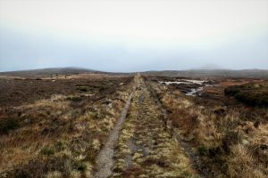
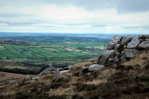
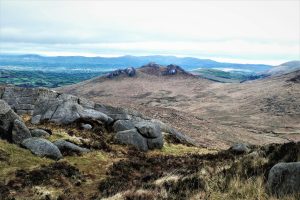
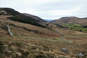
The bog road follows a perfectly straight course for about 500m until it meets a path junction. The formidable Castle Bog dominates the ground-level scenery on both sides of the track. In clear weather, Pierce’s Castle appears ahead while to the east, Shanlieve, Eagle Mountain and Slievemoughanmore flaunt their considerable bulk.
As the bog road nears its end, the view opens out to include Rocky Mountain, Hen Mountain and Cock Mountain. At the T-junction, turn right and walk towards Pierce’s Castle. A number of tracks peel off on either side, but the course to the Castle is obvious.
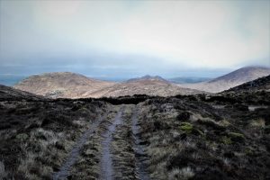
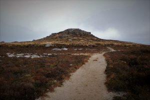
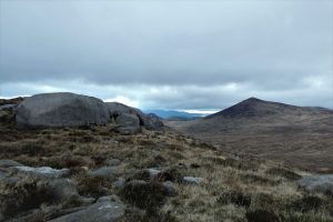
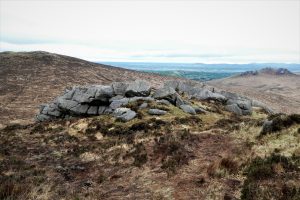
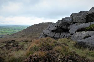
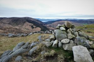
Pierce’s Castle must be one of the easiest of the Mourne peaks to climb, certainly from this southern approach. Although it comes in at a respectable 467m, you’re already at well over 300m before you begin to ascend. It’s a very attractive peak, essentially a granite tor, with many interesting rock features and views that cover a lot of other Mourne peaks and beyond to Slieve Foye in County Louth, Slieve Gullion in County Armagh and the Dromara Hills in County Down.
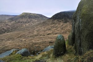
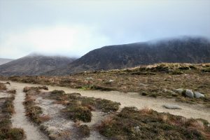
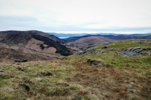
From Pierce’s Castle, the next section crossing the saddle to Tornamrock is clearly visible. The descent from the Castle is not quite as straightforward as the ascent as it involves negotiating a short but steep gully to the left of the main tor. All four limbs need to be employed carefully and flexibly with minimal regard for dignity to achieve a bruise-free landing. Although it is not marked on the map, a clear path leads across the saddle. A few soggy sections intervene, but it is mostly dry and firm. The views ahead are dominated by the eye-catching tors of Hen Mountain and the verdant countryside between Hilltown and Rostrevor.
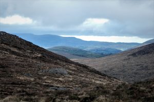
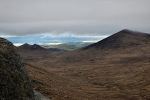
As you progress towards Tornamrock, several rocky outcrops add interest to the landscape. The views to the west open out to include the hills running north from Rostrevor, Leckan More, Slieve Roosley and Wee Roosley, while in the distance to the north, the Dromara Hills should be visible in clear weather. Continue north along the plateau to the rocky outcrop that marks the summit of Tornamrock. Keep to the left of the outcrop and descend on the path towards the saddle between Tornamrock and Rocky Mountain. Tornamrock was originally known as Tornum Rock which translates as ‘The Badgers’ Tower’. Badgers were once common in the area, but it seems the name disappeared along with the badgers.
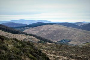
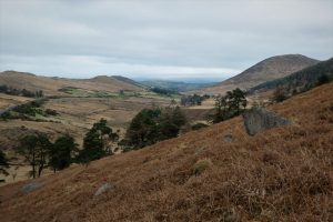
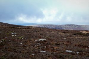
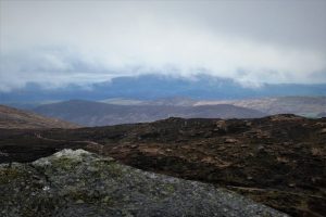
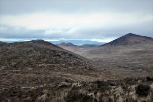
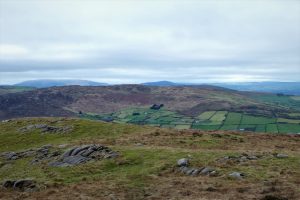
The ascent of Rocky Mountain is straightforward, with a very civilised gradient and a good surface. This is one of three identically named mountains in the Mourne range. At 405m, this one occupies the middle ground in terms of position and height. The summit vistas are excellent, with the high Mournes to the north, the hills rolling down to Carlingford Lough to the south and Slieve Gullion in the distance to the west.
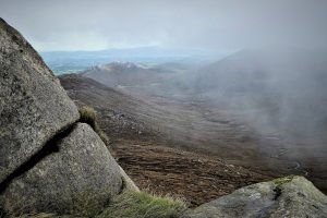
The position and topography of the mountain results in a descent that is longer than the ascent. It’s straightforward, but steep, and can pose a challenge for dodgy knees. The visuals are good, especially towards Rostrevor and Carlingford Lough.
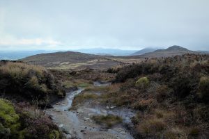
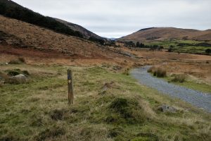
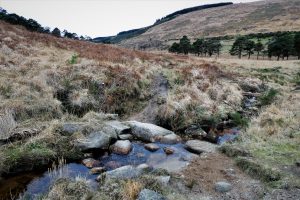
At the foot of Rocky Mountain, join the Mourne Way path and follow the signs as they direct you over a ford and onwards beneath Batt’s Wood and Altataggart.
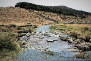
After about 1.5km, the route passes a Mass rock opposite an area of recently cleared forestry. The path then drops down and crosses a stream. Turn left across the stream (originally, there was a waymarker at this point, but it has disappeared). The track narrows and becomes quite rocky as it rises gradually uphill but it soon widens and flattens out before descending to the gate and stile where the ascent of Altataggart began earlier. If you have binoculars or a decent phone or camera, a look at the Mass rock and cross from the path will illustrate how perfectly they are positioned.
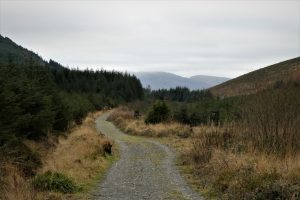
The walk ends with a leisurely return to the car park on the gravel forest track.

READ: The Best Adventure Spots in Northern Ireland
Find Out MoreOSNI Activity Map: The Mournes (1:25000)
OSNI Discovery Series: Sheet 29 (1:50000)
Harvey Mourne Mountains, Superwalker XT25 (1:25000)
21 January 2022
From Castlewellan take the A25, Dublin Road, drive on through Kilcoo and turn left onto the B8 Hilltown Road. Turn left onto the B27 Kilkeel Road just before entering Hilltown and carry on until reaching the sign for Rostrevor. Turn right onto Sandbank Road and continue for about 5 miles until you arrive at Yellow Water Picnic Area on the left.
If approaching from the south, head for Rostrevor and take the main road for Hilltown, Kilbroney Road. After less than half a mile, turn right onto Newtown Road and less than 3 miles further, arrive at Yellow Water Picnic Area on the right.
13km (8 miles)
About 5 hours
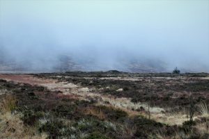
…you enjoy a quiet, peaceful walk with plenty of variety. The weather is as capricious and fickle as anywhere in the Mournes so be prepared for any manifestation of the Irish climate. As on this walk, mist can appear when least expected and being equipped with as many navigational aids as possible is advised, with map and compass the bare minimum. The walk requires an average to good level of fitness and would be best left until you have a couple of more straightforward outings under your belt.
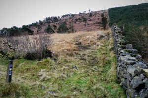
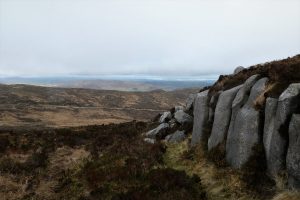
Batt’s Wall
Narcissus Batt, a wealthy Belfast banker and landowner, bought the Leitrim Estate in 1834. The eponymous wall marked the boundary of his estate and was probably constructed during the famine years. It remains in remarkable condition considering that it was built some eighty years before the Mourne Wall was completed. It runs from Tievedockaragh to the summit of Slieve Muck where it joins the Mourne Wall.

Derek, 76, spent 35 years working in national, academic and public libraries, followed by 14 years in the wine trade. He only began serious walking in his 60s, although he had previously travelled many miles on foot pursuing his favourite hobby of fishing. After retirement, he decided to give the fish a rest and bother the hills of Ireland and Britain instead. Derek regards walking as a simple pleasure to be enjoyed, not endured, and prefers a solo hike in quiet, remote surroundings.

Climbing Slieve Binnian from Carrick Little (for novice hikers)
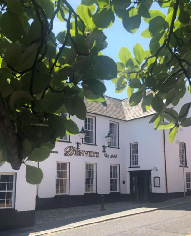
Denvir’s of Downpatrick: The Perfect Base for Walkers and Explorers in County Down
5 Outstanding Late Winter Hikes in the Mourne Mountains
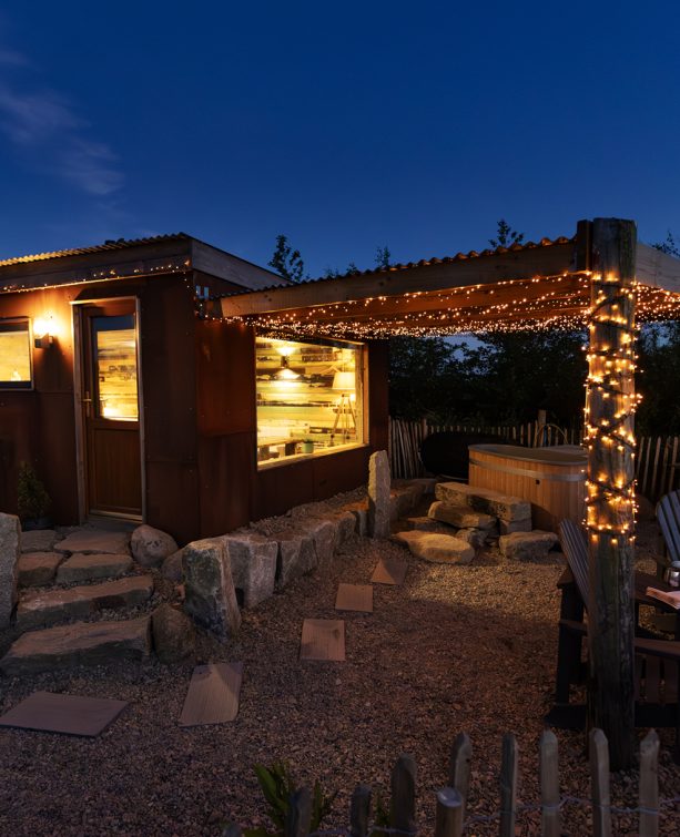
Willowtree Glamping: a Romantic, Rural Retreat in the Mournes
 Belfast,Photography
5 scenic walks around Lisburn
 Mourne Mountains
Bearnagh: Chased the sunset, caught the rain
 Mourne Mountains
Camping in the High Mournes
 Fermanagh and Tyrone
Cuilcagh: Stairway to Heaven
 Features
Every Game of Thrones Location in Northern Ireland
 Mourne Mountains
Hen and Cock Mountains
 Mourne Mountains
Leganabrachan, Millstone and Thomas: Donard’s Seaside Bodyguards
 Mourne Mountains
Percy Bysshe and Cove Caves
