
Climbing Slieve Binnian from Carrick Little (for novice hikers)
Would you like to sponsor this article?

Gortin Glen Forest Park is a gem of a forest that lies a few miles outside the pretty village of Gortin in County Tyrone. It lies on the slopes of Mullaghcarn mountain in the Sperrins whose peak lies at 1778ft. It is a really accessible place for all walkers as there are over 10km of walking trails and a 6km scenic drive and although the terrain is very easy, there are fantastic views at various points throughout the park.
SHOP: Organic cotton hoodies, available in a range of colours
Find Out MoreI started my walk on a lovely autumn morning by parking at the main forest visitor car park. This is signposted off the B48 between Gortin and Omagh and takes the visitor into a well maintained car park with information boards, toilets and a play park. These facilities are all maintained by Fermanagh and Omagh District Council. It also includes a wildlife area and a deer enclosure so plenty of interesting things to see!
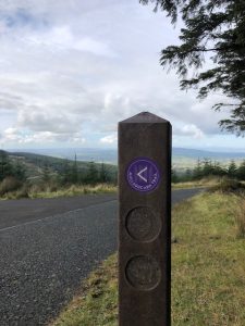
The various trails through the park are really well signposted. I was going to take the purple trail to the summit of Mullaghcarn and then divert onto the red “Ladies View” trail.
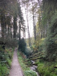
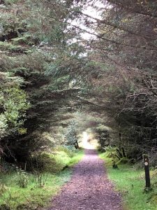
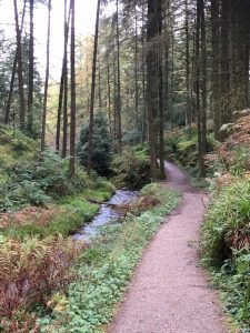
The Mullaghcarn trail initially followed along the side of the pretty Pollan Burn stream climbing uphill through the forest.
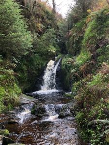
It then crossed over the burn via two sets of steps and a bridge that overlooked a lovely waterfall.
The path continued above the stream until a small bridge was reached. At this stage the purple trail swung left across the bridge and then right heading uphill on the main forest road. The trail headed steadily upwards following the forest road with cleared forestry to the right and trees to the left.
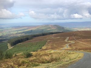
The views really started opening up behind and ahead it was now possible to see the summit of Mullaghcarn, distinguishable by the telecommunications mast on the summit.
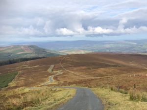
At the next junction the forest road swung around to the right but the purple trail turned sharply and more steeply to the left and then shortly afterwards to the right again. Very soon the road climbed out of the forest altogether and started winding it’s way steeply to the summit of Mullaghcarn with heather covered hillside either side of the road.

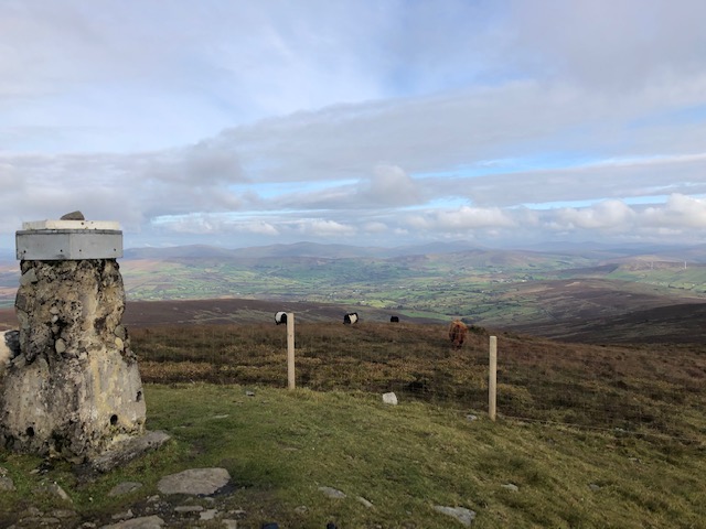
Although the summit of Mullaghcarn has a large telecommunications mast and a road to the top, this doesn’t detract from the fantastic views from the top in all directions.
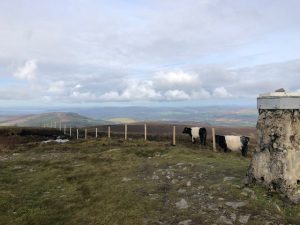
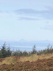
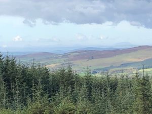
To the north I could see the entire ridge of the Glenelly valley in the Sperrins. To the west, I could see across to Donegal and even distantly on the horizon, I could see the shapely cone of Errigal and the flat summit of Muckish.
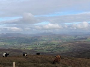
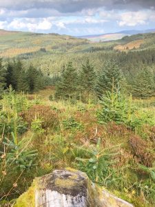
And all around below me were the beautiful autumn coloured trees of Gortin Forest itself. After a short photo stop at the summit cairn (overlooked by some bemused cows!), I retraced my steps back downhill to the bridge that I had crossed some time back.
Now, instead of following the purple trail back to the start, I followed the red trail sign back uphill along a winding, climbing, gravel path.
The ground was open here as there had been tree felling but again it meant that the views were lovely looking back across the Sperrins across the autumn coloured forest. After a bit of climbing, the path rejoined the forest road again turning right and heading along the road. This time the views were towards the West looking out over County Tyrone on this lovely bright afternoon. I could clearly see Bessy Bell near Newtownstewart and again see Donegal in the distance.
After following the road for about a mile, the red trail signs directed me back into the forest trails and the path started taking me downhill into denser growth, eventually rejoining the Pollan burn path followed earlier and then back down to the car park.
READ: The Commedagh Castles from the Bloody Bridge
Find Out MoreThis route was just over 6 miles with an ascent of around 1500 ft overall and took me a gentle 3 hrs with photo and lunch stops. It’s a really easy walk to a Sperrin summit with great views from the top and a lovely route around a scenic forest with great views in all directions.
For hiking purists the terrain is probably a bit too solid underfoot with a lot of forest road walking and some rougher gravel trails but this has its advantages too (no wet boggy ground and hence dry feet!). It would also be a good walk to do for all abilities and for families, children can visit the playpark and deer enclosure later.
The park is well equipped with picnic benches and seats and the signage of all the trails is really excellent. Well worth a visit and I’ll definitely come back and experience it in winter time!

I live in the north west with my husband, two teenage children and a very lazy cat. I work as an Accountant in the health service but love nothing better than getting away from spreadsheets either to get out in the fresh air and walk or to sing with my local choir. I love walking around the Causeway Coast and County Donegal and am never happier than when I can hear the sea.
 Belfast,Photography
5 scenic walks around Lisburn
 Mourne Mountains
Bearnagh: Chased the sunset, caught the rain
 Mourne Mountains
Camping in the High Mournes
 Fermanagh and Tyrone
Cuilcagh: Stairway to Heaven
 Features
Every Game of Thrones Location in Northern Ireland
 Mourne Mountains
Hen and Cock Mountains
 Mourne Mountains
Leganabrachan, Millstone and Thomas: Donard’s Seaside Bodyguards
 Mourne Mountains
Percy Bysshe and Cove Caves
